Category:London Outer Orbital Path
Jump to navigation
Jump to search
English: The London Outer Orbital Path—London Loop — a public footpath route in London and the Greater London region, England.
signed walk along public footpaths  | |||||
| Upload media | |||||
| Instance of |
| ||||
|---|---|---|---|---|---|
| Location | |||||
| Connects with | |||||
| Length |
| ||||
| official website | |||||
 | |||||
Subcategories
This category has the following 5 subcategories, out of 5 total.
Media in category "London Outer Orbital Path"
The following 54 files are in this category, out of 54 total.
-
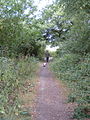 Walking the Loop - geograph.org.uk - 30534.jpg 480 × 640; 166 KB
-
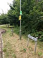
 London Loop sign.JPG 897 × 830; 61 KB
-
 London Loop Plaque - geograph.org.uk - 1061602.jpg 640 × 525; 106 KB
-

-
 Selsdon Wood Nature Reserve, CR0 - geograph.org.uk - 41201.jpg 640 × 481; 142 KB
-
 Albyns Farm Pond - geograph.org.uk - 49326.jpg 640 × 482; 76 KB
-
 Bakers Hill and London Loop sign.jpg 3,456 × 4,608; 5.16 MB
-
 Bakers Hill, Barnet, from Hadley Wood Road on the London Loop.jpg 4,000 × 3,000; 4.45 MB
-
 Barn Hill and Barn Hill Wood - geograph.org.uk - 33947.jpg 640 × 480; 78 KB
-
 Big Wood (east side) - geograph.org.uk - 52866.jpg 640 × 480; 104 KB
-
 Bourne Hall park.jpg 2,500 × 1,527; 736 KB
-
 Bridge 169, Grand Union Canal - geograph.org.uk - 465005.jpg 640 × 427; 98 KB
-
 Bridleway 227 - geograph.org.uk - 58214.jpg 640 × 480; 150 KB
-
 Carshalton Road Pastures information board.jpg 2,000 × 1,523; 953 KB
-
 Carshalton Road Pastures.jpg 2,500 × 1,875; 1.39 MB
-
 Carshalton Urban District Council boundary marker 1898.jpg 2,035 × 2,370; 1.18 MB
-
 Down train to Caterham - geograph.org.uk - 56906.jpg 640 × 480; 123 KB
-
 Flats by Hounslow Heath - geograph.org.uk - 108918.jpg 640 × 480; 220 KB
-
 Footpath beside the Hogsmill River. - geograph.org.uk - 32677.jpg 640 × 480; 157 KB
-
 The London Loop - geograph.org.uk - 38546.jpg 640 × 482; 80 KB
-
 Hogsmill, Loop, TDL sign.jpg 1,200 × 322; 136 KB
-
 Hounslow Heath - geograph.org.uk - 108662.jpg 640 × 480; 247 KB
-
-

-
 London Loop Footpath - geograph.org.uk - 1280887.jpg 427 × 640; 73 KB
-

-
 London Loop footpath east of Hadley Wood - geograph.org.uk - 983950.jpg 640 × 480; 178 KB
-
 LOOP route map.jpg 1,000 × 935; 253 KB
-
 Milepost for London Loop, the Warren - geograph.org.uk - 801845.jpg 480 × 640; 50 KB
-
 Nonesuch Park, Banqueting House site.jpg 3,000 × 2,003; 1.68 MB
-
 Petts Wood, Kent - geograph.org.uk - 137110.jpg 640 × 480; 159 KB
-

-
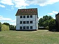 Queen Elizabeth's Hunting Lodge - geograph.org.uk - 30289.jpg 640 × 480; 107 KB
-
 Railway bridge near Bakers Hill on the London Loop (2).JPG 4,000 × 3,000; 4.4 MB
-
 Railway bridge near Bakers Hill on the London Loop.JPG 4,000 × 3,000; 4.13 MB
-

-
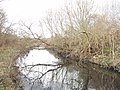 River Crane by Hounslow Heath - geograph.org.uk - 108636.jpg 640 × 480; 277 KB
-
 River Cray near Hall Place, Sidcup, Kent - geograph.org.uk - 137413.jpg 640 × 429; 116 KB
-

-
 Sparrow Wood, Bromley, Kent - geograph.org.uk - 137191.jpg 640 × 480; 171 KB
-

-

-
 The Oaks Park, grotto.jpg 3,000 × 2,250; 3.11 MB
-
 The River Ching - geograph.org.uk - 30291.jpg 480 × 640; 184 KB
-
-
 Cycleway 13 and Reed beds - geograph.org.uk - 1601703.jpg 640 × 430; 113 KB
-

-

-
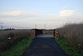
 Distance post, Rainham to Purfleet Path - geograph.org.uk - 1601701.jpg 640 × 430; 141 KB
-
 Distance post, Rainham to Purfleet Path - geograph.org.uk - 1601706.jpg 640 × 430; 111 KB
-

-
 Rainham to Purfleet Path (Cycleway 13) - geograph.org.uk - 1601710.jpg 640 × 430; 110 KB
-
 Rainham to Purfleet Path - geograph.org.uk - 1601489.jpg 640 × 430; 113 KB
-
 Reed bed by the Rainham to Purfleet Path - geograph.org.uk - 1601707.jpg 640 × 430; 115 KB


_-_geograph.org.uk_-_52866.jpg)


.JPG)


_-_geograph.org.uk_-_1601710.jpg)


Categories:
- Public footpaths in London
- Public footpaths in Hertfordshire
- Trails in England
- Public footpaths in the London Borough of Barnet
- Public footpaths in the London Borough of Bexley
- Public footpaths in the London Borough of Bromley
- Public footpaths in the London Borough of Croydon
- Public footpaths in the London Borough of Enfield
- Public footpaths in the London Borough of Havering
- Public footpaths in the London Borough of Hillingdon
- Public footpaths in the London Borough of Hounslow
- Public footpaths in the Royal Borough of Kingston upon Thames
- Public footpaths in the London Borough of Redbridge
- Public footpaths in the London Borough of Sutton
- Public footpaths in the London Borough of Waltham Forest
- Parks in London
- Visitor attractions in London
- Walks in London