Category:Lofthouse - Stanley Ferry waggonway
Jump to navigation
Jump to search
The footpath following the old waggonway is locally known as the "Naggers line" or "Nagger lines".
Media in category "Lofthouse - Stanley Ferry waggonway"
The following 15 files are in this category, out of 15 total.
-
 Line of former waggonway, Stanley - geograph.org.uk - 3885314.jpg 1,024 × 768; 142 KB
-
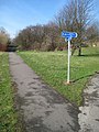
 Looking along the former waggonway, Stanley - geograph.org.uk - 3885318.jpg 1,024 × 768; 257 KB
-
 Section of the old tram road, TPT 67 (1) - geograph.org.uk - 2294884.jpg 480 × 640; 127 KB
-
 Section of the old tram road, TPT 67 (2) - geograph.org.uk - 2294896.jpg 480 × 640; 145 KB
-
 Section of the old tram road, TPT 67 - geograph.org.uk - 2202535.jpg 768 × 1,024; 1,013 KB
-
 Telecoms mast by the Naggers Line - geograph.org.uk - 6437286.jpg 1,600 × 1,200; 430 KB
-
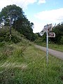
 The Naggers Line crossing Aberford Road - geograph.org.uk - 6437207.jpg 1,600 × 1,200; 758 KB
-
 The Naggers Line, near Meadowcroft Road - geograph.org.uk - 6423343.jpg 1,600 × 1,199; 585 KB
-
 The Trans Pennine trail. - geograph.org.uk - 5976534.jpg 1,024 × 683; 262 KB
-
 TPT 67, the old tram road (1) - geograph.org.uk - 2294933.jpg 480 × 640; 104 KB
-
 TPT 67, the old tram road (2) - geograph.org.uk - 2294945.jpg 480 × 640; 81 KB
-
 Trans Pennine Trail 67 (1) - geograph.org.uk - 2478165.jpg 1,024 × 768; 723 KB
-
 Trans Pennine Trail 67 (2) - geograph.org.uk - 2478175.jpg 768 × 1,024; 793 KB
-
 Trans Pennine Trail 67 (3) - geograph.org.uk - 2478189.jpg 768 × 1,024; 758 KB
-
 Trans-Pennine Trail at Stanley Ferry - geograph.org.uk - 6493125.jpg 1,024 × 768; 358 KB


_-_geograph.org.uk_-_2294884.jpg)
_-_geograph.org.uk_-_2294896.jpg)


_-_geograph.org.uk_-_2294933.jpg)
_-_geograph.org.uk_-_2294945.jpg)
_-_geograph.org.uk_-_2478165.jpg)
_-_geograph.org.uk_-_2478175.jpg)
_-_geograph.org.uk_-_2478189.jpg)