Category:Lode, Cambridgeshire
Jump to navigation
Jump to search
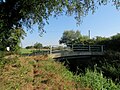
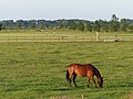
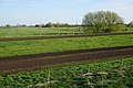
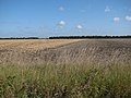
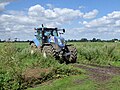
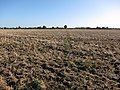
English: Lode is a small village in East Cambridgeshire on the southern edge of The Fens. It lies just north of the B1102 between Quy and Swaffham Bulbeck, to the north east of Cambridge.

village and civil parish in Cambridgeshire, UK  | |||||
| Upload media | |||||
| Instance of | |||||
|---|---|---|---|---|---|
| Location | East Cambridgeshire, Cambridgeshire, East of England, England | ||||
| Population |
| ||||
| Different from | |||||
| Said to be the same as | Lode (Wikimedia duplicated page, civil parish) | ||||
| official website | |||||
 | |||||
Subcategories
This category has the following 9 subcategories, out of 9 total.
Media in category "Lode, Cambridgeshire"
The following 200 files are in this category, out of 507 total.
(previous page) (next page)-
 1 Quy Road, Lode - geograph.org.uk - 1710856.jpg 640 × 480; 56 KB
-
 A bend in Quy Water - geograph.org.uk - 2496547.jpg 800 × 600; 528 KB
-
 A black pheasant in the Cambridgeshire Fens - geograph.org.uk - 3915165.jpg 3,294 × 2,588; 2.3 MB
-
 A bumpy road to the polo club - geograph.org.uk - 3915097.jpg 4,320 × 3,240; 5.87 MB
-
 A comically haughty griffin - geograph.org.uk - 5933605.jpg 1,500 × 2,000; 1.06 MB
-
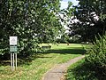 A corner of Lode Recreation Ground - geograph.org.uk - 3597131.jpg 1,200 × 900; 1.94 MB
-
 A muddy track on Bottisham Fen - geograph.org.uk - 3214251.jpg 1,024 × 741; 1.05 MB
-
 A wavy Bottisham Lode - geograph.org.uk - 4639346.jpg 2,560 × 1,920; 1.6 MB
-
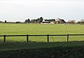 Across a field to Northfields Farm - geograph.org.uk - 2717569.jpg 1,024 × 709; 866 KB
-
 Along Bottisham Lode - geograph.org.uk - 5842751.jpg 1,024 × 768; 1.01 MB
-
 An autumn morning on Bottisham Lode - geograph.org.uk - 3213495.jpg 1,024 × 768; 1.05 MB
-
 An old railway bridge - geograph.org.uk - 6411030.jpg 1,024 × 681; 202 KB
-
 Anglesey Abbey (11) - geograph.org.uk - 6723075.jpg 4,320 × 3,240; 3.78 MB
-
 Anglesey Abbey (14) - geograph.org.uk - 6723082.jpg 3,240 × 4,320; 3.38 MB
-
 Anglesey Abbey (15) - geograph.org.uk - 6723083.jpg 3,240 × 4,320; 3.82 MB
-
 Anglesey Abbey (16) - geograph.org.uk - 6723084.jpg 4,186 × 3,140; 3.65 MB
-
 Anglesey Abbey (17) - geograph.org.uk - 6723085.jpg 4,320 × 3,240; 4.58 MB
-
 Anglesey Abbey (19) - geograph.org.uk - 6723090.jpg 4,320 × 3,240; 4.31 MB
-
 Anglesey Abbey (20) - geograph.org.uk - 6723091.jpg 4,320 × 3,240; 4.28 MB
-
 Anglesey Abbey (22) - geograph.org.uk - 6723094.jpg 4,320 × 3,240; 4.3 MB
-
 Anglesey Abbey (23) - geograph.org.uk - 6723098.jpg 3,167 × 4,223; 4.03 MB
-
 Anglesey Abbey (24) - geograph.org.uk - 6723100.jpg 4,320 × 3,240; 4.56 MB
-
 Anglesey Abbey (25) - geograph.org.uk - 6723199.jpg 4,171 × 3,129; 2.51 MB
-
 Anglesey Abbey (26) - geograph.org.uk - 6723205.jpg 4,320 × 3,240; 3.11 MB
-
 Anglesey Abbey (27) - geograph.org.uk - 6723208.jpg 4,207 × 3,155; 2.61 MB
-
 Anglesey Abbey (28) - geograph.org.uk - 6723385.jpg 3,240 × 4,320; 3.66 MB
-
 Anglesey Abbey (3) - geograph.org.uk - 6722406.jpg 3,240 × 4,320; 3.19 MB
-
 Anglesey Abbey (30) - geograph.org.uk - 6723991.jpg 3,240 × 4,320; 4.33 MB
-
 Anglesey Abbey (32) - geograph.org.uk - 6723995.jpg 3,240 × 4,320; 3.93 MB
-
 Anglesey Abbey (33) - geograph.org.uk - 6723999.jpg 4,320 × 3,240; 3.92 MB
-
 Anglesey Abbey (34) - geograph.org.uk - 6724001.jpg 3,240 × 4,320; 4.18 MB
-
 Anglesey Abbey (35) - geograph.org.uk - 6724002.jpg 3,155 × 4,207; 3.06 MB
-
 Anglesey Abbey (36) - geograph.org.uk - 6724005.jpg 3,129 × 4,171; 3.78 MB
-
 Anglesey Abbey (38) - geograph.org.uk - 6724007.jpg 4,320 × 3,240; 3.57 MB
-
 Anglesey Abbey (4) - geograph.org.uk - 6722407.jpg 3,240 × 4,320; 3.77 MB
-
 Anglesey Abbey (41) - geograph.org.uk - 6724013.jpg 4,223 × 3,167; 3.96 MB
-
 Anglesey Abbey (45) - geograph.org.uk - 6724570.jpg 3,240 × 4,320; 4.37 MB
-
 Anglesey Abbey (46) - geograph.org.uk - 6724571.jpg 3,240 × 4,320; 4.45 MB
-
 Anglesey Abbey (47) - geograph.org.uk - 6724572.jpg 3,240 × 4,320; 3.7 MB
-
 Anglesey Abbey (48) - geograph.org.uk - 6724574.jpg 3,155 × 4,207; 3.9 MB
-
 Anglesey Abbey (49) - geograph.org.uk - 6724575.jpg 3,240 × 4,320; 3.92 MB
-
 Anglesey Abbey (5) - geograph.org.uk - 6722408.jpg 3,240 × 4,320; 3.23 MB
-
 Anglesey Abbey (50) - geograph.org.uk - 6724576.jpg 3,075 × 4,101; 3.11 MB
-
 Anglesey Abbey (51) - geograph.org.uk - 6724577.jpg 3,240 × 4,320; 4.3 MB
-
 Anglesey Abbey (52) - geograph.org.uk - 6724578.jpg 3,167 × 4,223; 3.92 MB
-
 Anglesey Abbey (53) - geograph.org.uk - 6724579.jpg 3,240 × 4,320; 4.85 MB
-
 Anglesey Abbey (54) - geograph.org.uk - 6724583.jpg 3,240 × 4,320; 4.22 MB
-
 Anglesey Abbey (55) - geograph.org.uk - 6724584.jpg 3,240 × 4,320; 2.71 MB
-
 Anglesey Abbey (56) - geograph.org.uk - 6724585.jpg 3,240 × 4,320; 4.07 MB
-
 Anglesey Abbey (57) - geograph.org.uk - 6724586.jpg 3,240 × 4,320; 3.63 MB
-
 Anglesey Abbey (58) - geograph.org.uk - 6724587.jpg 3,240 × 4,320; 3.81 MB
-
 Anglesey Abbey (59) - geograph.org.uk - 6724588.jpg 3,240 × 4,320; 3.49 MB
-
 Anglesey Abbey (6) - geograph.org.uk - 6722410.jpg 4,320 × 3,240; 3.8 MB
-
 Anglesey Abbey (60) - geograph.org.uk - 6724601.jpg 3,240 × 4,320; 4.36 MB
-
 Anglesey Abbey (61) - geograph.org.uk - 6724603.jpg 3,240 × 4,320; 4.29 MB
-
 Anglesey Abbey (62) - geograph.org.uk - 6724605.jpg 3,155 × 4,207; 3.59 MB
-
 Anglesey Abbey (63) - geograph.org.uk - 6724608.jpg 3,240 × 4,320; 4.15 MB
-
 Anglesey Abbey (64) - geograph.org.uk - 6724609.jpg 3,239 × 4,319; 3.88 MB
-
 Anglesey Abbey (65) - geograph.org.uk - 6724610.jpg 3,240 × 4,320; 2.96 MB
-
 Anglesey Abbey (66) - geograph.org.uk - 6724611.jpg 3,167 × 4,223; 3.48 MB
-
 Anglesey Abbey (67) - geograph.org.uk - 6724612.jpg 3,240 × 4,320; 3.42 MB
-
 Anglesey Abbey (9) - geograph.org.uk - 6722428.jpg 4,320 × 3,240; 3.87 MB
-
 Anglesey Abbey gardens - geograph.org.uk - 6396471.jpg 2,500 × 1,667; 4.97 MB
-
 Anglesey in Stitches - geograph.org.uk - 3933450.jpg 800 × 533; 586 KB
-
 Animals grazing - geograph.org.uk - 4342417.jpg 640 × 430; 42 KB
-
 Another view of the garden beds - geograph.org.uk - 6396472.jpg 2,500 × 1,667; 4.62 MB
-
 Arable land near Ivydene - geograph.org.uk - 4509050.jpg 5,754 × 3,836; 4.86 MB
-
 At the end of Fen Head Drove - geograph.org.uk - 6279534.jpg 1,024 × 768; 864 KB
-
 Autumn in Lode - geograph.org.uk - 1008631.jpg 640 × 480; 90 KB
-
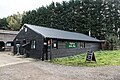
 Barn at Oily Hall Farm - geograph.org.uk - 3214195.jpg 1,024 × 764; 1.06 MB
-
 Barns, Lode Farm - geograph.org.uk - 4334590.jpg 640 × 430; 63 KB
-
 Bent and busted willows near Jack of Clubs Farm, Lode - geograph.org.uk - 3915089.jpg 4,320 × 3,240; 5.85 MB
-
 Beside Commissioners' Drain - geograph.org.uk - 3214231.jpg 1,024 × 768; 1.06 MB
-
 Blasted tree - detail - geograph.org.uk - 1265672.jpg 480 × 640; 155 KB
-
 Blasted tree beside Fen Road - geograph.org.uk - 1265669.jpg 640 × 480; 122 KB
-
 Boat on the River Cam - geograph.org.uk - 4337341.jpg 640 × 430; 52 KB
-
 Bottisham Fen - geograph.org.uk - 4337081.jpg 640 × 430; 68 KB
-
 Bottisham Fen - geograph.org.uk - 4337306.jpg 640 × 430; 41 KB
-
 Bottisham Fen - geograph.org.uk - 4337324.jpg 640 × 430; 42 KB
-
 Bottisham Fen - geograph.org.uk - 880987.jpg 640 × 480; 111 KB
-
 Bottisham Lode - geograph.org.uk - 2333999.jpg 800 × 591; 444 KB
-
 Bottisham Lode - geograph.org.uk - 4342427.jpg 640 × 430; 47 KB
-
 Bottisham Lode - geograph.org.uk - 4509095.jpg 6,000 × 4,000; 7.41 MB
-
 Bottisham Lode - geograph.org.uk - 4639293.jpg 2,560 × 1,920; 1.14 MB
-
 Bottisham Lode - geograph.org.uk - 5996447.jpg 4,032 × 3,024; 6.01 MB
-
 Bottisham Lode - geograph.org.uk - 6642632.jpg 768 × 1,024; 95 KB
-
 Bottisham Lode - geograph.org.uk - 880685.jpg 640 × 480; 130 KB
-
 Bottisham Lode and Fen Road - geograph.org.uk - 880764.jpg 640 × 480; 80 KB
-
 Bottisham Lode and Lug Fen Droveway - geograph.org.uk - 2717453.jpg 1,024 × 768; 1.06 MB
-
 Bottisham Lode and Lug Fen Droveway - geograph.org.uk - 3915091.jpg 4,320 × 3,240; 5.79 MB
-
 Bottisham Lode and Lug Fen Droveway - geograph.org.uk - 4639380.jpg 2,560 × 1,920; 2.24 MB
-
 Bottisham Lode and Lug Fen Droveway - geograph.org.uk - 4639413.jpg 2,560 × 1,920; 2.03 MB
-
 Bottisham Lode and Lug Fen Droveway - geograph.org.uk - 880795.jpg 640 × 471; 88 KB
-
 Bottisham Lode at old railway crossing - geograph.org.uk - 5066933.jpg 640 × 480; 131 KB
-
 Bottisham Lode in autumn - geograph.org.uk - 3213441.jpg 1,024 × 768; 989 KB
-
 Bottisham Lode in high summer - geograph.org.uk - 5842787.jpg 1,024 × 768; 1.12 MB
-
 Bottisham Lode meets the Cam - geograph.org.uk - 4342426.jpg 640 × 430; 47 KB
-
 Bottisham Lode near Jack of Clubs Farm - geograph.org.uk - 2717435.jpg 1,024 × 739; 1.07 MB
-
 Bottisham Lode near Lode in Cambridgeshire - geograph.org.uk - 3849338.jpg 4,320 × 3,240; 6.02 MB
-
 Bottisham Lode Pumping Station - geograph.org.uk - 1979497.jpg 640 × 427; 55 KB
-
 Bottisham Lode Pumping Station - geograph.org.uk - 2333987.jpg 800 × 594; 577 KB
-
 Bridge abutment, Mildenhall Branch Line - geograph.org.uk - 2717301.jpg 1,024 × 754; 1.19 MB
-
 Bridge over Bottisham Lode - geograph.org.uk - 4639338.jpg 2,560 × 1,920; 1.81 MB
-
 Bridge over Bottisham Lode - geograph.org.uk - 5064557.jpg 640 × 480; 142 KB
-
 Bridge over Bottisham Lode - geograph.org.uk - 5842807.jpg 1,024 × 768; 1.17 MB
-
 Bridge over the mill stream, Anglesey Abbey - geograph.org.uk - 4493560.jpg 2,000 × 1,319; 1.43 MB
-
 Bridge with no railway - geograph.org.uk - 2343871.jpg 800 × 600; 534 KB
-
 Bright sky and Bottisham Lode - geograph.org.uk - 3213486.jpg 1,024 × 768; 1,015 KB
-
 Buildings at Lode Farm - geograph.org.uk - 3641545.jpg 640 × 427; 242 KB
-
 Caewch y Giât^ - geograph.org.uk - 6427614.jpg 1,600 × 1,067; 994 KB
-
 Cam at Bottisham Fen - geograph.org.uk - 5915529.jpg 3,072 × 2,304; 1.46 MB
-
 Cam Washes, Bottisham Fen - geograph.org.uk - 2480228.jpg 640 × 465; 63 KB
-
 Cambridge County Polo Club - geograph.org.uk - 4350512.jpg 1,600 × 1,200; 961 KB
-
 Cambridge County Polo Club - geograph.org.uk - 4510915.jpg 6,000 × 4,000; 4.97 MB
-
 Cambridge County Polo Club - geograph.org.uk - 4639356.jpg 2,560 × 1,920; 1.46 MB
-
 Cambridge County Polo Club - geograph.org.uk - 4640110.jpg 2,560 × 1,920; 1.19 MB
-
 Cambridge County Polo Club - geograph.org.uk - 5842800.jpg 1,024 × 768; 879 KB
-
 Cambridge County Polo Club, ground 1 - geograph.org.uk - 5064571.jpg 640 × 480; 75 KB
-
 Car park by Anglesey Abbey - geograph.org.uk - 2968058.jpg 640 × 480; 183 KB
-
 Commissioner's Drain - geograph.org.uk - 4639741.jpg 2,560 × 1,920; 2.04 MB
-
 Cottage, Anglesey Abbey - geograph.org.uk - 5933588.jpg 2,000 × 1,428; 846 KB
-
 Cottages on a corner of the road, Lode - geograph.org.uk - 5934483.jpg 2,000 × 1,354; 548 KB
-
 Cottages, Lode - geograph.org.uk - 4043068.jpg 4,178 × 3,042; 4.03 MB
-
 Cow Bridge and Swaffham Bulbeck Lode - geograph.org.uk - 2343875.jpg 800 × 600; 467 KB
-
 Cows by Bottisham Lode - geograph.org.uk - 4509124.jpg 6,000 × 4,000; 5.83 MB
-
 Cows by the Cam - geograph.org.uk - 4639858.jpg 2,560 × 1,920; 1.78 MB
-
 Cranny Drove - geograph.org.uk - 3186287.jpg 1,600 × 1,200; 943 KB
-
 Cranny Drove - geograph.org.uk - 3186294.jpg 1,600 × 1,200; 938 KB
-
 Crossing a field to Quy Fen - geograph.org.uk - 2717241.jpg 1,024 × 768; 1.08 MB
-
 Crossing Swaffham Bulbeck Lode - geograph.org.uk - 6486543.jpg 1,024 × 732; 897 KB
-
 Cycle path across White Fen - geograph.org.uk - 5419188.jpg 1,600 × 1,200; 440 KB
-
 Cyclists on Fen Road - geograph.org.uk - 2717428.jpg 1,024 × 668; 886 KB
-
 Dam Drove in December - geograph.org.uk - 2717247.jpg 1,024 × 768; 1.29 MB
-
 Dam Drove in late September - geograph.org.uk - 6279521.jpg 819 × 1,024; 1.41 MB
-
 Derelict railway bridge, Speyside Farm - geograph.org.uk - 6411031.jpg 1,024 × 681; 244 KB
-
 Direction sign-Sunflower - geograph.org.uk - 2472976.jpg 480 × 640; 135 KB
-
 Disused shop, Lode - geograph.org.uk - 5934469.jpg 2,000 × 1,333; 676 KB
-
 Ditch and pylons on Quy Fen - geograph.org.uk - 1264372.jpg 640 × 480; 72 KB
-
 Ditch and track, Bottisham Fen - geograph.org.uk - 4337309.jpg 640 × 430; 54 KB
-
 Ditch, Red Tile Farm - geograph.org.uk - 6411020.jpg 1,024 × 681; 158 KB
-
 Docking Droveway - geograph.org.uk - 3186353.jpg 1,600 × 1,200; 834 KB
-
 Docking Droveway - geograph.org.uk - 3186356.jpg 1,600 × 1,200; 926 KB
-
 Drain beside Lug Fen Droveway - geograph.org.uk - 1265683.jpg 640 × 480; 107 KB
-

-
 Edge of a maize field, Ivydene - geograph.org.uk - 4337245.jpg 640 × 430; 60 KB
-
 Facilities for horses near Frolic Farm - geograph.org.uk - 4509083.jpg 6,000 × 4,000; 5.89 MB
-
 Facilities for horses on Bottisham Fen - geograph.org.uk - 4509059.jpg 6,000 × 4,000; 6.48 MB
-
 Fallow field by Sandy Road - geograph.org.uk - 4639470.jpg 2,560 × 1,920; 1.36 MB
-
 Farm Shop Lode - geograph.org.uk - 4718431.jpg 1,600 × 1,067; 674 KB
-
 Farm track with blossom trees - geograph.org.uk - 1264973.jpg 640 × 480; 93 KB
-
 Farmland by Quy Water - geograph.org.uk - 5722626.jpg 640 × 480; 112 KB
-
 Farmland by the Fen Rivers Walk - geograph.org.uk - 4337330.jpg 640 × 430; 45 KB
-

-
 Farmland, Bottisham Fen - geograph.org.uk - 4337257.jpg 640 × 430; 53 KB
-
 Farmland, Bottisham Fen - geograph.org.uk - 4337264.jpg 640 × 430; 42 KB
-
 Farmland, Bottisham Fen - geograph.org.uk - 4342410.jpg 640 × 430; 39 KB
-
 Fen Head Drove - geograph.org.uk - 2717280.jpg 1,024 × 768; 1.09 MB
-
 Fen Polo - geograph.org.uk - 3213456.jpg 1,024 × 769; 1,017 KB
-
 Fen Rivers Way - geograph.org.uk - 4334591.jpg 640 × 430; 70 KB
-
 Fen Rivers Way - geograph.org.uk - 4337086.jpg 640 × 430; 63 KB
-
 Fen Rivers Way - geograph.org.uk - 4337093.jpg 640 × 430; 48 KB
-
 Fen Rivers Way - geograph.org.uk - 4337261.jpg 640 × 430; 31 KB
-
 Fen Rivers Way - geograph.org.uk - 4337265.jpg 640 × 430; 43 KB
-
 Fen Rivers Way - geograph.org.uk - 4337326.jpg 640 × 430; 47 KB
-
 Fen Rivers Way - geograph.org.uk - 4337331.jpg 640 × 430; 52 KB
-
 Fen Rivers Way - geograph.org.uk - 4342414.jpg 640 × 430; 46 KB
-
 Fen Rivers Way - geograph.org.uk - 4342416.jpg 640 × 430; 51 KB
-
 Fen Rivers Way approaching Swaffham Lock - geograph.org.uk - 4509014.jpg 6,000 × 4,000; 4.26 MB
-
 Fen Rivers Way passing Swaffham Marina - geograph.org.uk - 4509034.jpg 6,000 × 4,000; 4.73 MB
-
 Fen Rivers Way, North of Clayhithe - geograph.org.uk - 3849029.jpg 1,600 × 1,200; 589 KB
-
 Fen Road and Bottisham Lode - geograph.org.uk - 3215408.jpg 1,024 × 768; 1,014 KB
-
 Fen Road beside Bottisham Lode - geograph.org.uk - 5915513.jpg 3,072 × 2,304; 1.44 MB
-
 Fen Road near Jack of Clubs Farm - geograph.org.uk - 5842824.jpg 1,024 × 732; 834 KB
-
 Fenland farmland - geograph.org.uk - 3186340.jpg 1,600 × 1,200; 876 KB
-
 Fenland farmland - geograph.org.uk - 3186342.jpg 1,600 × 1,200; 1 MB
-
 Fenland farmland - geograph.org.uk - 6414364.jpg 1,024 × 681; 172 KB
-
 Fenland tractor - geograph.org.uk - 5064733.jpg 640 × 480; 123 KB
-
 Field entrance near the polo club - geograph.org.uk - 3915123.jpg 4,320 × 3,240; 5.23 MB
-
 Field near Lode - geograph.org.uk - 4701930.jpg 640 × 480; 59 KB
-
 Field of maize - geograph.org.uk - 4639429.jpg 2,560 × 1,920; 1.84 MB
-
 Fields north of Long Meadow Road - geograph.org.uk - 4273058.jpg 1,024 × 768; 973 KB
-
 Fishing lake by Swaffham Bulbeck Lode - geograph.org.uk - 3186390.jpg 1,600 × 1,200; 968 KB
-
 Flat farmland - geograph.org.uk - 4337334.jpg 640 × 430; 55 KB
-
 Flat grassland - geograph.org.uk - 4337328.jpg 640 × 430; 41 KB
-
 Floodbanks of Bottisham Lode - geograph.org.uk - 2717464.jpg 1,024 × 768; 1.09 MB
-
 Footbridge at the edge of Quy Fen - geograph.org.uk - 2717200.jpg 1,024 × 746; 992 KB
-
 Footbridge over Commissioners' Drain - geograph.org.uk - 3214238.jpg 1,024 × 746; 1.11 MB
-
 Footpath across Bottisham Fen - geograph.org.uk - 3186410.jpg 1,600 × 1,200; 809 KB
-
 Footpath across Swaffham Poor's Fen - geograph.org.uk - 3186347.jpg 1,600 × 1,200; 1.02 MB
-
 Footpath along Swaffham Bullbeck Lode - geograph.org.uk - 4639701.jpg 2,560 × 1,920; 2.31 MB
-
 Footpath at Fen Farm - geograph.org.uk - 5842767.jpg 1,024 × 683; 900 KB
-
 Footpath by Bottisham Lode - geograph.org.uk - 4350515.jpg 1,600 × 1,200; 729 KB
-
 Footpath from Long Meadow to Lode - geograph.org.uk - 3597270.jpg 1,200 × 900; 1.4 MB
-
 Footpath past pylon - geograph.org.uk - 3186406.jpg 1,600 × 1,200; 768 KB
-
 Footpath to Cow Bridge - geograph.org.uk - 2748289.jpg 1,024 × 768; 1.06 MB
-
 Footpath to Lode - geograph.org.uk - 3186272.jpg 1,600 × 1,200; 970 KB
-
 Footpath to Lode - geograph.org.uk - 3186283.jpg 1,600 × 1,200; 917 KB
-
 Footpath to Long Meadow - geograph.org.uk - 3186277.jpg 1,600 × 1,200; 1.05 MB
-
 Footpath to Long Meadow - geograph.org.uk - 3186282.jpg 1,200 × 1,600; 877 KB
-
 Footpath to Lug Fen Droveway - geograph.org.uk - 3186443.jpg 1,600 × 1,200; 980 KB


_-_geograph.org.uk_-_6723075.jpg)
_-_geograph.org.uk_-_6723082.jpg)
_-_geograph.org.uk_-_6723083.jpg)
_-_geograph.org.uk_-_6723084.jpg)
_-_geograph.org.uk_-_6723085.jpg)
_-_geograph.org.uk_-_6723090.jpg)
_-_geograph.org.uk_-_6723091.jpg)
_-_geograph.org.uk_-_6723094.jpg)
_-_geograph.org.uk_-_6723098.jpg)
_-_geograph.org.uk_-_6723100.jpg)
_-_geograph.org.uk_-_6723199.jpg)
_-_geograph.org.uk_-_6723205.jpg)
_-_geograph.org.uk_-_6723208.jpg)
_-_geograph.org.uk_-_6723385.jpg)
_-_geograph.org.uk_-_6722406.jpg)
_-_geograph.org.uk_-_6723991.jpg)
_-_geograph.org.uk_-_6723995.jpg)
_-_geograph.org.uk_-_6723999.jpg)
_-_geograph.org.uk_-_6724001.jpg)
_-_geograph.org.uk_-_6724002.jpg)
_-_geograph.org.uk_-_6724005.jpg)
_-_geograph.org.uk_-_6724007.jpg)
_-_geograph.org.uk_-_6722407.jpg)
_-_geograph.org.uk_-_6724013.jpg)
_-_geograph.org.uk_-_6724570.jpg)
_-_geograph.org.uk_-_6724571.jpg)
_-_geograph.org.uk_-_6724572.jpg)
_-_geograph.org.uk_-_6724574.jpg)
_-_geograph.org.uk_-_6724575.jpg)
_-_geograph.org.uk_-_6722408.jpg)
_-_geograph.org.uk_-_6724576.jpg)
_-_geograph.org.uk_-_6724577.jpg)
_-_geograph.org.uk_-_6724578.jpg)
_-_geograph.org.uk_-_6724579.jpg)
_-_geograph.org.uk_-_6724583.jpg)
_-_geograph.org.uk_-_6724584.jpg)
_-_geograph.org.uk_-_6724585.jpg)
_-_geograph.org.uk_-_6724586.jpg)
_-_geograph.org.uk_-_6724587.jpg)
_-_geograph.org.uk_-_6724588.jpg)
_-_geograph.org.uk_-_6722410.jpg)
_-_geograph.org.uk_-_6724601.jpg)
_-_geograph.org.uk_-_6724603.jpg)
_-_geograph.org.uk_-_6724605.jpg)
_-_geograph.org.uk_-_6724608.jpg)
_-_geograph.org.uk_-_6724609.jpg)
_-_geograph.org.uk_-_6724610.jpg)
_-_geograph.org.uk_-_6724611.jpg)
_-_geograph.org.uk_-_6724612.jpg)
_-_geograph.org.uk_-_6722428.jpg)


_-_geograph.org.uk_-_4706376.jpg)


_-_geograph.org.uk_-_4706375.jpg)


