Category:Lockton
Jump to navigation
Jump to search
village in North Yorkshire, England, United Kingdom .jpg) | |||||
| Upload media | |||||
| Instance of | |||||
|---|---|---|---|---|---|
| Location | Ryedale, North Yorkshire, Yorkshire and the Humber, England | ||||
 | |||||
English: Lockton is a small village and civil parish in the Ryedale district of North Yorkshire, England. It is situated in the North Yorkshire Moors about north-east of Pickering. Nearby villages include Newton-on-Rawcliffe and Levisham.
Subcategories
This category has the following 4 subcategories, out of 4 total.
Media in category "Lockton"
The following 200 files are in this category, out of 669 total.
(previous page) (next page)-
 4MT 76079 at Eller Beck - geograph.org.uk - 5882390.jpg 1,024 × 768; 169 KB
-
 A Bridestone. - geograph.org.uk - 117518.jpg 640 × 480; 93 KB
-
 A disappointing old gatepost - geograph.org.uk - 4132159.jpg 1,600 × 1,067; 938 KB
-
 A View To Snod Hill And RAF Fylingdales - geograph.org.uk - 2856666.jpg 4,592 × 3,448; 2.04 MB
-

-
 A169 at the hairpin - geograph.org.uk - 4377121.jpg 640 × 428; 82 KB
-
 A169 at White Dale - geograph.org.uk - 3709767.jpg 800 × 514; 531 KB
-
 A169 at White Dale - geograph.org.uk - 5584376.jpg 640 × 480; 394 KB
-
 A169 climbing - geograph.org.uk - 4377122.jpg 640 × 428; 87 KB
-

-
 A169 northbound - geograph.org.uk - 3921051.jpg 640 × 454; 63 KB
-
 A169 northbound - geograph.org.uk - 3921058.jpg 640 × 480; 53 KB
-
 A169 northbound - geograph.org.uk - 3921060.jpg 640 × 480; 80 KB
-

-
 A169 Saltergate Bank - geograph.org.uk - 3499835.jpg 640 × 427; 205 KB
-
 A169 toward Pickering - geograph.org.uk - 5349168.jpg 1,535 × 1,152; 584 KB
-
 A169 towards Pickering - geograph.org.uk - 2554042.jpg 1,280 × 960; 490 KB
-
 A169 towards Pickering - geograph.org.uk - 2728140.jpg 800 × 519; 46 KB
-
 A169 towards Pickering - geograph.org.uk - 2728156.jpg 640 × 416; 56 KB
-
 A169 towards Pickering - geograph.org.uk - 2728166.jpg 640 × 406; 49 KB
-
 A169 towards Pickering - geograph.org.uk - 2728173.jpg 640 × 415; 43 KB
-
 A169 towards Pickering - geograph.org.uk - 2728176.jpg 800 × 535; 85 KB
-
 A169 towards Pickering - geograph.org.uk - 2728181.jpg 640 × 408; 27 KB
-
 A169 towards Pickering - geograph.org.uk - 2729425.jpg 800 × 526; 88 KB
-
 A169 towards Whitby - geograph.org.uk - 2554054.jpg 1,280 × 960; 559 KB
-
 A169 White Way Heads - geograph.org.uk - 5421078.jpg 1,200 × 750; 257 KB
-
 A169, Fox and Rabbit - geograph.org.uk - 2554075.jpg 1,280 × 960; 566 KB
-
 Above Horcum Wood, beside the A169 - geograph.org.uk - 3615242.jpg 4,000 × 2,248; 5.15 MB
-
 Above Newgate Foot - geograph.org.uk - 4466851.jpg 3,259 × 3,447; 1.85 MB
-
 Above Pifelhead Wood - geograph.org.uk - 4377103.jpg 640 × 428; 80 KB
-
 Access road to Newgate Foot Footpath to the right - geograph.org.uk - 4520888.jpg 4,526 × 3,346; 5.54 MB
-
 Access to footpaths near Lockton cemetery - geograph.org.uk - 2961832.jpg 1,024 × 768; 334 KB
-
 Across the Hole of Horcum - geograph.org.uk - 4375902.jpg 640 × 428; 81 KB
-
 Another accident on the hairpin at Hole of Horcum - geograph.org.uk - 4135100.jpg 1,600 × 1,067; 644 KB
-
 Approaching Fox and Rabbit Farm - geograph.org.uk - 2456015.jpg 640 × 480; 71 KB
-
 Approaching hairpin on A169 above Hole of Horcum - geograph.org.uk - 3615111.jpg 4,000 × 2,248; 5.22 MB
-
 Approaching Kingthorpe House - geograph.org.uk - 3532722.jpg 3,264 × 2,448; 3.85 MB
-
 Autumnal footpath through woodland above Jackdaw Griff - geograph.org.uk - 3725290.jpg 4,000 × 3,000; 3.57 MB
-
 Autumnal footpath through woodland on Saltergate Brow - geograph.org.uk - 3725300.jpg 3,000 × 4,000; 3.9 MB
-
 Avenue out of Lockton to the A169 junction - geograph.org.uk - 4416214.jpg 4,608 × 3,456; 7.36 MB
-
 Back Lane in Lockton - geograph.org.uk - 5880372.jpg 5,200 × 3,900; 2.54 MB
-
 Barley crop NE of Pickering - geograph.org.uk - 2454370.jpg 2,048 × 1,536; 663 KB
-
 Barley crop near Brewster's Slack - geograph.org.uk - 2455844.jpg 800 × 524; 141 KB
-
 Barn at Low Kingthorpe Farm - geograph.org.uk - 2743729.jpg 3,296 × 2,472; 1.91 MB
-
 Barn on The Old Wife's Way - geograph.org.uk - 292319.jpg 640 × 384; 73 KB
-
 Barns at High Pastures Farm - geograph.org.uk - 2566554.jpg 3,264 × 2,448; 1.82 MB
-
 Barr Farm - geograph.org.uk - 3698067.jpg 800 × 554; 559 KB
-
 Barr Farm at Saltergate - geograph.org.uk - 3989707.jpg 640 × 426; 66 KB
-
 Barr Farm from Saltergate Brow - geograph.org.uk - 4425737.jpg 1,024 × 683; 670 KB
-
 Bi-planes near Old Wife's Way - geograph.org.uk - 4147922.jpg 2,816 × 2,112; 976 KB
-
 Bigger gates - geograph.org.uk - 2455921.jpg 1,024 × 768; 248 KB
-
 Black Rigg, Saltergate Moor - geograph.org.uk - 4157949.jpg 2,594 × 1,853; 927 KB
-
 Blakey Topping - geograph.org.uk - 2987574.jpg 1,600 × 1,200; 663 KB
-
 Blooming heather along Newgate Brow - geograph.org.uk - 4132143.jpg 1,600 × 1,067; 775 KB
-
 Blue Skies Hole of Horcum - geograph.org.uk - 3621913.jpg 1,597 × 1,600; 556 KB
-
 Blue Skies Horcum Slack - geograph.org.uk - 3621892.jpg 1,535 × 1,600; 668 KB
-
 Bracken-clad slopes of the Hole of Horcum - geograph.org.uk - 3729876.jpg 2,000 × 1,500; 2.48 MB
-
 Bridestone Griff - geograph.org.uk - 3868510.jpg 3,240 × 4,320; 3.77 MB
-
 Bridestone Griff - geograph.org.uk - 6034676.jpg 640 × 360; 109 KB
-
 Bridestones Moor - geograph.org.uk - 5877052.jpg 640 × 360; 71 KB
-
 Bridestones Moor - geograph.org.uk - 5956957.jpg 640 × 427; 107 KB
-
 Bridestones Moor - geograph.org.uk - 6071186.jpg 640 × 360; 76 KB
-
 Bridestones Nature Reserve - geograph.org.uk - 4737426.jpg 640 × 480; 112 KB
-
 Bridestones, Stain Dale Moor, Yorkshire - geograph.org.uk - 4603070.jpg 1,400 × 1,050; 284 KB
-
 Bridestones, Stain Dale Moor, Yorkshire - geograph.org.uk - 4603076.jpg 1,400 × 1,050; 381 KB
-
 Bridestones, Stain Dale Moor, Yorkshire - geograph.org.uk - 4603082.jpg 1,400 × 1,050; 390 KB
-
 Bridestones, Stain Dale Moor, Yorkshire - geograph.org.uk - 4603083.jpg 1,400 × 1,050; 277 KB
-
 Bridestones, Stain Dale Moor, Yorkshire - geograph.org.uk - 4603085.jpg 1,400 × 1,050; 258 KB
-
 Bridestones, Stain Dale Moor, Yorkshire - geograph.org.uk - 4603087.jpg 1,400 × 1,050; 333 KB
-
 Bridestones, Stain Dale Moor, Yorkshire - geograph.org.uk - 4603091.jpg 1,400 × 1,050; 336 KB
-
 Bridestones, Stain Dale Moor, Yorkshire - geograph.org.uk - 4603099.jpg 1,400 × 1,050; 361 KB
-
 Bridestones, Stain Dale Moor, Yorkshire - geograph.org.uk - 4603103.jpg 1,400 × 1,050; 347 KB
-
 Bridestones, Stain Dale Moor, Yorkshire - geograph.org.uk - 4603125.jpg 1,400 × 1,050; 325 KB
-
 Bridleway below Whinny Nab - geograph.org.uk - 4425921.jpg 1,024 × 683; 807 KB
-
 Bridleway gate out of MOD land toward Malo Cross - geograph.org.uk - 5176808.jpg 4,598 × 3,442; 4.82 MB
-
 Bridleway gate with MOD boundary stone beyond - geograph.org.uk - 5176773.jpg 3,124 × 4,378; 7.8 MB
-
 Bridleway on Snod Hill RAF Fylingdales in sight - geograph.org.uk - 5354299.jpg 2,296 × 1,718; 1.54 MB
-
 Bridleway to Cross Dale - geograph.org.uk - 3962049.jpg 1,024 × 768; 176 KB
-
 Bridleway to Low Kingthorpe - geograph.org.uk - 3532070.jpg 3,264 × 2,448; 3.6 MB
-
 Bridleway to Malo Cross - geograph.org.uk - 4425813.jpg 1,024 × 683; 854 KB
-
 Bridleway to Saltergate Brow - geograph.org.uk - 4131006.jpg 2,000 × 1,333; 1.15 MB
-
 Bridleway towards RAF Fylingdales - geograph.org.uk - 5176794.jpg 4,544 × 3,370; 5.2 MB
-
 Car park at the Hole of Horcum Viewpoint - geograph.org.uk - 2428242.jpg 1,024 × 768; 150 KB
-
 Car park at view point - geograph.org.uk - 3989713.jpg 640 × 431; 47 KB
-
 Caravan site by the Fox and Rabbit - geograph.org.uk - 5949289.jpg 1,024 × 768; 180 KB
-
 Cargate Nab and Hazelhead Moor - geograph.org.uk - 4133671.jpg 1,600 × 1,129; 552 KB
-
 Cherry Tree Farm, Lockton - geograph.org.uk - 2499065.jpg 800 × 600; 252 KB
-
 Church of St Giles, Lockton - geograph.org.uk - 3868626.jpg 4,320 × 3,240; 2.82 MB
-
 Clay Pigeon Shoot at Warren Farm - geograph.org.uk - 5906072.jpg 671 × 516; 174 KB
-
 Climbing up through Cross Dale - geograph.org.uk - 4465340.jpg 1,024 × 767; 558 KB
-
 Cottages at farmtrack crossing at Farwath - geograph.org.uk - 4686968.jpg 1,024 × 768; 191 KB
-
 Countryside - Hole of Horcum - geograph.org.uk - 3622018.jpg 1,370 × 1,600; 784 KB
-
 Crop field near Fox and Rabbit Farm - geograph.org.uk - 2456023.jpg 1,024 × 768; 278 KB
-
 Cross Dale - geograph.org.uk - 1529596.jpg 640 × 480; 69 KB
-
 Cross Dale - geograph.org.uk - 2653054.jpg 427 × 640; 272 KB
-
 Cross Dyke - geograph.org.uk - 292403.jpg 640 × 384; 97 KB
-
 Cross Dyke and Horcum Slack - geograph.org.uk - 3962929.jpg 2,814 × 2,010; 1.03 MB
-
 Cross Dyke, Far Black Rigg - geograph.org.uk - 3962925.jpg 2,814 × 2,010; 1,018 KB
-
 Cross, Lilla Howe - geograph.org.uk - 3693863.jpg 1,920 × 2,560; 2.1 MB
-
 Crossdale Spring - geograph.org.uk - 2653058.jpg 640 × 427; 253 KB
-
 Cut bench mark on Malo Cross - geograph.org.uk - 4425931.jpg 1,024 × 683; 1.21 MB
-
 Dark clouds gathering - geograph.org.uk - 2455983.jpg 1,024 × 768; 244 KB
-
 David Lane, off the A169 - geograph.org.uk - 4577661.jpg 1,600 × 1,067; 1.1 MB
-
 Dead trees at Saltergate - geograph.org.uk - 5949321.jpg 1,024 × 768; 252 KB
-
 Deciduous woodland off Kingthorpe Common - geograph.org.uk - 2455940.jpg 640 × 480; 108 KB
-
 Descending moorland - geograph.org.uk - 4874851.jpg 640 × 427; 86 KB
-
 Descending to cross the stream - geograph.org.uk - 3245864.jpg 640 × 480; 129 KB
-
 Disused Primitive Methodist Chapel, Lockton - geograph.org.uk - 4951435.jpg 3,002 × 2,252; 2.64 MB
-
 Disused Quarry in Whitedale - geograph.org.uk - 2566531.jpg 3,264 × 2,448; 2.04 MB
-
 Double Dike - geograph.org.uk - 4425751.jpg 1,024 × 683; 904 KB
-
 Double Dyke, Saltergate Brow - geograph.org.uk - 5316039.jpg 3,240 × 4,320; 3.11 MB
-
 Dove Dale - geograph.org.uk - 292414.jpg 640 × 384; 71 KB
-
 Dove Dale - geograph.org.uk - 3868535.jpg 4,320 × 3,240; 2.66 MB
-
 Dove Dale, The Bridestones - geograph.org.uk - 2987581.jpg 2,592 × 1,944; 6.3 MB
-
 Dovedale Griff - geograph.org.uk - 3868554.jpg 3,240 × 4,320; 3.47 MB
-
 Dovesdale Griff - geograph.org.uk - 3245925.jpg 640 × 480; 102 KB
-
 Drive to Newstead Farm - geograph.org.uk - 514260.jpg 640 × 480; 104 KB
-
 East from Newgate Bank - geograph.org.uk - 3868445.jpg 4,320 × 3,240; 2.98 MB
-
 East Kingthorpe House - geograph.org.uk - 2455952.jpg 1,024 × 768; 179 KB
-
 Eastern slopes, North Dale - geograph.org.uk - 4474957.jpg 1,024 × 768; 137 KB
-
 Edge of the Hole of Horcum - geograph.org.uk - 2428220.jpg 2,048 × 1,340; 558 KB
-
 Electrical sub station near Saltergate brow - geograph.org.uk - 4147939.jpg 2,816 × 2,112; 1.04 MB
-
 Electricity Transmission Pylons - geograph.org.uk - 2653530.jpg 427 × 640; 220 KB
-
 Electricity Transmission Pylons - geograph.org.uk - 2653564.jpg 640 × 427; 199 KB
-
 Ella Bridge A169 - geograph.org.uk - 6274681.jpg 5,456 × 3,632; 6.23 MB
-
 Eller Beck Bridge - geograph.org.uk - 4577057.jpg 1,600 × 799; 819 KB
-
 Eller Beck Bridge on the A169 - geograph.org.uk - 5349122.jpg 2,262 × 1,670; 1.49 MB
-
 Eller Beck from the A169 - geograph.org.uk - 3989667.jpg 640 × 426; 94 KB
-
 Eller Beck in a moorland valley - geograph.org.uk - 5354276.jpg 2,292 × 1,712; 1.6 MB
-
 Entering Lockton - geograph.org.uk - 2653578.jpg 640 × 427; 285 KB
-
 Entrance to Low Kingthorpe - geograph.org.uk - 3989737.jpg 640 × 380; 71 KB
-
 Entrance to RAF Fylingdales - geograph.org.uk - 2394348.jpg 800 × 508; 107 KB
-
 Entrance to RAF Fylingdales - geograph.org.uk - 5319052.jpg 1,600 × 1,200; 338 KB
-
 Entrance, RAF Fylingdales - geograph.org.uk - 3351047.jpg 640 × 366; 34 KB
-
 Estate road entering valley of Eller Beck - geograph.org.uk - 2655987.jpg 1,500 × 1,022; 1.53 MB
-
 Far Black Rigg - geograph.org.uk - 4375917.jpg 640 × 428; 101 KB
-
 Farm - geograph.org.uk - 1906891.jpg 1,600 × 1,200; 427 KB
-
 Farm buildings - geograph.org.uk - 3852941.jpg 800 × 494; 448 KB
-
 Farm buildings at Mount Pleasant - geograph.org.uk - 6358605.jpg 800 × 533; 142 KB
-
 Farm track into Cross Dale - geograph.org.uk - 4465343.jpg 1,024 × 768; 483 KB
-
 Farm track near East Kingsthorpe - geograph.org.uk - 2961835.jpg 1,024 × 768; 204 KB
-
 Farm Tracks - geograph.org.uk - 3623207.jpg 1,261 × 1,600; 586 KB
-
 Farmland, Cross Dale - geograph.org.uk - 3107045.jpg 640 × 480; 54 KB
-
 Farwath Farm - geograph.org.uk - 2653003.jpg 640 × 427; 262 KB
-
 Farwath Farm - geograph.org.uk - 3107051.jpg 640 × 558; 85 KB
-
 Fen Bog - geograph.org.uk - 2407777.jpg 640 × 427; 79 KB
-
 Fen Bog Yorkshire Wildlife Trust - geograph.org.uk - 5349101.jpg 2,304 × 1,728; 2.02 MB
-
 Fen Bogs - geograph.org.uk - 3107213.jpg 640 × 480; 79 KB
-
 Fen Bogs - geograph.org.uk - 5332439.jpg 1,024 × 768; 158 KB
-
 Fen Bogs - geograph.org.uk - 5787065.jpg 5,568 × 3,712; 6.49 MB
-
 Fen Bogs alongside the North Yorkshire Moors Railway - geograph.org.uk - 4686600.jpg 1,600 × 1,200; 257 KB
-
 Fen Bogs in April (1) - geograph.org.uk - 4474856.jpg 1,024 × 768; 184 KB
-
 Fen Bogs in April (2) - geograph.org.uk - 4474861.jpg 1,024 × 768; 181 KB
-
 Fen Bogs in April (3) - geograph.org.uk - 4474867.jpg 1,024 × 768; 154 KB
-
 Fen Moor - geograph.org.uk - 2553899.jpg 640 × 480; 148 KB
-
 Fen Moor View - geograph.org.uk - 2915532.jpg 640 × 480; 114 KB
-
 Fen Moor's northern headland - geograph.org.uk - 4474875.jpg 1,024 × 614; 109 KB
-
 Fence above the beck, below Fen Moor - geograph.org.uk - 4474893.jpg 1,024 × 768; 244 KB
-
 Fence Crossing, Levisham Beck - geograph.org.uk - 3499824.jpg 427 × 640; 293 KB
-
 Field in Newtondale - geograph.org.uk - 2653065.jpg 640 × 427; 217 KB
-
 Field of barley - geograph.org.uk - 3532056.jpg 3,264 × 2,448; 3.66 MB
-
 Field track into Wedland Slack - geograph.org.uk - 4416260.jpg 4,534 × 3,356; 4.85 MB
-
 Field with goats - geograph.org.uk - 3870017.jpg 2,000 × 1,451; 2.45 MB
-
 Fields, Pasture Rigg - geograph.org.uk - 292410.jpg 640 × 384; 99 KB
-
 Fingerpost on Fylingdale Moor - geograph.org.uk - 6274675.jpg 5,456 × 3,632; 3.52 MB
-
 Flood Plain Near Farwath - geograph.org.uk - 2915593.jpg 640 × 480; 91 KB
-
 Follow That Bus - geograph.org.uk - 2231785.jpg 3,456 × 2,304; 4.13 MB
-

-
 Footbridge and Ford - geograph.org.uk - 2653017.jpg 640 × 427; 292 KB
-
 Footpath and old field boundary near Nab Farm - geograph.org.uk - 4147961.jpg 2,816 × 2,112; 1.03 MB
-
 Footpath below Horcum Slack - geograph.org.uk - 4375929.jpg 640 × 428; 84 KB
-
 Footpath down the edge of Grime Moor - geograph.org.uk - 4470265.jpg 1,024 × 765; 389 KB
-
 Footpath from Lockton to the A169 - geograph.org.uk - 4416237.jpg 4,526 × 3,346; 5.96 MB
-
 Footpath in White Dale - geograph.org.uk - 3868357.jpg 4,320 × 3,240; 5.79 MB
-
 Footpath into Dalby Forest - geograph.org.uk - 3532060.jpg 3,264 × 2,448; 3.83 MB
-
 Footpath south of Malo Cross - geograph.org.uk - 4426809.jpg 1,024 × 683; 749 KB
-
 Footpath southwest of Glebe Farm - geograph.org.uk - 3085670.jpg 2,048 × 1,536; 749 KB
-
 Footpath through Stain Dale - geograph.org.uk - 4470156.jpg 748 × 1,024; 485 KB
-
 Footpath through the Hole of Horcum. - geograph.org.uk - 2513238.jpg 640 × 404; 56 KB
-
 Footpath to Cross Dyke - geograph.org.uk - 4375914.jpg 640 × 428; 85 KB
-
 Footpath to Low Horcum - geograph.org.uk - 4375903.jpg 640 × 428; 134 KB
-
 Footpath to stile above The Hole of Horcum - geograph.org.uk - 4416280.jpg 4,608 × 3,456; 4.85 MB
-
 Footpath to the right of Havern Beck - geograph.org.uk - 4417002.jpg 4,608 × 3,456; 6.9 MB
-
 Footpath to Whitethorn - geograph.org.uk - 2566542.jpg 3,264 × 2,448; 3.99 MB
-
 Former Chapel, Lockton - geograph.org.uk - 2938893.jpg 640 × 427; 249 KB
-
 Former Inn - geograph.org.uk - 2653589.jpg 427 × 640; 245 KB
-
 Fox and Rabbit - geograph.org.uk - 2554060.jpg 1,280 × 960; 608 KB
-
 Fox and Rabbit Farm - geograph.org.uk - 2653534.jpg 640 × 427; 221 KB
-
 Fox and Rabbit on the A169 - geograph.org.uk - 4465344.jpg 1,024 × 766; 376 KB
-
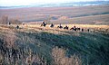 Fox Hunting - geograph.org.uk - 292315.jpg 640 × 384; 83 KB
-
 Frosty trees - geograph.org.uk - 3251215.jpg 1,600 × 1,200; 291 KB
-
 Funny Sign - Thanks but I'll give them a miss^^ - geograph.org.uk - 2986694.jpg 1,200 × 1,600; 649 KB
-
 Fylingdales golf balls - geograph.org.uk - 4662390.jpg 1,711 × 1,165; 308 KB
-
 Gate at Cross Dyke - geograph.org.uk - 4375923.jpg 640 × 428; 111 KB
-
 Gate ^ Stile - Hole of Horcum - geograph.org.uk - 3622005.jpg 1,250 × 1,600; 625 KB
-
 Gated entrance to bridleway - geograph.org.uk - 2454346.jpg 1,024 × 768; 201 KB
-
 Gated road to Old Wife's Way - geograph.org.uk - 4520854.jpg 3,430 × 4,588; 6.19 MB
-
 Glebe Farm, Saltergate - geograph.org.uk - 4135072.jpg 1,600 × 1,067; 537 KB
-
 Goathland Moor - geograph.org.uk - 1160874.jpg 640 × 526; 40 KB
-
 Got myself a convoy - geograph.org.uk - 4416984.jpg 4,346 × 3,072; 4.91 MB


_-_geograph.org.uk_-_4474856.jpg)
_-_geograph.org.uk_-_4474861.jpg)
_-_geograph.org.uk_-_4474867.jpg)


