Category:Lochton
Jump to navigation
Jump to search
English: Lochton is a settlement on the Slug Road in Aberdeenshire, Scotland. Roman legions marched from Raedykes to Normandykes Roman Camp somewhat east of Lochton, using higher ground evading the bogs of Red Moss and other low-lying areas including the Burn of Muchalls. That march used the nearby Elsick Mounth, an ancient trackways crossing the Mounth of the Grampian Mountains, lying westerly of Netherley.
village in Aberdeenshire, Scotland, UK  | |||||
| Upload media | |||||
| Instance of | |||||
|---|---|---|---|---|---|
| Location |
| ||||
 | |||||
Media in category "Lochton"
The following 9 files are in this category, out of 9 total.
-
 A cottage by Lochton House - geograph.org.uk - 891792.jpg 640 × 468; 81 KB
-
 A weather vane - geograph.org.uk - 891771.jpg 640 × 480; 38 KB
-
 A957 by Lochton Cottage - geograph.org.uk - 891798.jpg 640 × 486; 86 KB
-
 Blairydrine sand and gravel pit - geograph.org.uk - 891784.jpg 640 × 480; 83 KB
-
 Lochton Smithy - geograph.org.uk - 891823.jpg 640 × 496; 83 KB
-
 Road to Wardend - geograph.org.uk - 891752.jpg 640 × 480; 66 KB
-
 Road towards Lochton House - geograph.org.uk - 891788.jpg 640 × 480; 51 KB
-
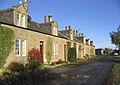 Cottages near Lochton Farm - geograph.org.uk - 285138.jpg 640 × 454; 52 KB
-
 Lochton Farm near Birgham - geograph.org.uk - 285135.jpg 640 × 425; 43 KB


