Category:Lochaber
Jump to navigation
Jump to search
Traditional districts (lordships, provinces etc) of Scotland: The Aird · Annandale · Atholl · Boyne · Buchan · Badenoch · Breadalbane · Carrick · Clydesdale / Lanark · Cowal · Cunninghame · Eskdale · Fothriff · Galloway · Garioch · Garmoran · The Glenkens · Gowrie · Kintyre · Knapdale · Kyle · Lauderdale · Lennox · Liddesdale · Lochaber · Lorn · Lothian · Mar · Mearns · Menteith · Merse · Nithsdale · The Rhinns · Ross (Easter · Wester) · Stormont · Strathavon · Strathbogie · Strathearn · Strathgryfe · Strathnaver · Strathspey · Teviotdale · Tweeddale ·

ward management area of the Highland Council   | |||||
| Upload media | |||||
| Instance of | |||||
|---|---|---|---|---|---|
| Location | Highland, Scottish Highlands, Scotland | ||||
 | |||||
Subcategories
This category has the following 38 subcategories, out of 38 total.
A
B
- Beinn Resipol (7 F)
- Ben Tee (22 F)
C
- Caol (21 F)
- Càrn Mòr Dearg (62 F)
E
- Loch Eilt (32 F)
G
K
- Kentra Bay (20 F)
L
- Leum Uilleim (15 F)
- Loch Doilet (10 F)
M
- Monessie Gorge (10 F)
N
P
Q
S
- Sgurr Ghiubhsachain (5 F)
U
Media in category "Lochaber"
The following 38 files are in this category, out of 38 total.
-

-

-

-
 A welcoming sight - geograph.org.uk - 727147.jpg 640 × 480; 134 KB
-
 A' Chuil - geograph.org.uk - 703784.jpg 640 × 427; 68 KB
-
 A' Chuil From Above - geograph.org.uk - 703793.jpg 640 × 427; 93 KB
-
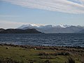
 Ardtornish Castle and the Sound of Mull.jpg 640 × 640; 74 KB
-
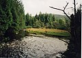 Barr River and Puppy - geograph.org.uk - 689694.jpg 640 × 452; 103 KB
-
 Bealach Staonaig - geograph.org.uk - 18124.jpg 640 × 404; 60 KB
-
 Beinn a' Bheithir - Flickr - Graham Grinner Lewis.jpg 3,648 × 2,736; 2.56 MB
-
 Caol Charna - geograph.org.uk - 1449822.jpg 640 × 463; 59 KB
-
 Chris and Jon - Flickr - Graham Grinner Lewis.jpg 3,648 × 2,736; 2.58 MB
-
 Gleann Leac na Muidhe - Flickr - Graham Grinner Lewis.jpg 3,648 × 2,736; 2.59 MB
-
-
 Kiel Church and the Morvern Cross, Lochaline.jpg 480 × 640; 66 KB
-
 Loch Garry in Scotland.jpg 2,736 × 2,736; 2.84 MB
-
 Loch Leven - Flickr - Graham Grinner Lewis.jpg 3,648 × 2,736; 2.56 MB
-
 Loch na Droma Buidhe Anchorage - geograph.org.uk - 136960.jpg 640 × 380; 26 KB
-
 Lochaber (district).PNG 368 × 456; 17 KB
-
 Lochaber High School - geograph.org.uk - 1409494.jpg 640 × 480; 48 KB
-
 Lochaber Tailrace - geograph.org.uk - 1105433.jpg 640 × 480; 87 KB
-
 Lochaber UK blank map.svg 1,425 × 893; 2.27 MB
-
 Lochaber UK location map.svg 1,425 × 893; 2.39 MB
-
 Lochaber UK relief location map.jpg 2,001 × 1,253; 532 KB
-

-
 Looking Back into Glen Spean - Flickr - Graham Grinner Lewis.jpg 3,648 × 2,736; 2.53 MB
-
 Lorn and Lochaber.jpg 9,805 × 11,882; 59.41 MB
-
 Lochaber No More by John Watson Nicol.jpg 907 × 1,200; 116 KB
-
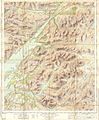
 Ordnance Survey One-Inch Sheet 35 Loch Arkaig, Published 1956.jpg 8,251 × 9,878; 11.84 MB
-
 Rubha Aird Beithe - geograph.org.uk - 1528889.jpg 640 × 480; 84 KB
-
 Rubha na h-Airde Seiliche - geograph.org.uk - 729052.jpg 640 × 480; 58 KB
-
 Scot1975Lochaber.png 200 × 229; 30 KB
-
 Seapool, Barr River - geograph.org.uk - 689688.jpg 640 × 435; 64 KB
-
 Stepping stones at Staoineag bothy - geograph.org.uk - 19768.jpg 640 × 413; 116 KB
-
 The Quarterly journal of the Geological Society of London (12645880773).jpg 1,313 × 1,084; 281 KB
-
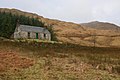
 The ruin at Barr - geograph.org.uk - 689648.jpg 640 × 459; 110 KB
-
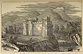 Tor Castle.jpg 544 × 352; 104 KB
-
 Welcome to Lochaber - geograph.org.uk - 1593035.jpg 640 × 480; 51 KB


.PNG)


.jpg)


%27_(11286977596).jpg)
%27_(11294054576).jpg)
%27_(11297740773).jpg)