Category:Loch Sligachan
Jump to navigation
Jump to search
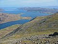
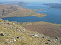
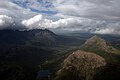
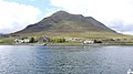
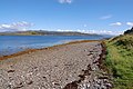
Loch Sligachan is a sea loch on the Isle of Skye, south of Portree.link

Media in category "Loch Sligachan"
The following 36 files are in this category, out of 36 total.
-
 Across Loch Sligachan - geograph.org.uk - 1369657.jpg 640 × 480; 116 KB
-
 Admiralty Chart No 2498 Sound of Raasay and Inner Sound, Published 1961.jpg 12,236 × 8,367; 33.96 MB
-
 Coire na h-Airighe - geograph.org.uk - 790063.jpg 640 × 480; 145 KB
-
 East shoulder of An Coileach - geograph.org.uk - 790075.jpg 640 × 480; 151 KB
-
 Glen Sligachan.jpg 4,310 × 2,868; 1.25 MB
-
 Loch Sligachan - geograph.org.uk - 136823.jpg 640 × 480; 69 KB
-
 Loch Sligachan - geograph.org.uk - 1369655.jpg 640 × 480; 104 KB
-
 Loch Sligachan - geograph.org.uk - 3942690.jpg 640 × 427; 48 KB
-
 Loch Sligachan - geograph.org.uk - 5406676.jpg 640 × 427; 337 KB
-
 Loch Sligachan from Sconser - geograph.org.uk - 2067624.jpg 3,456 × 2,304; 952 KB
-
 Loch Sligachan from Sconser - geograph.org.uk - 5402837.jpg 1,024 × 672; 232 KB
-
 Loch Sligachan Shoreline - geograph.org.uk - 937698.jpg 640 × 360; 74 KB
-
 Low tide on Loch Sligachan - geograph.org.uk - 1268900.jpg 640 × 480; 63 KB
-
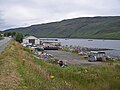 Marine services yard, Sconser - geograph.org.uk - 1410007.jpg 640 × 480; 102 KB
-
 Mouth of Loch Sligachan - geograph.org.uk - 528118.jpg 640 × 426; 251 KB
-
 North shoreline on Loch Sligachan - geograph.org.uk - 1268893.jpg 640 × 480; 76 KB
-
 Old fishing weir (Cairidh) - geograph.org.uk - 180896.jpg 640 × 480; 118 KB
-
 Ordnance Survey One-Inch Sheet 25 Portree, Published 1956.jpg 8,271 × 9,868; 8.63 MB
-
 Ordnance Survey One-Inch Sheet 35 Sound of Sleat, Published 1947.jpg 8,186 × 10,443; 9.59 MB
-
 Rubh' an Tòrra Mhòir from Ben Lee - geograph.org.uk - 1403830.jpg 640 × 480; 77 KB
-
 Sconser - geograph.org.uk - 1410029.jpg 640 × 480; 110 KB
-
 Sconser Lodge Hotel - geograph.org.uk - 1476541.jpg 640 × 480; 62 KB
-
 Sconser Pier, Loch Sligachan - geograph.org.uk - 937709.jpg 640 × 360; 47 KB
-
 Shore of Loch Sligachan - geograph.org.uk - 1704882.jpg 1,020 × 670; 627 KB
-
 Shoreline on Loch Sligachan - geograph.org.uk - 1805978.jpg 640 × 502; 91 KB
-
 South Shore of Loch Sligachan - geograph.org.uk - 136817.jpg 640 × 480; 113 KB
-
 Spit at Rubha an Tòrra Mhòir - geograph.org.uk - 1476543.jpg 640 × 480; 68 KB
-

-
 The shoreline of Sligachan Loch from the Sconser ferry - geograph.org.uk - 1910848.jpg 2,052 × 1,154; 525 KB
-
 Unloading the catch - geograph.org.uk - 1410031.jpg 640 × 479; 101 KB
-
 View from Sconser Pier - geograph.org.uk - 591112.jpg 640 × 426; 145 KB
-
 Head of Loch Sligachan - geograph.org.uk - 411666.jpg 640 × 480; 308 KB
-
 Rubh' an Uillt Dharaich - geograph.org.uk - 144251.jpg 640 × 480; 83 KB
-
 Sconser - geograph.org.uk - 411887.jpg 640 × 480; 247 KB
-
 Shore of Loch Sligachan - geograph.org.uk - 525555.jpg 640 × 425; 336 KB
-
 The mouth of Loch Sligachan - geograph.org.uk - 651645.jpg 640 × 425; 151 KB


_-_geograph.org.uk_-_180896.jpg)


