Category:Loch Siophort
Jump to navigation
Jump to search
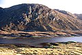
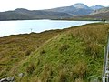
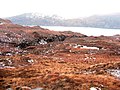
English: Loch Siophort (Loch Seaforth, Loch Shiphoirt) is a sealoch in North Harris, opening into the sea at Reinigeadal.
bay in Outer Hebrides, Scotland, UK  | |||||
| Upload media | |||||
| Instance of | |||||
|---|---|---|---|---|---|
| Location | Outer Hebrides, Scotland | ||||
 | |||||
Subcategories
This category has the following 2 subcategories, out of 2 total.
M
- Loch Mhàraig (12 F)
S
- Seaforth Island (11 F)
Media in category "Loch Siophort"
The following 42 files are in this category, out of 42 total.
-
 A view over Loch Seaforth-Loch Shiphoirt - geograph.org.uk - 4751870.jpg 640 × 480; 129 KB
-
 An inlet on the shore of Loch Seaforth - geograph.org.uk - 1265247.jpg 640 × 480; 125 KB
-

-
 Ceann Mòr - geograph.org.uk - 3686206.jpg 2,560 × 1,920; 2.29 MB
-
 Cottage Loch Seaforth - geograph.org.uk - 623817.jpg 640 × 480; 125 KB
-
 Cul Chreag, Isle of Lewis - geograph.org.uk - 135853.jpg 640 × 429; 103 KB
-
 Cutting on the Rhenigidale road - geograph.org.uk - 1291598.jpg 640 × 480; 51 KB
-
 Dorus Beag, Loch Seaforth-Loch Shiphoirt, Isle of Lewis - geograph.org.uk - 5863950.jpg 1,932 × 1,411; 315 KB
-
 Enchanted Isle On Loch Seaforth-Loch Shiphoirt - geograph.org.uk - 3686168.jpg 2,560 × 1,920; 2.56 MB
-
-
 Head of Loch Seaforth - geograph.org.uk - 1965730.jpg 2,048 × 1,536; 1.36 MB
-
 Loch Maraig - geograph.org.uk - 2617177.jpg 2,560 × 1,920; 1.96 MB
-
 Loch Maraig and An Cliseam - geograph.org.uk - 2431848.jpg 1,024 × 768; 143 KB
-
 Loch Màraig - geograph.org.uk - 3636999.jpg 3,648 × 2,736; 3.46 MB
-
 Loch Màraig - geograph.org.uk - 4486698.jpg 1,024 × 660; 175 KB
-
 Loch Seaforth - geograph.org.uk - 8721.jpg 640 × 289; 160 KB
-
 Loch Seaforth- Loch Shiophoirt - geograph.org.uk - 6718601.jpg 1,600 × 900; 841 KB
-
 Loch Shiphoirt (Seaforth) - geograph.org.uk - 574598.jpg 640 × 480; 70 KB
-
 Looking across Loch Seaforth - geograph.org.uk - 1265228.jpg 640 × 480; 102 KB
-
 Looking over Mhàraig - geograph.org.uk - 3486796.jpg 2,048 × 1,536; 1.59 MB
-
 Looking up Loch Seaforth towards Seaforth Island - geograph.org.uk - 1866622.jpg 4,000 × 3,000; 6.35 MB
-
 Maraig - geograph.org.uk - 2617189.jpg 2,560 × 1,920; 2.05 MB
-

-
 New road looking at Loch Seaforth - geograph.org.uk - 1210131.jpg 640 × 439; 54 KB
-
 Peat Bog, Isle of Lewis - geograph.org.uk - 137719.jpg 640 × 480; 87 KB
-
 River Gorge, Isle of Lewis - geograph.org.uk - 137744.jpg 640 × 480; 103 KB
-
 Road to Rhenigidale - geograph.org.uk - 1258490.jpg 640 × 480; 106 KB
-

-

-
 Sheep graze on Eilean Mhàraig - geograph.org.uk - 2621576.jpg 1,333 × 1,000; 1.09 MB
-
 Shoreline feature on Loch Seaforth - geograph.org.uk - 1264765.jpg 640 × 480; 126 KB
-
 Summit cairn on Seaforth Island - geograph.org.uk - 653622.jpg 640 × 480; 33 KB
-
 Summit of Clisham looking SE - geograph.org.uk - 643125.jpg 640 × 360; 52 KB
-
 Support craft on Loch Maraig - geograph.org.uk - 5831702.jpg 1,600 × 900; 300 KB
-
 The A959 Trunk Road - geograph.org.uk - 572347.jpg 640 × 480; 75 KB
-
 The Langabhat Track with Loch Seaforth beyond - geograph.org.uk - 2381178.jpg 4,000 × 3,000; 6.48 MB
-
 Unnamed Islet in Loch Seaforth from summit of Meall Beag - geograph.org.uk - 3548966.jpg 6,016 × 4,016; 6.31 MB
-

-
 View east south east from An Cliseam - geograph.org.uk - 1580282.jpg 1,000 × 658; 295 KB
-
 View northeast from An Cliseam - geograph.org.uk - 1037253.jpg 800 × 519; 156 KB
-
 View southwest from An Cliseam - geograph.org.uk - 1037257.jpg 640 × 446; 102 KB
-
 Peat Bog, Isle of Lewis - geograph.org.uk - 137707.jpg 640 × 480; 113 KB


_-_geograph.org.uk_-_574598.jpg)


_from_Mulhagery_-_geograph.org.uk_-_5294537.jpg)


