Category:Loch Coruisk
Jump to navigation
Jump to search
lake in Highland, Scotland, UK, outflows to the Scavaig River  | |||||
| Upload media | |||||
| Instance of | |||||
|---|---|---|---|---|---|
| Location |
| ||||
| Width |
| ||||
| Length |
| ||||
| Inflows |
| ||||
| Outflows |
| ||||
| Basin country | |||||
 | |||||
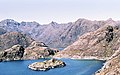
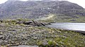
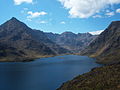
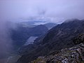
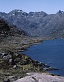
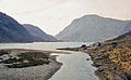
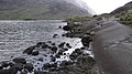
Loch Coruisk is a remote freshwater on the Isle of Skye, Inner Hebrides.
Media in category "Loch Coruisk"
The following 71 files are in this category, out of 71 total.
-
 A Marvellous View - geograph.org.uk - 866915.jpg 640 × 382; 50 KB
-
 A view towards Loch Coruisk - geograph.org.uk - 3451420.jpg 640 × 480; 132 KB
-
 Above Loch Coruisk - geograph.org.uk - 3498297.jpg 640 × 480; 199 KB
-
 An island in Loch Coruisk - geograph.org.uk - 3499503.jpg 640 × 480; 182 KB
-
 Approaching the Bad Step - geograph.org.uk - 853798.jpg 640 × 402; 81 KB
-

-
 Black Cuillin from Sgùrr na Strì.jpg 3,000 × 1,996; 3.72 MB
-
 Boulders next to Loch Coruisk - geograph.org.uk - 482740.jpg 640 × 427; 89 KB
-
 By Loch Coruisk - geograph.org.uk - 14692.jpg 427 × 640; 66 KB
-
 Coir'-uisg, from Sgùrr na Banachdich - geograph.org.uk - 1826999.jpg 800 × 600; 141 KB
-
 Coire Riabhach from the opposite shore of Loch Coruisk - geograph.org.uk - 1914260.jpg 2,112 × 1,188; 956 KB
-
 Cooling down in Loch Coruisk - geograph.org.uk - 1301620.jpg 640 × 480; 233 KB
-
 Coruisk Memorial Hut - geograph.org.uk - 4007768.jpg 640 × 480; 235 KB
-
 Coruisk Memorial Hut - geograph.org.uk - 833111.jpg 581 × 565; 123 KB
-
 Cuillin views - Flickr - Graham Grinner Lewis.jpg 3,648 × 2,736; 2.59 MB
-
 Druim Nan Ramh Cuillin Hills geograph-3215361-by-Ben-Brooksbank.jpg 895 × 563; 467 KB
-
 Druim Nan Ramh Cuillin Hills geograph-3215423-by-Ben-Brooksbank.jpg 935 × 525; 426 KB
-

-
 Landing stage at Loch na Cuilce - geograph.org.uk - 4557174.jpg 640 × 480; 546 KB
-
 Letters from England, Loch Coruisk and Cuillin Hills.jpg 951 × 631; 260 KB
-
 Loch Coruisk - Flickr - Graham Grinner Lewis.jpg 3,648 × 2,736; 2.54 MB
-
 Loch Coruisk - geograph.org.uk - 2005050.jpg 1,021 × 1,500; 446 KB
-
 Loch Coruisk - geograph.org.uk - 2524039.jpg 1,600 × 1,200; 223 KB
-
 Loch Coruisk - geograph.org.uk - 4028013.jpg 640 × 427; 380 KB
-
 Loch Coruisk - geograph.org.uk - 4028067.jpg 640 × 427; 385 KB
-
 Loch Coruisk - geograph.org.uk - 746773.jpg 640 × 478; 141 KB
-
 Loch Coruisk - geograph.org.uk - 829284.jpg 501 × 640; 82 KB
-
 Loch Coruisk - geograph.org.uk - 874501.jpg 422 × 640; 64 KB
-
 Loch Coruisk - geograph.org.uk - 96826.jpg 640 × 480; 112 KB
-
 Loch Coruisk - panoramio.jpg 3,008 × 2,000; 1.14 MB
-
 Loch Coruisk and Loch na Cuilce (sea loch) - geograph.org.uk - 5914714.jpg 1,024 × 768; 285 KB
-
 Loch Coruisk Black Cuillin.JPG 3,648 × 2,432; 4.38 MB
-
 Loch Coruisk from An Dorus - geograph.org.uk - 928867.jpg 419 × 640; 148 KB
-
 Loch Coruisk from the eastern shore - geograph.org.uk - 862551.jpg 640 × 420; 59 KB
-

-
 Loch Coruisk landing stage - geograph.org.uk - 1561034.jpg 640 × 480; 106 KB
-
 Loch Coruisk Landing Stage - geograph.org.uk - 4027905.jpg 427 × 640; 401 KB
-

-

-
 Loch Coruisk, Isle of Skye, United Kingdom (Unsplash mR57OYco4MY).jpg 5,472 × 3,648; 1.32 MB
-
 Loch Coruisk, Isle of Skye, United Kingdom (Unsplash).jpg 5,472 × 3,648; 2.33 MB
-
 Loch Coruisk, Skye, Scotland, 1963 - Flickr - PhillipC.jpg 1,639 × 1,012; 779 KB
-
 Loch na Cuilce - geograph.org.uk - 1964200.jpg 640 × 426; 179 KB
-
 Loch na Cuilce - geograph.org.uk - 4027914.jpg 640 × 427; 351 KB
-

-
 Lock Coruisk - 15-50 (July 13th) - Flickr - Un ragazzo chiamato Bi.jpg 800 × 800; 232 KB
-
 Massive slabs of Gabbro along the shoreline at Coruisk - geograph.org.uk - 1914288.jpg 2,112 × 1,188; 757 KB
-
 Meall na Cuilce above Loch na Cuilce - geograph.org.uk - 4008261.jpg 640 × 480; 221 KB
-
 Near the outflow of Loch Coruisk - geograph.org.uk - 6482248.jpg 5,640 × 3,760; 2.43 MB
-
 North shore of Loch Coruisk - geograph.org.uk - 761238.jpg 640 × 426; 134 KB
-
 Northern Spirit - geograph.org.uk - 2475756.jpg 640 × 480; 264 KB
-
 Ordnance Survey One-Inch Sheet 33 Rhum and part of Skye, Published 1957.jpg 8,263 × 9,746; 6.63 MB
-
 Ordnance Survey One-Inch Sheet 34 The Cuillins, Rhum & Canna, Published 1947.jpg 8,724 × 12,904; 8.71 MB
-
 Our boat arrives - geograph.org.uk - 4008315.jpg 640 × 480; 236 KB
-
 Our ferry for Elgol arriving at Coruisk - geograph.org.uk - 6518762.jpg 1,024 × 768; 691 KB
-
 Path on the south side of Loch Coruisk - geograph.org.uk - 761225.jpg 640 × 413; 116 KB
-

-
 Playing ring-a-ring-a-roses - geograph.org.uk - 2497544.jpg 2,000 × 1,500; 581 KB
-
 Rock and water - geograph.org.uk - 829282.jpg 640 × 482; 66 KB
-
 Sgurr Dubh Beag via the Dubh Slabs - geograph.org.uk - 1635595.jpg 640 × 480; 50 KB
-
 Sidney Richard Percy Skye 1874.jpg 1,600 × 1,107; 780 KB
-
 Sidney Richard Percy26.jpg 1,280 × 812; 154 KB
-
 South east end of Loch Coruisk - geograph.org.uk - 761385.jpg 640 × 415; 93 KB
-
 The 'Bad Step' - geograph.org.uk - 4007747.jpg 640 × 480; 259 KB
-
 The Cuillin - Flickr - Graham Grinner Lewis (3).jpg 3,648 × 2,736; 2.52 MB
-
 The Cuillin and Loch Coruisk - Flickr - Graham Grinner Lewis.jpg 3,648 × 2,736; 2.51 MB
-
 The Loch na Cuilce landing stage - geograph.org.uk - 4008220.jpg 640 × 480; 264 KB
-

-
 Waiting for the boat to Elgol - geograph.org.uk - 4008288.jpg 640 × 480; 243 KB
-
 Loch Coruisk, Skye - geograph.org.uk - 19693.jpg 640 × 480; 90 KB
-
 View from Sgurr na Banachdich - geograph.org.uk - 457840.jpg 480 × 640; 351 KB


_-_geograph.org.uk_-_5914714.jpg)


.jpg)
.jpg)


_-_Flickr_-_Un_ragazzo_chiamato_Bi.jpg)


.jpg)


