Category:Loch Arklet
Jump to navigation
Jump to search

Loch Arklet is a freshwater loch lying between Loch Lomond and Loch Katrine; it is used as a water supply.
reservoir in Stirling, Scotland, UK, outflows west via Arklet Water to Loch Ness, and east via a tunnel to Loch Katrine  | |||||
| Upload media | |||||
| Instance of | |||||
|---|---|---|---|---|---|
| Location | Stirling, Scotland | ||||
| Outflows | |||||
| Dam | |||||
 | |||||
Media in category "Loch Arklet"
The following 41 files are in this category, out of 41 total.
-
 Autumn by Loch Arklet - geograph.org.uk - 968864.jpg 640 × 480; 50 KB
-
 Bathymetrical survey of the lochs of Scotland, vol.III, plate IV (Lochs Katrine & Arklet).png 9,616 × 5,632; 69.34 MB
-

-

-
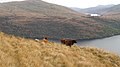 Cattle above Loch Lomond - geograph.org.uk - 1037408.jpg 640 × 359; 74 KB
-
 Flickr - Rainbirder - Common Sandpiper (Actitis hypoleucos) (1).jpg 800 × 533; 126 KB
-
 Loch Arklet - geograph.org.uk - 1038655.jpg 640 × 480; 52 KB
-
 Loch Arklet - geograph.org.uk - 3110465.jpg 640 × 480; 70 KB
-
 Loch Arklet dam - geograph.org.uk - 818958.jpg 640 × 480; 63 KB
-
 Loch Arklet dam - panoramio - SteveMi.jpg 1,600 × 1,200; 813 KB
-
 Loch Arklet dam - panoramio.jpg 2,560 × 1,920; 2.29 MB
-
 Loch Arklet shores - Highland cattle 01.JPG 3,264 × 2,448; 1.28 MB
-
 Loch Arklet shores - Highland cattle 02.JPG 3,264 × 2,448; 1.31 MB
-
 Loch Arklet shores - Highland cattle 03.JPG 3,264 × 2,448; 1.31 MB
-
 Loch Arklet shores - Highland cattle 04.JPG 3,264 × 2,448; 1.28 MB
-
 Loch Arklet shores - Highland cattle 05.JPG 3,264 × 2,448; 1.21 MB
-
 Loch Arklet shores - Highland cattle 06.JPG 3,264 × 2,448; 1.18 MB
-
 Loch Arklet shores - Highland cattle 07.JPG 3,264 × 2,448; 1.29 MB
-
 Loch Arklet shores - Highland cattle 08.JPG 3,264 × 2,448; 1.14 MB
-
 Loch Arklet shores - Highland cattle 09.JPG 3,264 × 2,448; 1.17 MB
-
 Loch Arklet shores - Highland cattle 10.JPG 3,264 × 2,448; 1.15 MB
-
 Loch Arklet shores - Highland cattle 11.JPG 2,448 × 3,264; 1.29 MB
-
 Loch Arklet shores - Highland cattle 12.JPG 2,448 × 3,264; 1.28 MB
-
 Loch Arklet, viewed from B829 - geograph.org.uk - 1772810.jpg 640 × 375; 57 KB
-
 Rough pasture, Coire nan Each - geograph.org.uk - 1038651.jpg 640 × 480; 95 KB
-
 Small burn flowing down to Loch Arklet - geograph.org.uk - 1344218.jpg 480 × 640; 125 KB
-
-

-
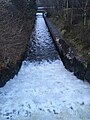
 Stronachlachar, Loch Arklet To Loch Katrine Aqueduct Outlet, Weirs And Water Channel.jpg 3,024 × 4,032; 3.58 MB
-
 Telecommunications mast, Inveruglas - geograph.org.uk - 1030224.jpg 640 × 480; 80 KB
-
 The Arrocher Hills across Loch Arklet - geograph.org.uk - 925118.jpg 640 × 480; 36 KB
-
 Tree lined shore of Loch Arklet - geograph.org.uk - 1344231.jpg 640 × 480; 122 KB
-

-
 Allt Ardvorlich - geograph.org.uk - 1041630.jpg 640 × 359; 66 KB
-
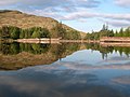
 Boat house - geograph.org.uk - 209814.jpg 640 × 480; 144 KB
-
 Corrieachan - geograph.org.uk - 212145.jpg 640 × 480; 149 KB
-
 Hillside - geograph.org.uk - 209822.jpg 640 × 480; 158 KB
-
 Hillside above Loch Arklet - geograph.org.uk - 648534.jpg 640 × 480; 89 KB
-
 Loch Arklet - geograph.org.uk - 261961.jpg 640 × 432; 86 KB
-
 Loch Arklet aqueduct - geograph.org.uk - 571164.jpg 640 × 427; 83 KB
-


.png)


_(1).jpg)


