Category:Locator maps of western New Guinea
Jump to navigation
Jump to search
| NO WIKIDATA ID FOUND! Search for Locator maps of western New Guinea on Wikidata | |
| Upload media |
Subcategories
This category has the following 5 subcategories, out of 5 total.
!
Media in category "Locator maps of western New Guinea"
The following 18 files are in this category, out of 18 total.
-
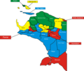
29 Kabupaten Papua.png 3,166 × 2,704; 749 KB
-
IndonesiaPapua.png 800 × 375; 97 KB
-
IndonesiaPapua2.png 400 × 163; 32 KB
-
IndonesiaWesternNewGuinea.png 400 × 163; 32 KB
-
Map of Central Papua 2022-06.png 2,560 × 942; 267 KB
-
Map of Central Papua Province.png 768 × 768; 111 KB
-
Map of Highland Papua 2022-06.png 2,560 × 942; 268 KB
-
Map of Papua Province 2022-06 (cropped).png 649 × 639; 21 KB
-
Map of Papua Province 2022-06.png 2,560 × 942; 265 KB
-
Map of South Papua 2022-06.png 2,560 × 942; 270 KB
-
Papua in Indonesia.png 1,500 × 590; 24 KB
-
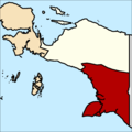
Peta Provinsi Papua Barat Daya.png 768 × 768; 120 KB
-
Peta Provinsi Papua Selatan.png 768 × 768; 111 KB
-
Peta Provinsi Papua Tengah.png 768 × 768; 111 KB
-
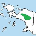
Snow Mountains Quail range.jpg 167 × 167; 11 KB
-
Sultanate of Tidore in 1800.png 2,368 × 2,191; 389 KB
-
West Papua.png 1,000 × 1,000; 195 KB
-
Westpapua.png 408 × 210; 7 KB


