Category:Locator maps of wards in London
Jump to navigation
Jump to search
Media in category "Locator maps of wards in London"
The following 56 files are in this category, out of 56 total.
-
 Alibon UK ward map.svg 1,108 × 1,266; 472 KB
-
 Barking and Dagenham London UK labelled ward map 2002.svg 1,037 × 1,195; 83 KB
-
 Barnet London UK labelled ward map 2002.svg 1,025 × 1,160; 158 KB
-
 Bexley London UK labelled ward map 2002.svg 1,019 × 1,266; 147 KB
-
 Brent London UK labelled ward map 2002.svg 1,354 × 1,140; 88 KB
-
 Bromley London UK labelled ward map 2002.svg 1,175 × 1,301; 179 KB
-
 Camden London UK blank ward map.svg 1,355 × 1,266; 293 KB
-
 Camden UK blank ward map 2022.svg 735 × 745; 1.02 MB
-
 Camden UK ward map 1978.svg 738 × 728; 27 KB
-
 Camden UK ward map highlighting Belsize Ward (2021).svg 735 × 745; 1,010 KB
-
 Camden UK ward map highlighting Bloomsbury Ward (2021).svg 735 × 745; 1,007 KB
-
 Camden UK ward map highlighting Camden Square Ward (2021).svg 735 × 745; 1,006 KB
-
 Camden UK ward map highlighting Camden Town Ward (2021).svg 735 × 745; 1,007 KB
-
 Camden UK ward map highlighting Fortune Green Ward (2021).svg 735 × 745; 1,010 KB
-
 Camden UK ward map highlighting Frognal Ward (2021).svg 735 × 745; 1,010 KB
-
 Camden UK ward map highlighting Gospel Oak Ward (2021).svg 735 × 745; 1,010 KB
-
 Camden UK ward map highlighting Hampstead Town Ward (2021).svg 735 × 745; 1,012 KB
-
 Camden UK ward map highlighting Haverstock Ward (2021).svg 735 × 745; 1,009 KB
-
 Camden UK ward map highlighting Highgate Ward (2021).svg 735 × 745; 1,015 KB
-
 Camden UK ward map highlighting Holborn & Covent Garden Ward (2021).svg 735 × 745; 1,010 KB
-
 Camden UK ward map highlighting Kentish Town North Ward (2021).svg 735 × 745; 1,007 KB
-
 Camden UK ward map highlighting Kentish Town South Ward (2021).svg 735 × 745; 1,006 KB
-
 Camden UK ward map highlighting Kilburn Ward (2021).svg 735 × 745; 1,012 KB
-
 Camden UK ward map highlighting King's Cross Ward (2021).svg 735 × 745; 1,011 KB
-
 Camden UK ward map highlighting Primrose Hill Ward (2021).svg 735 × 745; 1,008 KB
-
 Camden UK ward map highlighting Regent's Park Ward (2021).svg 735 × 745; 1,007 KB
-
 Camden UK ward map highlighting South Hampstead Ward (2021).svg 735 × 745; 1,008 KB
-
 Camden UK ward map highlighting St. Pancras & Somers Town Ward (2021).svg 735 × 745; 1,007 KB
-
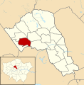
 Camden UK ward map highlighting Swiss Cottage.svg 1,355 × 1,266; 294 KB
-
 Camden UK ward map highlighting West Hampstead Ward (2021).svg 735 × 745; 1,011 KB
-
 Camden ward map.svg 1,224 × 1,093; 65 KB
-
 Ealing London UK labelled ward map 2002.svg 1,390 × 986; 110 KB
-
 Greenwich London UK labelled ward map 2002.svg 1,232 × 1,205; 98 KB
-
 Hackney London UK labelled ward map 2002-2014.svg 1,112 × 1,266; 66 KB
-
 Hammersmith and Fulham London UK labelled ward map 2002.svg 797 × 1,266; 68 KB
-
 Haringey London UK labelled ward map 2002.svg 1,319 × 888; 83 KB
-
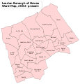 Harrow London UK labelled ward map 2002.svg 1,116 × 1,169; 116 KB
-
 Havering London UK labelled ward map 2002.svg 1,003 × 1,311; 163 KB
-
 Hillingdon London UK labelled ward map 2002.svg 656 × 1,337; 142 KB
-
 Hounslow London UK labelled ward map 2002.svg 1,390 × 921; 112 KB
-
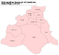
 Islington London UK labelled ward map 2002.svg 850 × 1,254; 50 KB
-
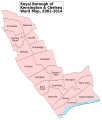 Kensington and Chelsea London UK labelled ward map 2002-2014.svg 1,082 × 1,266; 52 KB
-
 Kingston upon Thames London UK labelled ward map 2002.svg 655 × 1,346; 73 KB
-
 Lambeth London UK labelled ward map 2002.svg 620 × 1,276; 79 KB
-
 Lewisham London UK labelled ward map 2002.svg 1,038 × 1,266; 93 KB
-
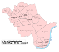
 Lewisham Met. B Ward Map 1916.svg 1,230 × 1,134; 95 KB
-
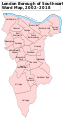
 London Borough of Lambeth Ward Map, 2022-Present.svg 512 × 1,051; 374 KB
-
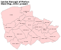 Merton London UK labelled ward map 2002.svg 1,364 × 1,123; 84 KB
-
 Newham London UK labelled ward map 2002.svg 1,240 × 1,124; 102 KB
-
 Redbridge London UK labelled ward map 2002.svg 1,161 × 1,231; 105 KB
-
 Richmond upon Thames London UK labelled ward map 2002.svg 1,276 × 1,266; 140 KB
-
 Southwark London UK labelled ward map 2002.svg 684 × 1,290; 99 KB
-
 Sutton London UK labelled ward map 2002.svg 1,233 × 1,195; 83 KB
-
 Waltham Forest London UK labelled ward map 2002.svg 780 × 1,311; 90 KB
-
 Wandsworth London UK labelled ward map 2002.svg 1,346 × 1,116; 81 KB
-
 Westminster London UK labelled ward map 2002.svg 1,286 × 1,124; 61 KB


.svg)
.svg)
.svg)
.svg)
.svg)
.svg)
.svg)
.svg)
.svg)
.svg)
.svg)
.svg)
.svg)
.svg)
.svg)
.svg)
.svg)
.svg)
.svg)

.svg)


