Category:Locator maps of the Kingdom of Sicily
Jump to navigation
Jump to search
Media in category "Locator maps of the Kingdom of Sicily"
The following 43 files are in this category, out of 43 total.
-
 Valli del Regno di Sicilia e Contea di Modica (1720).png 1,528 × 1,329; 200 KB
-
 Kingdom of Sicily 1154 locator.svg 712 × 807; 780 KB
-
 Location of the Kingdom of the Two Sicilies-no.svg 3,500 × 4,200; 1.07 MB
-
 Spain1580.gif 397 × 312; 6 KB
-
 Administrative Map of Kingdom of Sicily (1203).png 1,528 × 1,729; 231 KB
-
 Administrative Map of Kingdom of Sicily (1233).png 1,528 × 1,729; 225 KB
-
 Administrative Map of Kingdom of Sicily (1818).png 1,528 × 1,729; 248 KB
-
 Administrative Map of Kingdom of Trinacria (1375).png 1,528 × 1,729; 245 KB
-
 Administrative Map of Viceroyalty of Sicily (1583).png 1,528 × 1,729; 231 KB
-
 Aragonese Empire.PNG 386 × 255; 7 KB
-
 Contea di Modica (1720).png 1,528 × 1,329; 190 KB
-
 Giustizierati federiciani.png 713 × 713; 24 KB
-
 Giustizierato Abruzzo Citra.png 541 × 704; 36 KB
-
 Giustizierato Abruzzo Ultra.png 539 × 704; 51 KB
-
 Giustizierato Abruzzo.png 539 × 704; 35 KB
-
 Giustizierato di Calabria.png 539 × 704; 35 KB
-
 Giustizierato di Principato Ultra.png 560 × 704; 37 KB
-
 Giustizierato Principato e Terra Beneventana.png 539 × 704; 35 KB
-
 Giustizierato Sicilia citra Salso.png 539 × 704; 36 KB
-
 Giustizierato Sicilia ultra Salso.png 539 × 704; 36 KB
-
 Giustizierato Terra di Bari.png 539 × 704; 35 KB
-
 Giustizierato Terra di Lavoro.png 539 × 704; 36 KB
-
 Ita-sicilies.png 2,048 × 2,458; 270 KB
-
 Localisation map of the Contea di Geraci.png 1,528 × 1,329; 205 KB
-
 Localisation map of the Contea di Modica.png 1,528 × 1,329; 191 KB
-
 Localisation map of the Ducato di Bivona.png 1,528 × 1,329; 97 KB
-
 Localisation map of the Giustizierato di Malta.png 1,528 × 1,329; 180 KB
-
 Localisation map of the Giustizierato di Palermo.png 1,528 × 1,329; 181 KB
-
 Localisation map of the Strategoto di Messina after 1302.png 1,528 × 1,329; 202 KB
-
 Localisation map of the Val di Mazara.png 1,528 × 1,329; 197 KB
-
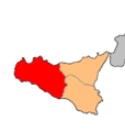
 Localisation map of the Valdemone.png 1,528 × 1,329; 202 KB
-
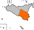
 Localisation map of the Vallo di Girgenti e di Castrogiovanni.png 1,528 × 1,329; 176 KB
-
 Localisation map of the Vallo di Girgenti.png 1,528 × 1,329; 200 KB
-
 Localisation map of the Vallo di Milazzo.png 1,528 × 1,329; 206 KB
-
 Location of the Kingdom of the Two Sicilies-it mod.PNG 500 × 600; 102 KB
-
 Location of the Kingdom of the Two Sicilies-it.svg 3,500 × 4,200; 1.07 MB
-
 Provincia Contado di Molise.png 539 × 704; 36 KB
-
 Val Demone (1720).png 1,528 × 1,329; 202 KB
-
 Val Demone.png 325 × 342; 10 KB
-
 Val di Noto (1720).png 1,528 × 1,329; 172 KB
-
 Val di Noto.png 325 × 342; 10 KB
-
 Vallo di Mazara (1720).png 1,528 × 1,329; 202 KB
-
 Vallo di Mazara.png 325 × 342; 10 KB
.png)


.png)
.png)
.png)
.png)
.png)

.png)


.png)

.png)

.png)
