Category:Locator maps of the Empire of Japan
Jump to navigation
Jump to search
Media in category "Locator maps of the Empire of Japan"
The following 39 files are in this category, out of 39 total.
-
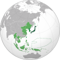 Japanese Empire (orthographic projection).svg 600 × 600; 665 KB
-
 China-nanjing.png 599 × 599; 143 KB
-
 Empire of Japan (1868-1945).png 1,000 × 600; 180 KB
-
 Empire of Japan (1868-1945).svg 774 × 495; 448 KB
-
 Empire of Japan (1930) territories.svg 600 × 600; 381 KB
-
 Empire of Japan (1930).svg 600 × 600; 304 KB
-
 Empire of Japan on the globe (de-facto) (Japan centered) svg.png 1,024 × 1,024; 426 KB
-
 Empire of Japan-stub.jpg 313 × 500; 33 KB
-
 Empire of Japan.png 1,000 × 1,000; 260 KB
-
 Free India orthographic map.png 1,000 × 1,000; 290 KB
-
 Greater Asian Co-prosperity sphere.png 1,000 × 1,000; 263 KB
-
 Greater Japanese empire.png 1,004 × 1,004; 280 KB
-
 ImperioJapones.png 1,427 × 628; 48 KB
-
 Japanese China.svg 600 × 600; 649 KB
-
 Japanese Dutch East Indies, Furthest Extent.png 3,163 × 1,847; 363 KB
-
 Japanese Empire - 1942.svg 1,100 × 837; 875 KB
-
 Japanese empire.png 1,004 × 1,004; 277 KB
-
 Japanese Hong Kong.svg 600 × 600; 645 KB
-
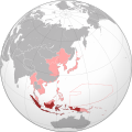 Japanese Indies.svg 600 × 600; 649 KB
-
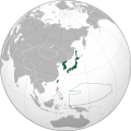
 Japanese Korea (orthographic projection).svg 600 × 600; 515 KB
-
 Japanese Philippines.svg 600 × 600; 644 KB
-
 Japanese Taiwan.svg 600 × 600; 644 KB
-
 Karafuto.png 1,000 × 1,000; 287 KB
-
 Karafuto.svg 600 × 600; 667 KB
-
 Korea in Empire of Japan.svg 600 × 600; 644 KB
-
 Korea in japanese empire.png 1,000 × 1,000; 287 KB
-
 Location Empire of Japan.png 298 × 148; 6 KB
-
 Location Japanese Empire.png 298 × 148; 6 KB
-
 Manchu State.png 998 × 999; 264 KB
-
 Manchukuo in Empire of Japan.svg 600 × 600; 1.17 MB
-
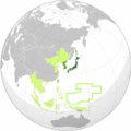
 Manchukuo locator map.svg 1,260 × 1,003; 2.66 MB
-
 Map world.png 2,753 × 1,400; 154 KB
-
 Mengjiang.png 599 × 599; 147 KB
-
 Russian Empire Empire of Japan Locator (1905–1910).svg 541 × 541; 363 KB
-
 Russian Empire Empire of Japan Locator (1910–1917).svg 541 × 541; 363 KB
-
 Russian Empire Empire of Japan Locator.png 1,357 × 628; 44 KB
-
 State of Burma orthographic map V2.png 1,000 × 1,000; 267 KB
-
 State of Burma orthographic map.png 1,000 × 1,000; 291 KB
-
 Vietnam within the Japanese Empire (orthographic projection).svg 600 × 600; 525 KB
.svg)

.png)
.svg)
_territories.svg)
.svg)
_(Japan_centered)_svg.png)


.svg)


.svg)
.svg)


.svg)