Category:Locator maps of states of the German Empire
Jump to navigation
Jump to search
Subcategories
This category has the following 3 subcategories, out of 3 total.
Media in category "Locator maps of states of the German Empire"
The following 39 files are in this category, out of 39 total.
-
 Deutsches R Anhalt.png 626 × 519; 22 KB
-
 Deutsches R Baden.png 626 × 519; 22 KB
-
 Deutsches R Braunschweig.png 626 × 519; 22 KB
-
 Deutsches R Bremen.png 624 × 519; 69 KB
-
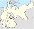
 Deutsches R Coburg Gotha.png 625 × 519; 55 KB
-
 Deutsches R Hessen-Da.png 626 × 519; 22 KB
-
 Deutsches R Lippe.png 630 × 521; 22 KB
-
 Deutsches R Mecklenburg-Schwerin.png 626 × 519; 22 KB
-
 Deutsches R Mecklenburg-Strelitz.png 647 × 535; 22 KB
-
 Deutsches R Meiningen.png 632 × 527; 76 KB
-
 Deutsches R Oldenburg.png 626 × 519; 22 KB
-
 Deutsches R Reuss aeltere.png 626 × 519; 22 KB
-
 Deutsches R Reuss juengere.png 626 × 519; 22 KB
-
 Deutsches R Sachsen.png 626 × 519; 56 KB
-
 Deutsches R Schaumburg-Lippe.png 630 × 520; 22 KB
-
 Deutsches R Waldeck.png 625 × 518; 22 KB
-
 Deutsches R Weimar-Eisenach.png 636 × 524; 22 KB
-
 Deutsches Reich (Karte).svg 650 × 545; 1.04 MB
-
 Kingdom of Prussia (1701–1918).svg 1,000 × 800; 704 KB
-
 KRAnhalt.png 1,200 × 1,015; 36 KB
-
 KRBeieren.png 1,741 × 1,444; 67 KB
-
 KRElzasL.png 1,741 × 1,444; 66 KB
-
 KRSLippe.png 1,741 × 1,444; 66 KB
-
 KRWuerttemberg.png 1,741 × 1,444; 66 KB
-
 Map-DR-Luebeck.png 1,741 × 1,444; 64 KB
-
 Map-DR-Saxe-Meiningen.png 707 × 600; 134 KB
-
 Map-Prussia.png 707 × 600; 137 KB
-
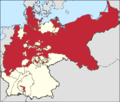
 Deutsches R Preussen.png 639 × 534; 22 KB
-
 Map-deutsches-kaiserreich-preussen.png 1,280 × 1,087; 83 KB
-
 ReussJLk.png 1,741 × 1,444; 66 KB
-
 ReussOLk.png 1,741 × 1,444; 66 KB
-
 Sachsen-Altenburg1871.png 723 × 600; 152 KB
-
 SCuG1871.png 1,741 × 1,444; 66 KB
-
 SaksenAltenburg1871.png 1,741 × 1,444; 66 KB
-
 SaksenMeiningen1871.png 1,741 × 1,444; 66 KB
-
 SaksenWeimarEisenach1871.png 1,741 × 1,444; 66 KB
-
 SchwRu1871.png 1,741 × 1,444; 66 KB
-
 SchwSon1871.png 1,741 × 1,444; 66 KB
-
 ThueringenKeizerrijk.png 1,200 × 1,015; 37 KB


.svg)
.svg)


