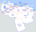
Category:Locator maps of states of Venezuela
Jump to navigation
Jump to search
| NO WIKIDATA ID FOUND! Search for Locator maps of states of Venezuela on Wikidata | |
| Upload media |
Federal territory: Capital District · Federal Dependencies · Territorial claim: Guayana Esequiba
Subcategories
This category has the following 3 subcategories, out of 3 total.
!
Media in category "Locator maps of states of Venezuela"
The following 7 files are in this category, out of 7 total.
-
Estados de Venezuela.jpg 960 × 720; 42 KB
-
Mapa con el limite TIFM 1.png 2,481 × 2,884; 5.33 MB
-
Venezuela Administrative Divisions.jpg 1,983 × 2,393; 912 KB
-
Venezuela politica copy.png 2,160 × 1,664; 625 KB
-
Venezuela-map-with-states.jpg 2,160 × 1,664; 109 KB
-
Venezuela-ㅡmap.png 5,000 × 4,419; 2.5 MB
-
Венесуэла административное деление.png 1,000 × 894; 27 KB


