Category:Locator maps of regions of Somaliland
Jump to navigation
Jump to search
Subcategories
This category has only the following subcategory.
S
Media in category "Locator maps of regions of Somaliland"
The following 18 files are in this category, out of 18 total.
-
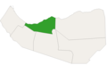
 Awdal.png 1,192 × 726; 53 KB
-
 Maroodijeex.png 1,192 × 726; 52 KB
-
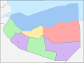 Political locator map of Somaliland.svg 786 × 587; 83 KB
-
 Saaxil.png 1,192 × 726; 53 KB
-
 Sanaag.png 1,192 × 726; 53 KB
-
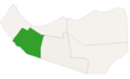
 Somalia-Somaliland-Awdal.png 426 × 585; 18 KB
-
 Somalia-Somaliland-Sool.png 426 × 585; 18 KB
-
 Somalia-Somaliland-Togdheer.png 426 × 585; 18 KB
-
 Somalia-Somaliland-Woqooyi-Galbeed.png 426 × 585; 18 KB
-
 Somalia-Somaliland.png 426 × 585; 17 KB
-
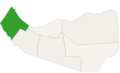
 Somaliland regions map Awdal.png 800 × 522; 36 KB
-
 Somaliland regions map Maroodi Jeeh.png 800 × 522; 36 KB
-
 Somaliland regions map Saahil.png 800 × 522; 36 KB
-
 Somaliland regions map Sanaag.png 800 × 522; 36 KB
-
 Somaliland regions map Sool.png 800 × 522; 36 KB
-
 Somaliland regions map Togdheer.png 800 × 522; 36 KB
-
 Sool region.png 1,192 × 726; 54 KB
-
 Togdheer.png 1,192 × 726; 52 KB


