Category:Locator maps of regions of New Zealand
Jump to navigation
Jump to search
| NO WIKIDATA ID FOUND! Search for Locator maps of regions of New Zealand on Wikidata | |
| Upload media |
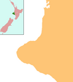
Regions of New Zealand: West Coast
Outlying islands, territories and dependencies: Chatham Islands · Tokelau – Territory with specific status:
Associated countries: Cook Islands · Niue
Outlying islands, territories and dependencies: Chatham Islands · Tokelau – Territory with specific status:
Associated countries: Cook Islands · Niue
Subcategories
This category has the following 2 subcategories, out of 2 total.
Media in category "Locator maps of regions of New Zealand"
The following 24 files are in this category, out of 24 total.
-
 NZ-Auckland plain map.png 378 × 423; 28 KB
-
 Position of Auckland Region.png 405 × 590; 7 KB
-
 Position of Bay of Plenty.png 405 × 590; 7 KB
-
 Position of Canterbury Region.png 405 × 590; 7 KB
-
 Position of Gisborne Region.png 405 × 590; 7 KB
-
 Position of Hawkes Bay.png 405 × 590; 7 KB
-
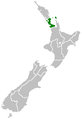
 Kahungunu.png 695 × 794; 25 KB
-
 Marlborough nz location.png 405 × 590; 7 KB
-
 NZ-Marlborough plain map.png 378 × 423; 10 KB
-
 Positie van Nelson.png 405 × 590; 11 KB
-
 NZ-Northland plain map.png 378 × 423; 11 KB
-
 NZ-Northland plain map2.png 378 × 423; 12 KB
-
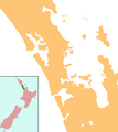
 Position of Northland.png 405 × 590; 7 KB
-
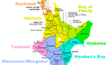 NZTerritorialAuthorities-Waikato.png 565 × 341; 34 KB
-
 Position of Otago.png 405 × 590; 7 KB
-
 Position of ManawatuWanganui.png 405 × 590; 7 KB
-
 Position of Southland Region.png 405 × 590; 7 KB
-
 NZ-Taranaki plain map.png 378 × 423; 10 KB
-
 Position of Taranaki.png 405 × 590; 7 KB
-
 Position of Tasman Region.png 405 × 590; 7 KB
-
 Position of Waikato Region.png 405 × 590; 7 KB
-
 Position of Wellington Region.png 405 × 590; 7 KB
-
 NZ-West Coast plain map.png 378 × 423; 21 KB
-
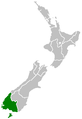
 Position of West Coast.png 405 × 590; 7 KB


