Category:Locator maps of regions of Augustan Italy
Jump to navigation
Jump to search
Media in category "Locator maps of regions of Augustan Italy"
The following 12 files are in this category, out of 12 total.
-
 Regio I Latium et Campania locator map.svg 502 × 588; 2.62 MB
-
 Regio II Apulia et Calabria locator map.svg 502 × 588; 2.62 MB
-
 Regio III Lucania et Bruttii locator map.svg 502 × 588; 2.62 MB
-
 Regio IV Samnium locator map.svg 502 × 588; 2.62 MB
-
 Regio IX Liguria locator map.svg 502 × 588; 2.62 MB
-
 Regio V Picenum locator map.svg 502 × 588; 2.62 MB
-
 Regio VI Umbria locator map.svg 502 × 588; 2.62 MB
-
 Regio VII Etruria locator map.svg 502 × 588; 2.62 MB
-
 Regio VIII Aemilia locator map.svg 502 × 588; 2.62 MB
-
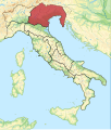 Regio X Venetia et Histria locator map.svg 502 × 588; 2.62 MB
-
 Regio X Venetia et Histria with expanded area locator map.svg 502 × 588; 2.62 MB
-
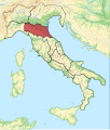
 Regio XI Transpadana locator map.svg 502 × 588; 2.62 MB


