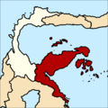
Category:Locator maps of provinces of Indonesia
Jump to navigation
Jump to search
| NO WIKIDATA ID FOUND! Search for Locator maps of provinces of Indonesia on Wikidata | |
| Upload media |
Subcategories
This category has the following 7 subcategories, out of 7 total.
B
E
M
P
S
W
Media in category "Locator maps of provinces of Indonesia"
The following 43 files are in this category, out of 43 total.
-
IndonesiaAceh.png 800 × 375; 97 KB
-
IndonesiaBangkaBelitung.png 800 × 375; 97 KB
-
IndonesiaBanten.png 800 × 375; 97 KB
-
IndonesiaBengkulu.png 800 × 375; 97 KB
-
IndonesiaCentralJava.png 800 × 375; 97 KB
-
IndonesiaCentralKalimantan.png 800 × 375; 97 KB
-
IndonesiaCentralSulawesi.png 800 × 375; 97 KB
-
IndonesiaEastJava.png 800 × 375; 97 KB
-
IndonesiaEastNusaTenggara.png 800 × 375; 97 KB
-
IndonesiaGorontalo.png 800 × 375; 97 KB
-
IndonesiaBorneoProvince.png 2,938 × 1,379; 426 KB
-
IndonesiaCentralSumatra.png 2,938 × 1,379; 439 KB
-
IndonesiaSulawesiProvince.png 2,938 × 1,379; 458 KB
-
IndonesiaSundaKecil.png 2,938 × 1,379; 453 KB
-
IndonesiaJakarta.png 800 × 375; 97 KB
-
IndonesiaJambi.png 800 × 375; 97 KB
-
IndonesiaLampung.png 800 × 375; 97 KB
-
Locator kalteng final.png 300 × 197; 21 KB
-
Locator north sumatra.png 300 × 206; 28 KB
-
Locator west sumatra.png 300 × 179; 21 KB
-
IndonesiaNorthMaluku.png 800 × 375; 97 KB
-
IndonesiaNorthSulawesi.png 800 × 375; 97 KB
-
Indonesia, North Sumatra.png 800 × 375; 97 KB
-
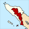
Peta Provinsi Aceh Leuser Antara.png 768 × 768; 97 KB
-
Peta Provinsi Bolaang Mongondow.png 768 × 768; 71 KB
-
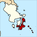
Peta Provinsi Kepulauan Buton.png 768 × 768; 101 KB
-
Peta Provinsi Kepulauan Nias.png 768 × 768; 109 KB
-
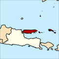
Peta Provinsi Madura.png 768 × 768; 76 KB
-
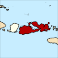
Peta Provinsi Pulau Sumbawa.png 768 × 768; 77 KB
-
Peta Provinsi Sulawesi Timur.png 768 × 768; 137 KB
-
Peta Provinsi Tapanuli.png 768 × 768; 115 KB
-
IndonesiaRiau.png 800 × 375; 97 KB
-
IndonesiaRiauIslands.png 800 × 375; 97 KB
-
IndonesiaSouthKalimantan.png 800 × 375; 97 KB
-
IndonesiaSouthSulawesi.png 800 × 375; 97 KB
-
IndonesiaSouthSumatra.png 800 × 375; 97 KB
-
IndonesiaSouthEastSulawesi.png 800 × 375; 97 KB
-
IndonesiaWestJava.png 800 × 375; 97 KB
-
IndonesiaWestKalimantan.png 800 × 375; 97 KB
-
IndonesiaWestNusaTenggara.png 800 × 375; 97 KB
-
IndonesiaWestSulawesi.png 800 × 375; 97 KB
-
IndonesiaWestSumatra.png 800 × 375; 97 KB
-
IndonesiaYogyakarta.png 800 × 375; 97 KB


