Category:Locator maps of populated places in Union County, New Jersey
Jump to navigation
Jump to search
Media in category "Locator maps of populated places in Union County, New Jersey"
The following 19 files are in this category, out of 19 total.
-
 Berkeley heights twp nj 039.png 660 × 580; 54 KB
-
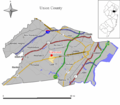
 Clark twp nj 039.png 660 × 580; 53 KB
-
 Elizabeth nj 039.png 660 × 580; 54 KB
-
 Fanwood nj 039.png 660 × 580; 52 KB
-
 Garwood nj 039.png 660 × 580; 52 KB
-
 Hillside twp nj 039.png 660 × 580; 53 KB
-
 Kenilworth nj 039.png 660 × 580; 53 KB
-
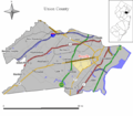
 Linden nj 039.png 660 × 580; 54 KB
-
 Mountainside nj 039.png 660 × 580; 53 KB
-
 New providence nj 039.png 660 × 580; 53 KB
-
 Plainfield nj 039.png 660 × 580; 53 KB
-
 Rahway nj 039.png 660 × 580; 53 KB
-
 Roselle nj 039.png 660 × 580; 52 KB
-
 Roselle park nj 039.png 660 × 580; 52 KB
-
 Scotch plains twp nj 039.png 660 × 580; 54 KB
-
 Springfield twp nj 039.png 660 × 580; 53 KB
-
 Summit nj 039.png 660 × 580; 53 KB
-
 Union twp nj 039.png 660 × 580; 54 KB
-
 Westfield nj 039.png 660 × 580; 53 KB


