Category:Locator maps of oblasts in Ukraine
Jump to navigation
Jump to search
Subcategories
This category has only the following subcategory.
Media in category "Locator maps of oblasts in Ukraine"
The following 115 files are in this category, out of 115 total.
-
Map of Ukraine political simple Oblast Tscherkasy.png 2,466 × 1,749; 204 KB
-
Cherkasy Oblast in Ukraine (de jure).svg 1,547 × 1,041; 726 KB
-
Chernihiv Oblast in Ukraine (de jure).svg 1,547 × 1,041; 716 KB
-
Chernivtsi Oblast in Ukraine (de jure).svg 1,547 × 1,041; 716 KB
-
Crimea Autonomous Republic in Ukraine (de jure).svg 1,547 × 1,041; 716 KB
-
Dnipropetrovsk Oblast in Ukraine (de jure).svg 1,547 × 1,041; 709 KB
-
Donetsk Oblast in Ukraine (de jure).svg 1,547 × 1,041; 709 KB
-
Ivano-Frankivsk Oblast in Ukraine (de jure).svg 1,547 × 1,041; 716 KB
-
Kharkiv Oblast in Ukraine (de jure).svg 1,547 × 1,041; 709 KB
-
Kherson Oblast in Ukraine (de jure).svg 1,547 × 1,041; 709 KB
-
Khmelnytsky Oblast in Ukraine (de jure).svg 1,547 × 1,041; 716 KB
-
Kiev City in Ukraine (de jure).svg 1,547 × 1,041; 716 KB
-
Kirovohrad Oblast in Ukraine (de jure).svg 1,547 × 1,041; 709 KB
-
Kyiv Oblast in Ukraine (de jure).svg 1,547 × 1,041; 716 KB
-
Locator map of Cherkasy province.svg 887 × 589; 544 KB
-
Locator map of Chernigiv province.svg 887 × 589; 544 KB
-
Locator map of Chernivtsi province.svg 887 × 589; 542 KB
-
Locator map of Dnipropetrovsk province.svg 887 × 589; 545 KB
-
Locator map of Donetsk province.svg 887 × 589; 545 KB
-
Locator map of Ivano-frankivsk province.svg 887 × 589; 542 KB
-
Locator map of Kharkiv province.svg 887 × 589; 545 KB
-
Locator map of Kherson province.svg 887 × 589; 545 KB
-
Locator map of Khmelnitskiy province.svg 887 × 589; 543 KB
-
Locator map of Krym province.svg 887 × 589; 544 KB
-
Locator map of Kyiv province.svg 887 × 589; 546 KB
-
Locator map of Kyrovograd province.svg 887 × 589; 545 KB
-
Locator map of Lugansk province.svg 887 × 589; 544 KB
-
Locator map of Lviv province.svg 887 × 589; 542 KB
-
Locator map of Mykolaiv province.svg 887 × 589; 545 KB
-
Locator map of Odessa province.svg 887 × 589; 548 KB
-
Locator map of Poltava province.svg 887 × 589; 543 KB
-
Locator map of Rivne province.svg 887 × 589; 543 KB
-
Locator map of Sumy province.svg 887 × 589; 544 KB
-
Locator map of Ternopil province.svg 887 × 589; 542 KB
-
Locator map of Vinnytsa province.svg 887 × 589; 544 KB
-
Locator map of Volyn province.svg 887 × 589; 543 KB
-
Locator map of Zakarpattya province.svg 887 × 589; 541 KB
-
Locator map of Zaporizhzhya province.svg 887 × 589; 544 KB
-
Locator map of Zhytomyr province.svg 887 × 589; 543 KB
-
Luhansk Oblast in Ukraine (de jure).svg 1,547 × 1,041; 709 KB
-
Lviv Oblast in Ukraine (de jure).svg 1,547 × 1,041; 716 KB
-
Map of Ukraine political Crimea.png 800 × 559; 134 KB
-
Map of Ukraine political Oblast Dnipropetrowsk.png 1,181 × 825; 39 KB
-
Map of Ukraine political simple Donbass (de jure).svg 1,547 × 1,041; 722 KB
-
Map of Ukraine political simple Donbass.png 1,280 × 860; 246 KB
-
Map of Ukraine political simple Oblast Charkiw.png 1,200 × 799; 220 KB
-
Map of Ukraine political simple Oblast Cherson.png 2,466 × 1,749; 202 KB
-
Map of Ukraine political simple Oblast Chmelnyzkyj.png 2,466 × 1,749; 204 KB
-
Map of Ukraine political simple Oblast Czernowitz.png 2,466 × 1,749; 203 KB
-
Map of Ukraine political simple Oblast Dnipropetrowsk.png 2,466 × 1,749; 203 KB
-
Map of Ukraine political simple Oblast Donezk.png 1,200 × 799; 140 KB
-
Map of Ukraine political simple Oblast Iwano-Frankiwsk.png 2,466 × 1,749; 203 KB
-
Map of Ukraine political simple Oblast Kiew.png 2,466 × 1,749; 204 KB
-
Map of Ukraine political simple Oblast Kirowohrad.png 2,466 × 1,749; 203 KB
-
Map of Ukraine political simple Oblast Krim.png 2,466 × 1,749; 202 KB
-
Map of Ukraine political simple Oblast Lemberg.png 2,466 × 1,749; 282 KB
-
Map of Ukraine political simple Oblast Luhansk.png 2,466 × 1,749; 283 KB
-
Map of Ukraine political simple Oblast Mykolajiw.png 2,466 × 1,749; 283 KB
-
Map of Ukraine political simple Oblast Odessa.png 2,466 × 1,749; 283 KB
-
Map of Ukraine political simple Oblast Poltawa.png 2,466 × 1,749; 283 KB
-
Map of Ukraine political simple Oblast Rivne.png 2,466 × 1,749; 282 KB
-
Map of Ukraine political simple Oblast Saporischja.png 2,466 × 1,749; 283 KB
-
Map of Ukraine political simple Oblast Schytomyr.png 2,466 × 1,749; 282 KB
-
Map of Ukraine political simple Oblast Sumy.png 2,466 × 1,749; 282 KB
-
Map of Ukraine political simple Oblast Ternopil.png 2,466 × 1,749; 282 KB
-
Map of Ukraine political simple Oblast Transkarpatien.png 2,466 × 1,749; 283 KB
-
Map of Ukraine political simple Oblast Tschernihiw.png 2,466 × 1,749; 282 KB
-
Map of Ukraine political simple Oblast Wolhynien.png 2,466 × 1,749; 282 KB
-
Map of Ukraine political simple Oblast Wynnyzja.png 2,466 × 1,749; 282 KB
-
Mykolaiv Oblast in Ukraine (de jure).svg 1,547 × 1,041; 709 KB
-
Odessa Oblast in Ukraine (de jure).svg 1,547 × 1,041; 709 KB
-
Poltava Oblast in Ukraine (de jure).svg 1,547 × 1,041; 709 KB
-
Rivne Oblast in Ukraine (de jure).svg 1,547 × 1,041; 716 KB
-
Riwne-Ukraine-Map.png 1,200 × 799; 80 KB
-
Sevastopol City in Ukraine (de jure).svg 1,547 × 1,041; 716 KB
-
Sumy Oblast in Ukraine (de jure).svg 1,547 × 1,041; 709 KB
-
Ternopil Oblast in Ukraine (de jure).svg 1,547 × 1,041; 716 KB
-
Ukraine Cherkasy small.png 254 × 216; 20 KB
-
Ukraine Chernigov small.png 217 × 241; 21 KB
-
Ukraine Chernihiv small.png 213 × 110; 14 KB
-
Ukraine Dnipropetrovs'k small.png 308 × 207; 25 KB
-
Ukraine Donets'k small.png 201 × 266; 21 KB
-
Ukraine Ivano-Frankivs'k small.png 164 × 217; 17 KB
-
Ukraine Kharkiv small.png 259 × 232; 22 KB
-
Ukraine Kherson small.png 276 × 192; 24 KB
-
Ukraine Kirovohrad small.png 326 × 182; 21 KB
-
Ukraine Krim small.png 294 × 185; 21 KB
-
Ukraine KYIV small.png 216 × 277; 21 KB
-
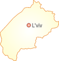
Ukraine L'viv small.png 217 × 224; 17 KB
-
Ukraine Luhans'k small.png 184 × 258; 20 KB
-
Ukraine Luts'k small.png 182 × 191; 16 KB
-
Ukraine Mykolayiv small.png 236 × 213; 22 KB
-
Ukraine Oblast Charkiw.png 709 × 495; 271 KB
-
Ukraine Oblast Czernowitz.png 709 × 495; 269 KB
-
Ukraine Oblast Donezk.png 709 × 495; 284 KB
-
Ukraine Oblast Iwano-Frankiwsk.png 709 × 495; 269 KB
-
Ukraine Oblast Kiew.png 709 × 495; 271 KB
-
Ukraine Oblast Lemberg.png 709 × 495; 270 KB
-
Ukraine Oblast Riwne.png 709 × 495; 270 KB
-
Ukraine Oblast Ternopil.png 709 × 495; 269 KB
-
Ukraine Oblast Transkarpatien.png 709 × 495; 269 KB
-
Ukraine Odesa small.png 257 × 361; 28 KB
-
Ukraine Poltava small.png 265 × 216; 20 KB
-
Ukraine Rivne small.png 208 × 223; 18 KB
-
Ukraine Sumy small.png 208 × 265; 20 KB
-
Ukraine Ternopil’ small.png 126 × 212; 15 KB
-
Ukraine Uzhhorod small.png 190 × 154; 15 KB
-
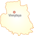
Ukraine Vinnytsya small.png 214 × 225; 20 KB
-
Ukraine Zhytomyr small.png 196 × 247; 21 KB
-
Vinnytsia Oblast in Ukraine (de jure).svg 1,547 × 1,041; 716 KB
-
Volyn Oblast in Ukraine (de jure).svg 1,547 × 1,041; 716 KB
-
Zakarpattia Oblast in Ukraine (de jure).svg 1,547 × 1,041; 716 KB
-
Zaporizh-Ukraine-Map good.png 1,200 × 799; 115 KB
-
Zaporizhia Oblast in Ukraine (de jure).svg 1,547 × 1,041; 709 KB
-
Zhytomyr Oblast in Ukraine (de jure).svg 1,547 × 1,041; 716 KB


