Category:Locator maps of neighborhoods in Zaltbommel
Jump to navigation
Jump to search
Media in category "Locator maps of neighborhoods in Zaltbommel"
The following 31 files are in this category, out of 31 total.
-

-

-

-

-

-

-
 Map - NL - Zaltbommel - Wijk 00 Zaltbommel.svg 625 × 575; 12 KB
-
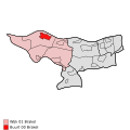 Map - NL - Zaltbommel - Wijk 01 Brakel - Buurt 00 Brakel.svg 375 × 375; 31 KB
-
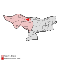
 Map - NL - Zaltbommel - Wijk 01 Brakel - Buurt 01 Poederoijen.svg 375 × 375; 31 KB
-
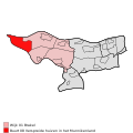
 Map - NL - Zaltbommel - Wijk 01 Brakel - Buurt 02 Aalst.svg 375 × 375; 31 KB
-
 Map - NL - Zaltbommel - Wijk 01 Brakel - Buurt 03 Zuilichem.svg 375 × 375; 31 KB
-
 Map - NL - Zaltbommel - Wijk 01 Brakel - Buurt 04 De Rietschoof.svg 375 × 375; 31 KB
-

-

-

-
-

-
 Map - NL - Zaltbommel - Wijk 01 Brakel.svg 625 × 575; 12 KB
-
 Map - NL - Zaltbommel - Wijk 02 Kerkwijk - Buurt 00 Kerkwijk.svg 375 × 375; 31 KB
-
 Map - NL - Zaltbommel - Wijk 02 Kerkwijk - Buurt 01 Bruchem.svg 375 × 375; 31 KB
-

-
 Map - NL - Zaltbommel - Wijk 02 Kerkwijk - Buurt 03 Gameren.svg 375 × 375; 31 KB
-
 Map - NL - Zaltbommel - Wijk 02 Kerkwijk - Buurt 04 Nieuwaal.svg 375 × 375; 31 KB
-

-

-

-
 Map - NL - Zaltbommel - Wijk 02 Kerkwijk.svg 625 × 575; 12 KB
-

-

-

-
 Map - NL - Zaltbommel - Wijk 03 Nederhemert.svg 625 × 575; 12 KB


