Category:Locator maps of neighborhoods in Westvoorne
Jump to navigation
Jump to search
Media in category "Locator maps of neighborhoods in Westvoorne"
The following 25 files are in this category, out of 25 total.
-
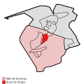
 Map - NL - Westvoorne - Wijk 00 Rockanje - Buurt 00 Rockanje.svg 375 × 375; 17 KB
-
 Map - NL - Westvoorne - Wijk 00 Rockanje - Buurt 01 Helhoek.svg 375 × 375; 17 KB
-
 Map - NL - Westvoorne - Wijk 00 Rockanje - Buurt 02 Strijpe.svg 375 × 375; 17 KB
-
 Map - NL - Westvoorne - Wijk 00 Rockanje - Buurt 03 Stuifakker.svg 375 × 375; 17 KB
-
 Map - NL - Westvoorne - Wijk 00 Rockanje - Buurt 04 Zuidhoek.svg 375 × 375; 17 KB
-
 Map - NL - Westvoorne - Wijk 00 Rockanje - Buurt 05 Nieuw gebied.svg 375 × 375; 17 KB
-

-
 Map - NL - Westvoorne - Wijk 00 Rockanje.svg 625 × 575; 6 KB
-
 Map - NL - Westvoorne - Wijk 01 Oostvoorne - Buurt 00 Oostvoorne.svg 375 × 375; 17 KB
-
 Map - NL - Westvoorne - Wijk 01 Oostvoorne - Buurt 01 De Waranda.svg 375 × 375; 17 KB
-

-
 Map - NL - Westvoorne - Wijk 01 Oostvoorne - Buurt 03 Tinte.svg 375 × 375; 17 KB
-
 Map - NL - Westvoorne - Wijk 01 Oostvoorne - Buurt 04 Goudhoek.svg 375 × 375; 17 KB
-

-
 Map - NL - Westvoorne - Wijk 01 Oostvoorne - Buurt 06 Duinoord.svg 375 × 375; 17 KB
-

-

-
 Map - NL - Westvoorne - Wijk 01 Oostvoorne.svg 625 × 575; 6 KB
-
 Map NL - Westvoorne - Helhoek.png 800 × 600; 11 KB
-
 Map NL - Westvoorne - Kruiningergors.png 800 × 600; 11 KB
-
 Map NL - Westvoorne - Oostvoorne.png 800 × 600; 11 KB
-
 Map NL - Westvoorne - Rockanje.png 800 × 600; 11 KB
-
 Map NL - Westvoorne - Strype.png 800 × 600; 11 KB
-
 Map NL - Westvoorne - Stuifakker.png 800 × 600; 11 KB
-
 Map NL - Westvoorne - Tinte.png 800 × 600; 11 KB


