Category:Locator maps of neighborhoods in Wester-Koggenland
Jump to navigation
Jump to search
Media in category "Locator maps of neighborhoods in Wester-Koggenland"
The following 13 files are in this category, out of 13 total.
-
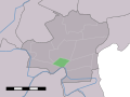 Map NL - Wester-Koggenland - Avenhorn.svg 800 × 600; 18 KB
-
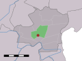
 Map NL - Wester-Koggenland - Berkhout.svg 800 × 600; 18 KB
-
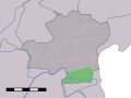
 Map NL - Wester-Koggenland - Bobeldijk.svg 800 × 600; 18 KB
-
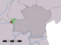
 Map NL - Wester-Koggenland - De Goorn.svg 800 × 600; 18 KB
-
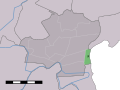
 Map NL - Wester-Koggenland - Grosthuizen.svg 800 × 600; 18 KB
-
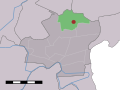
 Map NL - Wester-Koggenland - Noorddijk.svg 800 × 600; 18 KB
-
 Map NL - Wester-Koggenland - Nordermeer.jpg 800 × 600; 36 KB
-
 Map NL - Wester-Koggenland - Oudendijk.svg 800 × 600; 18 KB
-
 Map NL - Wester-Koggenland - Rustenburg.svg 800 × 600; 18 KB
-
 Map NL - Wester-Koggenland - Scharwoude.svg 800 × 600; 18 KB
-
 Map NL - Wester-Koggenland - Spierdijk.svg 800 × 600; 18 KB
-
 Map NL - Wester-Koggenland - Ursem.svg 800 × 600; 18 KB
-
 Map NL - Wester-Koggenland - Zuidermeer.svg 800 × 600; 18 KB


