Category:Locator maps of neighborhoods in Waterland
Jump to navigation
Jump to search
Media in category "Locator maps of neighborhoods in Waterland"
The following 25 files are in this category, out of 25 total.
-

-
-
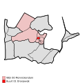
 Map - NL - Waterland - Wijk 00 Monnickendam - Buurt 02 Markgouw.svg 375 × 375; 24 KB
-

-
 Map - NL - Waterland - Wijk 00 Monnickendam - Buurt 04 Ooster Ee.svg 375 × 375; 24 KB
-
 Map - NL - Waterland - Wijk 00 Monnickendam - Buurt 05 't Spil.svg 375 × 375; 24 KB
-

-

-

-

-
 Map - NL - Waterland - Wijk 00 Monnickendam.svg 625 × 575; 12 KB
-
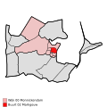
 Map - NL - Waterland - Wijk 01 Katwoude - Buurt 00 Katwoude.svg 375 × 375; 24 KB
-
 Map - NL - Waterland - Wijk 01 Katwoude.svg 625 × 575; 12 KB
-

-

-
 Map - NL - Waterland - Wijk 02 Marken.svg 625 × 575; 12 KB
-
-

-

-
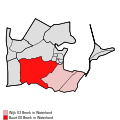
 Map - NL - Waterland - Wijk 03 Broek in Waterland.svg 625 × 575; 12 KB
-
 Map - NL - Waterland - Wijk 04 Ilpendam - Buurt 00 Ilpendam.svg 375 × 375; 24 KB
-

-
 Map - NL - Waterland - Wijk 04 Ilpendam.svg 625 × 575; 12 KB
-
 Map - NL - Waterland - Wijk 05 Watergang - Buurt 00 Watergang.svg 375 × 375; 24 KB
-
 Map - NL - Waterland - Wijk 05 Watergang.svg 625 × 575; 12 KB


.svg)


.svg)


