Category:Locator maps of neighborhoods in Maastricht
Jump to navigation
Jump to search
Media in category "Locator maps of neighborhoods in Maastricht"
The following 145 files are in this category, out of 145 total.
-
 Amby (Maastricht).svg 818 × 1,052; 14.36 MB
-
 Beatrixhaven (Maastricht).svg 818 × 1,052; 14.36 MB
-
 Belfort (Maastricht).svg 818 × 1,052; 14.37 MB
-
 Belvédère (Maastricht).svg 818 × 1,052; 14.37 MB
-
 Biesland (Maastricht).svg 818 × 1,052; 14.36 MB
-
 Binnenstad (Maastricht).svg 818 × 1,052; 14.36 MB
-
 Borgharen (Maastricht).svg 818 × 1,052; 14.36 MB
-
 Boschpoort (Maastricht).svg 818 × 1,052; 14.37 MB
-
 Boschstraatkwartier (Maastricht).svg 818 × 1,052; 14.36 MB
-
 Bosscherveld (Maastricht).svg 818 × 1,052; 14.37 MB
-
 Brusselsepoort (Maastricht).svg 818 × 1,052; 14.37 MB
-
 Caberg (Maastricht).svg 818 × 1,052; 14.37 MB
-
 Campagne (Maastricht).svg 818 × 1,052; 14.36 MB
-
 Céramique (Maastricht).svg 818 × 1,052; 14.36 MB
-
 Daalhof (Maastricht).svg 818 × 1,052; 14.37 MB
-
 De Heeg (Maastricht).svg 818 × 1,052; 14.36 MB
-
 Dousberg-Hazendans (Maastricht).svg 818 × 1,052; 14.37 MB
-
 Frontenkwartier (Maastricht).svg 818 × 1,052; 14.37 MB
-
 Heer (Maastricht).svg 818 × 1,052; 14.37 MB
-
 Heugem (Maastricht).svg 818 × 1,052; 14.36 MB
-
 Heugemerveld (Maastricht).svg 818 × 1,052; 14.36 MB
-
 Itteren (Maastricht).svg 818 × 1,052; 14.37 MB
-
 Jekerdal (Maastricht).svg 818 × 1,052; 14.36 MB
-
 Jekerkwartier (Maastricht).svg 818 × 1,052; 14.36 MB
-
 Kommelkwartier Maastricht.svg 818 × 1,052; 14.36 MB
-
 Lanakerveld (Maastricht).svg 818 × 1,052; 14.37 MB
-
 Limmel (Maastricht).svg 818 × 1,052; 14.36 MB
-
 Malberg (Maastricht).svg 818 × 1,052; 14.37 MB
-
 Malpertuis (Maastricht).svg 818 × 1,052; 14.37 MB
-
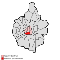
 Map - NL - Maastricht - Wijk 00 Centrum - Buurt 00 Binnenstad.svg 375 × 375; 31 KB
-
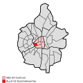
 Map - NL - Maastricht - Wijk 00 Centrum - Buurt 01 Jekerkwartier.svg 375 × 375; 31 KB
-
-

-
-
-
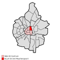
 Map - NL - Maastricht - Wijk 00 Centrum - Buurt 06 Wyck.svg 375 × 375; 31 KB
-
 Map - NL - Maastricht - Wijk 00 Centrum.svg 625 × 575; 11 KB
-

-

-

-
-

-

-
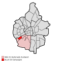
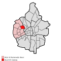
 Map - NL - Maastricht - Wijk 01 Buitenwijk Zuidwest.svg 625 × 575; 11 KB
-
-

-

-
-
-
-

-
-

-

-
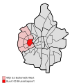
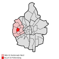
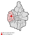
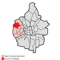
 Map - NL - Maastricht - Wijk 02 Buitenwijk West.svg 625 × 575; 11 KB
-

-

-
-

-
-
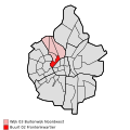
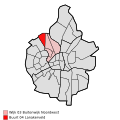
 Map - NL - Maastricht - Wijk 03 Buitenwijk Noordwest.svg 625 × 575; 11 KB
-

-
-

-
-

-

-
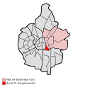
 Map - NL - Maastricht - Wijk 04 Buitenwijk Oost - Buurt 06 Amby.svg 375 × 375; 31 KB
-
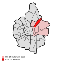
 Map - NL - Maastricht - Wijk 04 Buitenwijk Oost.svg 625 × 575; 11 KB
-

-

-

-

-
 Map - NL - Maastricht - Wijk 05 Buitenwijk Noordoost.svg 625 × 575; 11 KB
-

-

-
-

-

-
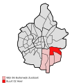
 Map - NL - Maastricht - Wijk 06 Buitenwijk Zuidoost.svg 625 × 575; 11 KB
-
 Map NL Maastricht - Amby.PNG 597 × 585; 24 KB
-
 Map NL Maastricht - Beatrixhaven.PNG 597 × 585; 24 KB
-
 Map NL Maastricht - Belfort.PNG 597 × 585; 24 KB
-
 Map NL Maastricht - Belvedere.PNG 597 × 585; 24 KB
-
 Map NL Maastricht - Biesland.PNG 597 × 585; 25 KB
-
 Map NL Maastricht - Borgharen.PNG 597 × 585; 24 KB
-
 Map NL Maastricht - Boschpoort.PNG 597 × 585; 24 KB
-
 Map NL Maastricht - Boschstraatkwartier.PNG 597 × 585; 24 KB
-
 Map NL Maastricht - Bosscherveld.PNG 597 × 585; 24 KB
-
 Map NL Maastricht - Brusselse Poort.PNG 597 × 585; 24 KB
-
 Map NL Maastricht - Caberg.PNG 597 × 585; 24 KB
-
 Map NL Maastricht - Campagne.PNG 597 × 585; 24 KB
-
 Map NL Maastricht - CBS7delen (met wijkcodes).png 597 × 585; 29 KB
-
 Map NL Maastricht - CBS7delen.PNG 597 × 585; 24 KB
-
 Map NL Maastricht - City.PNG 597 × 585; 25 KB
-
 Map NL Maastricht - Daalhof.PNG 597 × 585; 25 KB
-
 Map NL Maastricht - De Heeg.PNG 597 × 585; 24 KB
-
 Map NL Maastricht - Dousberg.PNG 597 × 585; 24 KB
-
 Map NL Maastricht - Frontenkwartier.PNG 597 × 585; 24 KB
-
 Map NL Maastricht - Heer.PNG 597 × 585; 24 KB
-
 Map NL Maastricht - Heugem.PNG 597 × 585; 24 KB
-
 Map NL Maastricht - Heugemerveld.PNG 597 × 585; 24 KB
-
 Map NL Maastricht - Itteren.PNG 597 × 585; 24 KB
-
 Map NL Maastricht - Jekerdal.PNG 597 × 585; 25 KB
-
 Map NL Maastricht - Jekerkwartier.PNG 597 × 585; 25 KB
-
 Map NL Maastricht - Kommelkwartier.PNG 597 × 585; 24 KB
-
 Map NL Maastricht - Lanakerveld.PNG 597 × 585; 24 KB
-
 Map NL Maastricht - Limmel.PNG 597 × 585; 24 KB
-
 Map NL Maastricht - Malberg.PNG 597 × 585; 25 KB
-
 Map NL Maastricht - Mariaberg.PNG 597 × 585; 24 KB
-
 Map NL Maastricht - Meerssenhoven.PNG 597 × 585; 25 KB
-
 Map NL Maastricht - Nazareth.PNG 597 × 585; 24 KB
-
 Map NL Maastricht - Oud-Caberg.PNG 597 × 585; 24 KB
-
 Map NL Maastricht - Pottenberg.PNG 597 × 585; 24 KB
-
 Map NL Maastricht - Randwyck.PNG 597 × 585; 24 KB
-
 Map NL Maastricht - Scharn.PNG 597 × 585; 25 KB
-
 Map NL Maastricht - Sint Maartenspoort.PNG 597 × 585; 24 KB
-
 Map NL Maastricht - Sint Pieter.PNG 597 × 585; 25 KB
-
 Map NL Maastricht - Statenkwartier.PNG 597 × 585; 24 KB
-
 Map NL Maastricht - Villapark.PNG 597 × 585; 25 KB
-
 Map NL Maastricht - Vroendaal.PNG 597 × 585; 25 KB
-
 Map NL Maastricht - Wittevrouweveld.PNG 597 × 585; 24 KB
-
 Map NL Maastricht - Wolder.PNG 597 × 585; 24 KB
-
 Map NL Maastricht - Wyck.PNG 597 × 585; 24 KB
-
 Map NL Maastricht - Wyckerpoort.PNG 597 × 585; 24 KB
-
 Map NL Maastricht -Malpertuis.PNG 597 × 585; 24 KB
-
 Map NL Maastricht.PNG 597 × 585; 24 KB
-
 Mariaberg (Maastricht).svg 818 × 1,052; 14.37 MB
-
 Meerssenhoven (Maastricht).svg 818 × 1,052; 14.36 MB
-
 Nazareth (Maastricht).svg 818 × 1,052; 14.36 MB
-
 Oud-Caberg (Maastricht).svg 818 × 1,052; 14.37 MB
-
 Pottenberg (Maastricht).svg 818 × 1,052; 14.37 MB
-
 Randwyck (Maastricht).svg 818 × 1,052; 14.36 MB
-
 Scharn (Maastricht).svg 818 × 1,052; 14.36 MB
-
 Sint Maartenspoort (Maastricht).svg 818 × 1,052; 14.36 MB
-
 Sint-Pieter (Maastricht).svg 818 × 1,052; 14.37 MB
-
 Stadsdeel Noord-West (Maastricht).svg 818 × 1,052; 14.37 MB
-
 Stadsdeel Zuid-West (Maastricht).svg 818 × 1,052; 14.37 MB
-
 Statenkwartier (Maastricht).svg 818 × 1,052; 14.36 MB
-
 Villapark (Maastricht).svg 818 × 1,052; 14.36 MB
-
 Vroendaal (Maastricht).svg 818 × 1,052; 14.37 MB
-
 Wittevrouwenveld (Maastricht).svg 818 × 1,052; 14.36 MB
-
 Wolder (Maastricht).svg 818 × 1,052; 14.36 MB
-
 Wyck (Maastricht).svg 818 × 1,052; 14.36 MB
-
 Wyckerpoort (Maastricht).svg 818 × 1,052; 14.36 MB
.svg)
.svg)
.svg)
.svg)
.svg)
.svg)
.svg)
.svg)
.svg)
.svg)
.svg)
.svg)
.svg)
.svg)
.svg)
.svg)
.svg)
.svg)
.svg)
.svg)
.svg)
.svg)
.svg)
.svg)

.svg)
.svg)
.svg)
.svg)


.png)


.svg)
.svg)
.svg)
.svg)
.svg)
.svg)
.svg)
.svg)
.svg)
.svg)
.svg)
.svg)
.svg)
.svg)
.svg)
.svg)
.svg)
.svg)