Category:Locator maps of neighborhoods in Groningen (city)
Jump to navigation
Jump to search
Subcategories
This category has the following 10 subcategories, out of 10 total.
L
Pages in category "Locator maps of neighborhoods in Groningen (city)"
This category contains only the following page.
Media in category "Locator maps of neighborhoods in Groningen (city)"
The following 11 files are in this category, out of 11 total.
-
 Map - NL - Midden-Groningen - Eemskanaal-Zuid.png 1,318 × 1,522; 159 KB
-
 Map - NL - Midden-Groningen - Foxham en Hoogezand-Noord.png 1,318 × 1,522; 160 KB
-
 Map - NL - Midden-Groningen - Foxhol.png 1,318 × 1,522; 160 KB
-
 Map - NL - Midden-Groningen - Froombosch.png 329 × 380; 35 KB
-
 Map - NL - Midden-Groningen - Harkstede, Scharmer en Woudbloem.png 329 × 380; 35 KB
-
 Map - NL - Midden-Groningen - Hellum.png 329 × 380; 36 KB
-
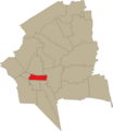
 Map - NL - Midden-Groningen - Kalkwijk.png 329 × 380; 35 KB
-
 Map - NL - Midden-Groningen - Kiel-Windeweer.png 329 × 380; 35 KB
-
 Map - NL - Midden-Groningen - Kolham.png 329 × 380; 35 KB
-
 Map - NL - Midden-Groningen - Kropswolde.png 329 × 380; 35 KB
-
 Map NL Groningen - Rivierenbuurt 2024.png 2,048 × 2,158; 798 KB


