Category:Locator maps of neighborhoods in Delft
Jump to navigation
Jump to search
Media in category "Locator maps of neighborhoods in Delft"
The following 104 files are in this category, out of 104 total.
-

-
 Map - NL - Delft - Wijk 11 Binnenstad - Buurt 01 Centrum-Noord.svg 375 × 375; 43 KB
-
 Map - NL - Delft - Wijk 11 Binnenstad - Buurt 02 Centrum-West.svg 375 × 375; 43 KB
-
 Map - NL - Delft - Wijk 11 Binnenstad - Buurt 03 Centrum-Oost.svg 375 × 375; 43 KB
-
 Map - NL - Delft - Wijk 11 Binnenstad - Buurt 04 Centrum.svg 375 × 375; 43 KB
-
 Map - NL - Delft - Wijk 11 Binnenstad - Buurt 05 Stationsbuurt.svg 375 × 375; 43 KB
-

-
 Map - NL - Delft - Wijk 11 Binnenstad - Buurt 07 In de Veste.svg 375 × 375; 43 KB
-

-
 Map - NL - Delft - Wijk 11 Binnenstad - Buurt 09 Zuidpoort.svg 375 × 375; 43 KB
-
 Map - NL - Delft - Wijk 11 Binnenstad.svg 625 × 575; 12 KB
-

-

-

-
 Map - NL - Delft - Wijk 12 Vrijenban - Buurt 03 Sint Joris.svg 375 × 375; 43 KB
-
 Map - NL - Delft - Wijk 12 Vrijenban - Buurt 04 Koepoort.svg 375 × 375; 43 KB
-
 Map - NL - Delft - Wijk 12 Vrijenban - Buurt 05 Bomenwijk.svg 375 × 375; 43 KB
-
 Map - NL - Delft - Wijk 12 Vrijenban - Buurt 06 Biesland.svg 375 × 375; 43 KB
-
 Map - NL - Delft - Wijk 12 Vrijenban - Buurt 07 Heilige Land.svg 375 × 375; 43 KB
-

-
 Map - NL - Delft - Wijk 12 Vrijenban.svg 625 × 575; 12 KB
-

-
-

-

-

-
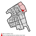
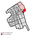
 Map - NL - Delft - Wijk 13 Hof van Delft - Buurt 05 Olofsbuurt.svg 375 × 375; 43 KB
-

-

-
 Map - NL - Delft - Wijk 13 Hof van Delft.svg 625 × 575; 12 KB
-

-
-
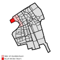
 Map - NL - Delft - Wijk 14 Voordijkshoorn - Buurt 02 Ecodus.svg 375 × 375; 43 KB
-
 Map - NL - Delft - Wijk 14 Voordijkshoorn - Buurt 03 Marlot.svg 375 × 375; 43 KB
-
 Map - NL - Delft - Wijk 14 Voordijkshoorn - Buurt 04 Westlandhof.svg 375 × 375; 43 KB
-
 Map - NL - Delft - Wijk 14 Voordijkshoorn - Buurt 05 Hoornse Hof.svg 375 × 375; 43 KB
-
 Map - NL - Delft - Wijk 14 Voordijkshoorn - Buurt 06 Den Hoorn.svg 375 × 375; 43 KB
-
 Map - NL - Delft - Wijk 14 Voordijkshoorn - Buurt 07 Molenbuurt.svg 375 × 375; 43 KB
-
 Map - NL - Delft - Wijk 14 Voordijkshoorn.svg 625 × 575; 12 KB
-
 Map - NL - Delft - Wijk 16 Delftse Hout - Buurt 00 De Bras.svg 375 × 375; 43 KB
-

-
 Map - NL - Delft - Wijk 16 Delftse Hout - Buurt 02 De Grote Plas.svg 375 × 375; 43 KB
-
-
 Map - NL - Delft - Wijk 16 Delftse Hout - Buurt 04 Hoflaan.svg 375 × 375; 43 KB
-
 Map - NL - Delft - Wijk 16 Delftse Hout.svg 625 × 575; 12 KB
-

-
-

-

-
 Map - NL - Delft - Wijk 22 Tanthof-West - Buurt 04 Aziëbuurt.svg 375 × 375; 43 KB
-

-
 Map - NL - Delft - Wijk 22 Tanthof-West.svg 625 × 575; 12 KB
-

-

-
 Map - NL - Delft - Wijk 23 Tanthof-Oost - Buurt 02 Dierenbuurt.svg 375 × 375; 43 KB
-

-

-
 Map - NL - Delft - Wijk 23 Tanthof-Oost - Buurt 05 Bosrand.svg 375 × 375; 43 KB
-
 Map - NL - Delft - Wijk 23 Tanthof-Oost.svg 625 × 575; 12 KB
-
 Map - NL - Delft - Wijk 24 Voorhof - Buurt 00 Poptahof-Noord.svg 375 × 375; 43 KB
-
 Map - NL - Delft - Wijk 24 Voorhof - Buurt 01 Poptahof-Zuid.svg 375 × 375; 43 KB
-
-
 Map - NL - Delft - Wijk 24 Voorhof - Buurt 03 Mythologiebuurt.svg 375 × 375; 43 KB
-

-
 Map - NL - Delft - Wijk 24 Voorhof - Buurt 05 Roland Holstbuurt.svg 375 × 375; 43 KB
-
 Map - NL - Delft - Wijk 24 Voorhof - Buurt 06 Voorhof-Hoogbouw.svg 375 × 375; 18 KB
-
 Map - NL - Delft - Wijk 24 Voorhof - Buurt 07 Multatulibuurt.svg 375 × 375; 43 KB
-
-
 Map - NL - Delft - Wijk 24 Voorhof.svg 625 × 575; 12 KB
-

-
 Map - NL - Delft - Wijk 25 Buitenhof - Buurt 01 Buitenhof-Noord.svg 375 × 375; 43 KB
-
 Map - NL - Delft - Wijk 25 Buitenhof - Buurt 02 Juniusbuurt.svg 375 × 375; 43 KB
-
 Map - NL - Delft - Wijk 25 Buitenhof - Buurt 03 Gillisbuurt.svg 375 × 375; 43 KB
-
 Map - NL - Delft - Wijk 25 Buitenhof - Buurt 04 Fledderusbuurt.svg 375 × 375; 43 KB
-
 Map - NL - Delft - Wijk 25 Buitenhof - Buurt 05 Het Rode Dorp.svg 375 × 375; 43 KB
-
 Map - NL - Delft - Wijk 25 Buitenhof - Buurt 06 Pijperring.svg 375 × 375; 43 KB
-
-
 Map - NL - Delft - Wijk 25 Buitenhof - Buurt 08 Vrijheidsbuurt.svg 375 × 375; 43 KB
-
 Map - NL - Delft - Wijk 25 Buitenhof - Buurt 09 Buitenhof-Zuid.svg 375 × 375; 43 KB
-
 Map - NL - Delft - Wijk 25 Buitenhof - Buurt 10 Kerkpolder.svg 375 × 375; 43 KB
-
 Map - NL - Delft - Wijk 25 Buitenhof.svg 625 × 575; 12 KB
-
 Map - NL - Delft - Wijk 26 Abtswoude - Buurt 00 Abtswoude.svg 375 × 375; 43 KB
-
 Map - NL - Delft - Wijk 26 Abtswoude.svg 625 × 575; 12 KB
-
 Map - NL - Delft - Wijk 27 Schieweg - Buurt 00 Delftzicht.svg 375 × 375; 43 KB
-

-

-

-
 Map - NL - Delft - Wijk 27 Schieweg - Buurt 04 Schieweg-Polder.svg 375 × 375; 43 KB
-
 Map - NL - Delft - Wijk 27 Schieweg.svg 625 × 575; 12 KB
-
 Map - NL - Delft - Wijk 28 Wippolder - Buurt 00 Zeeheldenbuurt.svg 375 × 375; 43 KB
-
 Map - NL - Delft - Wijk 28 Wippolder - Buurt 01 TU-Noord.svg 375 × 375; 43 KB
-
 Map - NL - Delft - Wijk 28 Wippolder - Buurt 02 Wippolder-Noord.svg 375 × 375; 43 KB
-
 Map - NL - Delft - Wijk 28 Wippolder - Buurt 03 Wippolder-Zuid.svg 375 × 375; 43 KB
-

-
 Map - NL - Delft - Wijk 28 Wippolder - Buurt 05 TU-Campus.svg 375 × 375; 43 KB
-
 Map - NL - Delft - Wijk 28 Wippolder - Buurt 06 Professorenbuurt.svg 375 × 375; 43 KB
-
-
 Map - NL - Delft - Wijk 28 Wippolder - Buurt 08 Pauwmolen.svg 375 × 375; 43 KB
-
 Map - NL - Delft - Wijk 28 Wippolder - Buurt 09 Koningsveldbuurt.svg 375 × 375; 43 KB
-
 Map - NL - Delft - Wijk 28 Wippolder.svg 625 × 575; 12 KB
-

-

-
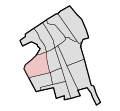
 Map - NL - Delft - Wijk 29 Ruiven - Buurt 02 Ackersdijk.svg 375 × 375; 43 KB
-
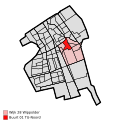
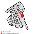
 Map - NL - Delft - Wijk 29 Ruiven.svg 625 × 575; 12 KB


