Category:Locator maps of neighborhoods in Amsterdam Nieuw-West
Jump to navigation
Jump to search
Media in category "Locator maps of neighborhoods in Amsterdam Nieuw-West"
The following 27 files are in this category, out of 27 total.
-
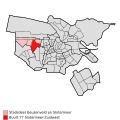
 Amsterdam - Stadsdeel Nieuw-West.PNG 655 × 507; 65 KB
-

-

-
-

-

-
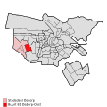
 Map - NL - Amsterdam - Stadsdeel Geuzenveld en Slotermeer.svg 625 × 575; 36 KB
-

-
 Map - NL - Amsterdam - Stadsdeel Osdorp - Buurt 81 Osdorp-Oost.svg 375 × 375; 84 KB
-
 Map - NL - Amsterdam - Stadsdeel Osdorp - Buurt 82 Osdorp-Midden.svg 375 × 375; 84 KB
-
 Map - NL - Amsterdam - Stadsdeel Osdorp - Buurt 83 De Punt.svg 375 × 375; 84 KB
-

-
 Map - NL - Amsterdam - Stadsdeel Osdorp.svg 625 × 575; 36 KB
-

-

-

-

-
 Map - NL - Amsterdam - Stadsdeel Slotervaart en Overtoomse Veld.svg 625 × 575; 36 KB
-
 Map NL - Amsterdam - Eendracht.png 651 × 520; 28 KB
-
 Map NL - Amsterdam - Geuzenveld.png 651 × 520; 28 KB
-
 Map NL - Amsterdam - Middelveldsche Akkerpolder en Sloten.png 651 × 520; 28 KB
-
 Map NL - Amsterdam - Overtoomse Veld.png 651 × 520; 28 KB
-
 Map NL - Amsterdam - Sloten.png 800 × 600; 18 KB
-
 Map NL - Amsterdam - Slotermeer.png 651 × 520; 28 KB
-
 Map NL - Amsterdam - Stadsdeel Geuzenveld-Slotermeer.png 651 × 520; 28 KB
-
 Map NL - Amsterdam - Stadsdeel Osdorp.png 651 × 520; 28 KB
-
 Map NL - Amsterdam - Stadsdeel Slotervaart.png 651 × 520; 28 KB


