Category:Locator maps of municipalities of Stara Zagora Province
Jump to navigation
Jump to search
Media in category "Locator maps of municipalities of Stara Zagora Province"
The following 22 files are in this category, out of 22 total.
-
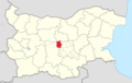
 BratyaDaskalovi Municipality Within Bulgaria.png 951 × 600; 182 KB
-
 Chirpan Municipality Within Bulgaria.png 951 × 600; 182 KB
-
 Galabovo Municipality Within Bulgaria.png 951 × 600; 182 KB
-
 Gurkovo Municipality Within Bulgaria.png 951 × 600; 182 KB
-
 Kazanlak Municipality Within Bulgaria.png 951 × 600; 182 KB
-
 Maglizh Municipality Within Bulgaria.png 951 × 600; 182 KB
-
 Map of Bratya Daskalovi municipality (Stara Zagora Province).png 673 × 612; 69 KB
-
 Map of Chirpan municipality (Stara Zagora Province).png 673 × 612; 69 KB
-
 Map of Galabovo municipality (Stara Zagora Province).png 673 × 612; 69 KB
-
 Map of Gurkovo municipality (Stara Zagora Province).png 673 × 612; 68 KB
-
 Map of Kazanlak municipality (Stara Zagora Province).png 673 × 612; 69 KB
-
 Map of Maglizh municipality (Stara Zagora Province).png 673 × 612; 69 KB
-
 Map of Nikolaevo municipality (Stara Zagora Province).png 673 × 612; 68 KB
-
 Map of Opan municipality (Stara Zagora Province).png 673 × 612; 69 KB
-
 Map of Pavel banya municipality (Stara Zagora Province).png 673 × 612; 69 KB
-
 Map of Radnevo municipality (Stara Zagora Province).png 673 × 612; 69 KB
-
 Map of Stara Zagora municipality (Stara Zagora Province).png 673 × 612; 70 KB
-
 Nikolaevo Municipality Within Bulgaria.png 951 × 600; 182 KB
-
 Opan Municipality Within Bulgaria.png 951 × 600; 182 KB
-
 PavelBanya Municipality Within Bulgaria.png 951 × 600; 182 KB
-
 Radnevo Municipality Within Bulgaria.png 951 × 600; 182 KB
-
 StaraZagora Municipality Within Bulgaria.png 951 × 600; 182 KB


.png)
.png)
.png)
.png)
.png)
.png)
.png)
.png)
.png)
.png)
.png)


