Category:Locator maps of municipalities of Sonora
Jump to navigation
Jump to search
Media in category "Locator maps of municipalities of Sonora"
The following 200 files are in this category, out of 295 total.
(previous page) (next page)-
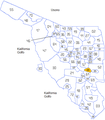
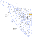
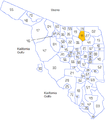
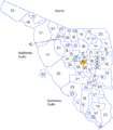
 001 Esperanto Sonora.PNG 550 × 629; 27 KB
-
 002 Esperanto Sonora.PNG 550 × 629; 27 KB
-
 003 Esperanto Sonora.PNG 550 × 629; 27 KB
-
 004 Esperanto Sonora.PNG 550 × 629; 27 KB
-
 005 Esperanto Sonora.PNG 550 × 629; 27 KB
-
 006 Esperanto Sonora.PNG 550 × 629; 27 KB
-
 007 Esperanto Sonora.PNG 550 × 629; 27 KB
-
 008 Esperanto Sonora.PNG 550 × 629; 27 KB
-
 009 Esperanto Sonora.PNG 550 × 629; 27 KB
-
 010 Esperanto Sonora.PNG 550 × 629; 27 KB
-
 011 Esperanto Sonora.PNG 550 × 629; 27 KB
-
 012 Esperanto Sonora.PNG 550 × 629; 27 KB
-
 013 Esperanto Sonora.PNG 550 × 629; 27 KB
-
 014 Esperanto Sonora.PNG 550 × 629; 27 KB
-
 015 Esperanto Sonora.PNG 550 × 629; 27 KB
-
 016 Esperanto Sonora.PNG 550 × 629; 27 KB
-
 017 Esperanto Sonora.PNG 550 × 629; 27 KB
-
 018 Esperanto Sonora.PNG 550 × 629; 27 KB
-
 019 Esperanto Sonora.PNG 550 × 629; 27 KB
-
 020 Esperanto Sonora.PNG 550 × 629; 27 KB
-
 021 Esperanto Sonora.png 550 × 629; 27 KB
-
 022 Esperanto Sonora.png 550 × 629; 27 KB
-
 023 Esperanto Sonora.png 550 × 629; 27 KB
-
 024 Esperanto Sonora.png 550 × 629; 27 KB
-
 025 Esperanto Sonora.png 550 × 629; 27 KB
-
 026 Esperanto Sonora.png 550 × 629; 27 KB
-
 027 Esperanto Sonora.png 550 × 629; 27 KB
-
 028 Esperanto Sonora.png 550 × 629; 27 KB
-
 029 Esperanto Sonora.png 550 × 629; 27 KB
-
 030 Esperanto Sonora.png 550 × 629; 27 KB
-
 031 Esperanto Sonora.png 550 × 629; 27 KB
-
 032 Esperanto Sonora.png 550 × 629; 27 KB
-
 033 Esperanto Sonora.png 550 × 629; 27 KB
-
 034 Esperanto Sonora.png 550 × 629; 27 KB
-
 035 Esperanto Sonora.png 550 × 629; 27 KB
-
 036 Esperanto Sonora.png 550 × 629; 27 KB
-
 037 Esperanto Sonora.png 550 × 629; 27 KB
-
 038 Esperanto Sonora.png 550 × 629; 27 KB
-
 039 Esperanto Sonora.png 550 × 629; 27 KB
-
 040 Esperanto Sonora.png 550 × 629; 27 KB
-
 041 Esperanto Sonora.png 550 × 629; 27 KB
-
 042 Esperanto Sonora.png 550 × 629; 27 KB
-
 043 Esperanto Sonora.png 550 × 629; 27 KB
-
 044 Esperanto Sonora.png 550 × 629; 27 KB
-
 045 Esperanto Sonora.png 550 × 629; 27 KB
-
 046 Esperanto Sonora.png 550 × 629; 27 KB
-
 047 Esperanto Sonora.png 550 × 629; 27 KB
-
 048 Esperanto Sonora.png 550 × 629; 27 KB
-
 049 Esperanto Sonora.png 550 × 629; 27 KB
-
 050 Esperanto Sonora.png 550 × 629; 27 KB
-
 051 Esperanto Sonora.png 550 × 629; 27 KB
-
 052 Esperanto Sonora.png 550 × 629; 27 KB
-
 053 Esperanto Sonora.png 550 × 629; 27 KB
-
 054 Esperanto Sonora.png 550 × 629; 27 KB
-
 055 Esperanto Sonora.png 550 × 629; 27 KB
-
 056 Esperanto Sonora.png 550 × 629; 27 KB
-
 057 Esperanto Sonora.png 550 × 629; 27 KB
-
 058 Esperanto Sonora.png 550 × 629; 27 KB
-
 059 Esperanto Sonora.png 550 × 629; 27 KB
-
 060 Esperanto Sonora.png 550 × 629; 27 KB
-
 061 Esperanto Sonora.png 550 × 629; 27 KB
-
 062 Esperanto Sonora.png 550 × 629; 27 KB
-
 063 Esperanto Sonora.png 550 × 629; 27 KB
-
 064 Esperanto Sonora.png 550 × 629; 27 KB
-
 065 Esperanto Sonora.png 550 × 629; 27 KB
-
 066 Esperanto Sonora.png 550 × 629; 27 KB
-
 067 Esperanto Sonora.png 550 × 629; 27 KB
-
 068 Esperanto Sonora.png 550 × 629; 27 KB
-
 069 Esperanto Sonora.png 550 × 629; 27 KB
-
 070 Esperanto Sonora.png 550 × 629; 27 KB
-
 071 Esperanto Sonora.png 550 × 629; 27 KB
-
 072 Esperanto Sonora.png 550 × 629; 27 KB
-
 Aconchi en Sonora.svg 2,799 × 2,835; 771 KB
-
 Aconchi Sonora map.png 600 × 686; 172 KB
-
 Agua Prieta en Sonora.svg 2,799 × 2,835; 771 KB
-
 Agua Prieta Sonora map.png 600 × 686; 172 KB
-
 Alamos en Sonora.svg 2,799 × 2,835; 771 KB
-
 Alamos Sonora map.png 600 × 686; 172 KB
-
 Altar en Sonora.svg 2,799 × 2,835; 771 KB
-
 Altar Sonora map.png 575 × 657; 168 KB
-
 Arivechi en Sonora.svg 2,799 × 2,835; 771 KB
-
 Arivechi Sonora map.png 575 × 657; 168 KB
-
 Arizpe en Sonora.svg 2,799 × 2,835; 771 KB
-
 Arizpe Sonora map.png 575 × 657; 168 KB
-
 Atil Sonora map.png 575 × 657; 168 KB
-
 Bacadehuachil Sonora map.png 575 × 657; 168 KB
-
 Bacadéhuachi en Sonora.svg 2,799 × 2,835; 771 KB
-
 Bacanora en Sonora.svg 2,799 × 2,835; 771 KB
-
 Bacanora Sonora map.png 575 × 657; 168 KB
-
 Bacerac en Sonora.svg 2,799 × 2,835; 771 KB
-
 Bacerac Sonora map.png 575 × 657; 168 KB
-
 Bacoachi en Sonora.svg 2,799 × 2,835; 771 KB
-
 Bacoachi Sonora map.png 575 × 657; 168 KB
-
 Bacum Sonora map.png 575 × 657; 168 KB
-
 Banamichi Sonora map.png 575 × 657; 168 KB
-
 Banámichi en Sonora.svg 2,799 × 2,835; 771 KB
-
 Baviacora Sonora map.png 575 × 657; 168 KB
-
 Bavispe en Sonora.svg 2,799 × 2,835; 771 KB
-
 Bavispe Sonora map.png 575 × 657; 168 KB
-
 Baviácora en Sonora.svg 2,799 × 2,835; 771 KB
-
 Benito Juarez Sonora map.png 575 × 657; 168 KB
-
 Benito Juárez en Sonora.svg 2,799 × 2,835; 772 KB
-
 Benjamin Hill Sonora map.png 575 × 657; 168 KB
-
 Benjamín Hill en Sonora.svg 2,799 × 2,835; 771 KB
-
 Bácum en Sonora.svg 2,799 × 2,835; 771 KB
-
 Caborca en Sonora.svg 2,799 × 2,835; 771 KB
-
 Caborca Sonora map.png 575 × 657; 168 KB
-
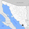
 CaborcaLoc.jpg 558 × 630; 43 KB
-
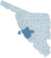
 Cajeme en Sonora.png 575 × 657; 168 KB
-
 Cajeme en Sonora.svg 2,799 × 2,835; 771 KB
-
 Cananea en Sonora.png 575 × 657; 168 KB
-
 Cananea en Sonora.svg 2,799 × 2,835; 771 KB
-
 Carbo Sonora map.png 575 × 657; 168 KB
-
 Carbó en Sonora.svg 2,799 × 2,835; 773 KB
-
 Cucurpe en Sonora.svg 2,799 × 2,835; 771 KB
-
 Cucurpe Sonora map.png 575 × 657; 168 KB
-
 Cumpas en Sonora.svg 2,799 × 2,835; 771 KB
-
 Cumpas Sonora map.png 575 × 657; 168 KB
-
 Divisaderos en Sonora.svg 2,799 × 2,835; 771 KB
-
 Divisaderos Sonora map.png 575 × 657; 168 KB
-
 Empalme en Sonoras.svg 2,799 × 2,835; 771 KB
-
 Empalme Sonora map.png 575 × 657; 168 KB
-
 Etchojoa en Sonora.svg 2,799 × 2,835; 771 KB
-
 Etchojoa Sonora map.png 575 × 657; 168 KB
-
 Fronteras en Sonora.svg 2,799 × 2,835; 771 KB
-
 Fronteras Sonora map.png 575 × 657; 168 KB
-
 General Plutarco Elías Calles en Sonora.svg 2,799 × 2,835; 771 KB
-
 GralPECalles en Sonora.png 575 × 657; 168 KB
-
 Granados en Sonora.svg 2,799 × 2,835; 771 KB
-
 Granados Sonora map.png 575 × 657; 168 KB
-
 Guaymas en Sonora.png 572 × 654; 41 KB
-
 Guaymas en Sonoras.svg 2,799 × 2,835; 772 KB
-
 Guaymas Sonora map.png 575 × 657; 167 KB
-
 Hermosillo en Sonora.png 575 × 657; 167 KB
-
 Hermosillo en Sonoras.svg 2,799 × 2,835; 772 KB
-
 Huachinera en Sonora.svg 2,799 × 2,835; 771 KB
-
 Huachinera Sonora map.png 575 × 657; 168 KB
-
 Huasabas Sonora map.png 575 × 657; 168 KB
-
 Huatabampo en Sonora.svg 2,799 × 2,835; 771 KB
-
 Huatabampo Sonora map.png 575 × 657; 167 KB
-
 Huepac Sonora map.png 575 × 657; 168 KB
-
 Huásabas en Sonora.svg 2,799 × 2,835; 771 KB
-
 Huépac en Sonora.svg 2,799 × 2,835; 771 KB
-
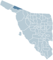
 Imuris en Sonora.png 573 × 655; 62 KB
-
 Imuris en Sonora.svg 2,799 × 2,835; 771 KB
-
 Imuris Sonora map.png 575 × 657; 168 KB
-
 La Colorada en Sonora.svg 2,799 × 2,835; 771 KB
-
 La Colorada Sonora map.png 575 × 657; 168 KB
-
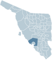
 Magdalena (Municipio).PNG 573 × 655; 42 KB
-
 Magdalena en Sonora.svg 2,799 × 2,835; 771 KB
-
 Magdalena Sonora map.png 575 × 657; 168 KB
-
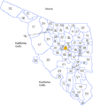
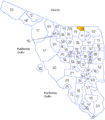
 Mapa Municipios Sonora Aconchi.png 1,119 × 1,271; 52 KB
-
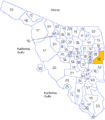
 Mapa Municipios Sonora Agua Prieta.png 1,119 × 1,271; 52 KB
-
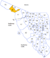
 Mapa Municipios Sonora Altar.png 1,119 × 1,271; 53 KB
-
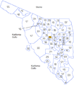
 Mapa Municipios Sonora Arivechi.png 1,119 × 1,271; 52 KB
-
 Mapa Municipios Sonora Arizpe.png 1,119 × 1,271; 52 KB
-
 Mapa Municipios Sonora Bacadéhuachi.png 1,119 × 1,271; 52 KB
-
 Mapa Municipios Sonora Bacanora.png 1,119 × 1,271; 52 KB
-
 Mapa Municipios Sonora Bacerac.png 1,119 × 1,271; 52 KB
-
 Mapa Municipios Sonora Bacoachi.png 1,119 × 1,271; 52 KB
-
 Mapa Municipios Sonora Banámichi.png 1,119 × 1,271; 52 KB
-
 Mapa Municipios Sonora Bavispe.png 1,119 × 1,271; 52 KB
-
 Mapa Municipios Sonora Baviácora.png 1,119 × 1,271; 52 KB
-
 Mapa Municipios Sonora Benito Juárez.png 1,119 × 1,271; 52 KB
-
 Mapa Municipios Sonora Benjamín Hill.png 1,119 × 1,271; 52 KB
-
 Mapa Municipios Sonora Bácum.png 1,119 × 1,271; 52 KB
-
 Mapa Municipios Sonora Caborca.png 1,119 × 1,271; 53 KB
-
 Mapa Municipios Sonora Cajeme.png 1,119 × 1,271; 53 KB
-
 Mapa Municipios Sonora Cananea.png 1,119 × 1,271; 52 KB
-
 Mapa Municipios Sonora Carbó.png 1,119 × 1,271; 52 KB
-
 Mapa Municipios Sonora Cucurpe.png 1,119 × 1,271; 52 KB
-
 Mapa Municipios Sonora Cumpas.png 1,119 × 1,271; 52 KB
-
 Mapa Municipios Sonora Divisaderos.png 1,119 × 1,271; 52 KB
-
 Mapa Municipios Sonora Empalme.png 1,119 × 1,271; 52 KB
-
 Mapa Municipios Sonora Etchojoa.png 1,119 × 1,271; 52 KB
-
 Mapa Municipios Sonora Fronteras.png 1,119 × 1,271; 52 KB
-
 Mapa Municipios Sonora General Plutarco Elías Calles.png 1,119 × 1,271; 52 KB
-
 Mapa Municipios Sonora Granados.png 1,119 × 1,271; 52 KB
-
 Mapa Municipios Sonora Guaymas.png 1,119 × 1,271; 53 KB
-
 Mapa Municipios Sonora Hermosillo.png 1,119 × 1,271; 52 KB
-
 Mapa Municipios Sonora Huachinera.png 1,119 × 1,271; 52 KB
-
 Mapa Municipios Sonora Huatabampo.png 1,119 × 1,271; 52 KB
-
 Mapa Municipios Sonora Huásabas.png 1,119 × 1,271; 52 KB
-
 Mapa Municipios Sonora Huépac.png 1,119 × 1,271; 52 KB
-
 Mapa Municipios Sonora La Colorada.png 1,119 × 1,271; 52 KB
-
 Mapa Municipios Sonora Magdalena.png 1,119 × 1,271; 52 KB
-
 Mapa Municipios Sonora Mazatán.png 1,119 × 1,271; 52 KB
-
 Mapa Municipios Sonora Moctezuma.png 1,119 × 1,271; 52 KB
-
 Mapa Municipios Sonora Naco.png 1,119 × 1,271; 52 KB
-
 Mapa Municipios Sonora Nacozari de García.png 1,119 × 1,271; 52 KB
-
 Mapa Municipios Sonora Navojoa.png 1,119 × 1,271; 52 KB
-
 Mapa Municipios Sonora Nogales.png 1,119 × 1,271; 52 KB
-
 Mapa Municipios Sonora Nácori Chico.png 1,119 × 1,271; 52 KB
-
 Mapa Municipios Sonora Opodepe.png 1,119 × 1,271; 52 KB
-
 Mapa Municipios Sonora Oquitoa.png 1,119 × 1,271; 52 KB
-
 Mapa Municipios Sonora Pitiquito.png 1,119 × 1,271; 53 KB
-
 Mapa Municipios Sonora Puerto Peñasco.png 1,119 × 1,271; 53 KB
-
 Mapa Municipios Sonora Quiriego.png 1,119 × 1,271; 52 KB
-
 Mapa Municipios Sonora Rayón.png 1,119 × 1,271; 52 KB
-
 Mapa Municipios Sonora Rosario.png 1,119 × 1,271; 52 KB


.PNG)


