Category:Locator maps of municipalities of San Luis Potosí
Jump to navigation
Jump to search
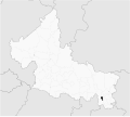
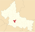
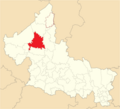
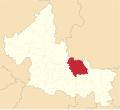
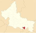
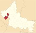
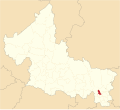
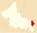
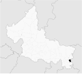
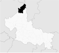
English: Locator maps of Municipalities in San Luis Potosí state — Northeastern Mexico.
Media in category "Locator maps of municipalities of San Luis Potosí"
The following 46 files are in this category, out of 46 total.
-
Aquismon en San Luis Potisi.jpg 665 × 594; 32 KB
-
Aquismón en San Luis Potosí.svg 1,184 × 1,059; 560 KB
-
Armadillo de los Infante en San Luis Potosi.svg 1,184 × 1,059; 557 KB
-
Catorce en San Luis Potosi.svg 1,184 × 1,059; 557 KB
-
Ciudad del Maiz en San Luis Potosi.svg 1,184 × 1,059; 560 KB
-
Ciudad Valles en San Luis Potosi.svg 1,184 × 1,059; 557 KB
-
Coxcatlan en San Luis Potosi.svg 1,184 × 1,059; 560 KB
-
Ebano en San Luis Potosi.svg 1,184 × 1,059; 560 KB
-
Guadalcazar en San Luis Potosi.svg 1,184 × 1,059; 560 KB
-
Guadalupe en San Luis Potosí.svg 1,184 × 1,059; 559 KB
-
Huehuetlan en San Luis Potosi.svg 1,184 × 1,059; 560 KB
-
Lagunillas en San Luis Potosi.svg 1,184 × 1,059; 560 KB
-
Mapa de rioverde.GIF 471 × 419; 8 KB
-
Mexico San Luis Potosi Alaquines location map.svg 2,744 × 2,501; 552 KB
-
Mexico San Luis Potosi Aquismon location map.svg 2,744 × 2,501; 552 KB
-
Mexico San Luis Potosi Armadillo de los Infante location map.svg 2,744 × 2,501; 552 KB
-
Mexico San Luis Potosi Catorce location map.svg 2,744 × 2,501; 552 KB
-
Mexico San Luis Potosi Charcas location map.png 512 × 467; 67 KB
-
Mexico San Luis Potosi Ciudad del Maiz location map.svg 2,744 × 2,501; 552 KB
-
Mexico San Luis Potosi Coxcatlan location map.svg 2,744 × 2,501; 552 KB
-
Mexico San Luis Potosi Ebano location map.svg 2,744 × 2,501; 552 KB
-
Mexico San Luis Potosi Lagunillas location map.svg 2,744 × 2,501; 552 KB
-
Mexico San Luis Potosi Moctezuma location map.svg 2,744 × 2,501; 552 KB
-
Mexico San Luis Potosi Salinas location map.svg 2,744 × 2,501; 552 KB
-
Mexico San Luis Potosi Tancanhuitz location map.svg 2,744 × 2,501; 552 KB
-
Mexico San Luis Potosi Vanegas location map.svg 2,744 × 2,501; 552 KB
-
Mexico San Luis Potosi Villa de la Paz location map.svg 2,744 × 2,501; 552 KB
-
Mexico San Luis Potosí Ciudad Fernández location map.svg 2,744 × 2,501; 538 KB
-
Mexico San Luis Potosí Ciudad Valles location map.svg 2,744 × 2,501; 536 KB
-
Mexico San Luis Potosí San Luis Potosí location map.svg 2,744 × 2,501; 536 KB
-
Mexico San Luis Potosí Soledad de Graciano Sánchez location map.svg 2,744 × 2,501; 536 KB
-
Mexico San Luis Potosí Tamuín location map.svg 2,744 × 2,501; 538 KB
-
Mexquitic en San Luis Potosi.svg 1,184 × 1,059; 560 KB
-
Moctezuma en San Luis Potosi.svg 1,184 × 1,059; 559 KB
-
Rioverde en San Luis Potosi.svg 1,184 × 1,059; 560 KB
-
Salinas en San Luis Potosi.svg 1,184 × 1,059; 559 KB
-
San Ciro de Acosta en San Luis Potosi.svg 1,184 × 1,059; 559 KB
-
San Maria del Rio en San Luis Potosi.svg 1,184 × 1,059; 557 KB
-
San Martin Chalchicuautla en San Luis Potosi.svg 1,184 × 1,059; 557 KB
-
San Nicolas Tolentino en San Luis Potosi.svg 1,184 × 1,059; 557 KB
-
San Vicente Tancuayalab en San Luis Potosi.svg 1,184 × 1,059; 683 KB
-
Santa Catarina en San Luis Potosi.svg 1,184 × 1,059; 557 KB
-
Tancanhuitz en San Luis Potosi.svg 1,184 × 1,059; 557 KB
-
Tanquian en San Luis Potosí.svg 1,184 × 1,059; 559 KB
-
Vanegas en San Luis Potosí.svg 1,184 × 1,059; 557 KB
-
Villa de Arriaga en San Luis Potosí.svg 1,184 × 1,059; 557 KB


