Category:Locator maps of municipalities of Libya (2007)
Jump to navigation
Jump to search
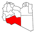
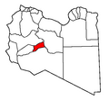
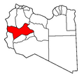
English: The current twenty-two Shabiyah or Districts of Libya, established in 2007. See also: Subdivisions of Libya, and the 1963-2007 Category: Locator maps of municipalities of Libya.
Media in category "Locator maps of municipalities of Libya (2007)"
The following 23 files are in this category, out of 23 total.
-
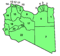 Lybian Shabiat 2007 with numbers.png 456 × 431; 14 KB
-
 Shabiat Al Butnan since 2007.png 462 × 427; 11 KB
-
 Shabiat Al Jabal al Akhdar 2007.png 462 × 427; 11 KB
-
 Shabiat Al Jabal al Gharbi since 2007.PNG 462 × 427; 11 KB
-
 Shabiat Al Jfara since 2007.png 462 × 427; 11 KB
-
 Shabiat Al Jufrah since 2007.png 462 × 427; 11 KB
-
 Shabiat Al Kufrah since 2007.png 462 × 427; 10 KB
-
 Shabiat Al Marj District 2007.png 462 × 427; 11 KB
-
 Shabiat Al Murgub since 2007.png 462 × 427; 11 KB
-
 Shabiat Al Wahat since 2007.png 462 × 427; 11 KB
-
 Shabiat An Nuqat al Khams since 2007.png 462 × 427; 11 KB
-
 Shabiat Az Zawiyah since 2007.png 462 × 427; 11 KB
-
 Shabiat Banghazi since 2007.png 462 × 427; 11 KB
-
 Shabiat Darnah from 2007.png 462 × 427; 11 KB
-
 Shabiat Ghat since 2007.png 462 × 427; 11 KB
-
 Shabiat Misratah since 2007.png 462 × 427; 11 KB
-
 Shabiat Murzuq since 2007.png 462 × 427; 11 KB
-
 Shabiat Nalut since 2007.png 462 × 427; 11 KB
-
 Shabiat Sabha since 2007.png 462 × 427; 11 KB
-
 Shabiat Surt since 2007.png 404 × 386; 8 KB
-
 Shabiat Tripoli since 2007.png 462 × 427; 11 KB
-
 Shabiat Wadi Al Shatii since 2007.png 462 × 427; 11 KB
-
 Shabiat Wadi Al Hayaa since 2007.PNG 462 × 427; 11 KB


