Category:Locator maps of municipalities of Latvia
Jump to navigation
Jump to search
Subcategories
This category has only the following subcategory.
Media in category "Locator maps of municipalities of Latvia"
The following 117 files are in this category, out of 117 total.
-
 Adazu novads karte 2021.png 2,560 × 1,612; 439 KB
-
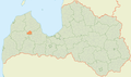
 Adazu novads karte.png 592 × 350; 69 KB
-
 AglonasMapa.png 592 × 350; 69 KB
-
 Aizkraukles novads karte.png 592 × 350; 69 KB
-
 Aizputes novads karte.png 592 × 350; 69 KB
-
 Aknistes novads karte.png 592 × 350; 69 KB
-
 Alojas novads karte.png 592 × 350; 69 KB
-
 Alsungas novads karte.png 592 × 350; 69 KB
-
 AluksnesNovads.png 592 × 350; 69 KB
-
 Amatas novada karte.JPG 592 × 350; 139 KB
-
 Apes novads karte.png 592 × 350; 69 KB
-
 Auces novads karte.png 592 × 350; 69 KB
-
 Augšdaugavas novads karte 2021.png 1,166 × 623; 130 KB
-
 Babites novads karte.png 592 × 350; 69 KB
-
 Baldones novads karte.png 592 × 356; 61 KB
-
 Baltinavas novads karte.png 592 × 350; 69 KB
-
 Balvu novads karte.png 592 × 350; 69 KB
-
 Bauskas novads karte.png 592 × 350; 69 KB
-
 BeverinasMapa.png 592 × 350; 69 KB
-
 Brocenu novads karte.png 592 × 350; 69 KB
-
 Burtnieku novads karte.png 592 × 350; 69 KB
-
 Carnikavas novads karte.png 592 × 350; 69 KB
-
 Cesu novads karte.png 592 × 350; 69 KB
-
 Cesvaines novads karte.png 592 × 350; 69 KB
-
 CiblasMapa.png 592 × 350; 69 KB
-
 Dagdas novads karte.png 592 × 350; 69 KB
-
 Daugavpils novads karte.png 592 × 350; 69 KB
-
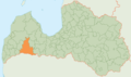
 Dienvidkurzemes novads karte 2021.png 1,166 × 623; 130 KB
-
 Dobeles novads karte.png 592 × 350; 70 KB
-
 Dundagas novads karte.png 592 × 350; 69 KB
-
 Durbes novads karte.png 592 × 350; 69 KB
-
 Engures novads karte.png 592 × 350; 69 KB
-
 Erglu novads karte.png 592 × 350; 69 KB
-
 Garkalnes novads karte.png 592 × 350; 69 KB
-
 Grobinas novads karte.png 592 × 350; 69 KB
-
 Gulbenes novads karte.png 592 × 350; 69 KB
-
 Iecavas novads karte.png 592 × 350; 69 KB
-
 Ikšķilesmapa.PNG 630 × 382; 43 KB
-
 Incukalnamapa.JPG 596 × 355; 24 KB
-
 Jaunjelgavas novada karte.png 592 × 350; 68 KB
-
 Jaunpiebalgas novada karte.png 592 × 350; 69 KB
-
 Jaunpils novada karte.png 592 × 350; 68 KB
-
 Jelgavas novada karte.png 592 × 350; 69 KB
-
 Jēkabpils novada karte (2009).png 592 × 350; 69 KB
-
 Kandavas novada karte.png 592 × 350; 68 KB
-
 Kokneses novada karte.png 592 × 350; 69 KB
-
 Krimuldas novada karte.png 592 × 350; 69 KB
-
 Krustpils novada karte.png 592 × 350; 68 KB
-
 Krāslavas novada karte.png 592 × 350; 68 KB
-
 Kuldīgas novada karte (2009).png 592 × 350; 68 KB
-
 Kārsavas novada karte.png 592 × 350; 68 KB
-
 Lielvārdes novada karte.png 592 × 350; 69 KB
-
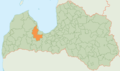
 Limbažu novada karte.png 592 × 350; 68 KB
-
 Location Novads.svg 284 × 168; 3.65 MB
-
 Lubānas novada karte.png 592 × 350; 68 KB
-
 Ludzas novada karte.png 592 × 350; 69 KB
-
 Līgatnes novada karte.png 592 × 350; 69 KB
-
 Līvānu novada karte.png 592 × 350; 68 KB
-
 Madonas novads karte.png 592 × 350; 35 KB
-
 MapaIlūkstes.PNG 630 × 382; 43 KB
-
 Marupese novads karte.png 592 × 350; 69 KB
-
 Mazsalacas novada karte.png 592 × 350; 69 KB
-
 Mālpils novada karte.png 592 × 350; 69 KB
-
 Mērsraga novads LocMap.png 506 × 299; 43 KB
-
 Naukšēnu novada karte.png 592 × 350; 68 KB
-
 Neretas novada karte.png 592 × 350; 68 KB
-
 Nīcas novada karte.png 592 × 350; 69 KB
-
 Ogres novada karte.png 592 × 350; 69 KB
-
 Olaines novada karte.png 592 × 350; 68 KB
-
 Ozolnieku novada karte.png 592 × 350; 69 KB
-
 Preiļu novada karte.png 592 × 350; 69 KB
-
 Priekules novada karte.png 592 × 350; 68 KB
-
 Priekuļu novada karte.png 592 × 350; 69 KB
-
 Pārgaujas novada karte.png 592 × 350; 68 KB
-
 Pāvilostas novada karte.png 592 × 350; 68 KB
-
 Pļaviņu novada karte.png 592 × 350; 69 KB
-
 Raunas novada karte.png 592 × 350; 69 KB
-
 Riebiņu novada karte.png 592 × 350; 69 KB
-
 Rojas novada karte.png 506 × 299; 43 KB
-
 Ropažu novada karte.png 592 × 350; 69 KB
-
 Rucavas novada karte.png 592 × 350; 68 KB
-
 Rugāju novada karte.png 592 × 350; 69 KB
-
 Rundāles novada karte.png 592 × 350; 68 KB
-
 Rēzeknes novada karte (2009).png 592 × 350; 69 KB
-
 Rūjienas novada karte.png 592 × 350; 68 KB
-
 Sabiles novads LocMap.png 506 × 299; 66 KB
-
 Salacgrīvas novada karte.png 592 × 350; 68 KB
-
 Salas novada karte.png 592 × 350; 68 KB
-
 Salaspils novada karte.png 592 × 350; 68 KB
-
 Saldus novada karte.png 592 × 350; 68 KB
-
 Saulkrastu novada karte.png 592 × 350; 69 KB
-
 Siguldas novada karte.png 592 × 350; 69 KB
-
 Skrundas novada karte.png 592 × 350; 68 KB
-
 Skrīveru novada karte.png 592 × 350; 69 KB
-
 Smiltenes novada karte.png 592 × 350; 68 KB
-
 Stopiņu novada karte.png 592 × 350; 69 KB
-
 Strenču novada karte.png 592 × 350; 69 KB
-
 Sējas novada karte.png 592 × 350; 69 KB
-
 Talsu municipality map 2021.png 2,560 × 1,612; 440 KB
-
 Talsu novada karte.png 592 × 350; 69 KB
-
 Tukuma novada karte.png 592 × 350; 69 KB
-
 Tērvetes novada karte.png 592 × 350; 69 KB
-
 Vaiņodes novada karte.png 592 × 350; 69 KB
-
 Valkas novada karte.png 592 × 350; 68 KB
-
 Valmieras novada karte.png 592 × 350; 68 KB
-
 Valmieras novads karte 2021.png 1,166 × 623; 128 KB
-
 Varakļānu novada karte.png 592 × 350; 68 KB
-
 Vecpiebalgas novada karte.png 592 × 350; 69 KB
-
 Vecumnieku novada karte.png 592 × 350; 69 KB
-
 Ventspils novada karte.png 592 × 350; 69 KB
-
 Viesītes novada karte.png 592 × 350; 68 KB
-
 Viļakas novada karte.png 592 × 350; 68 KB
-
 Viļānu novada karte.png 592 × 350; 69 KB
-
 Vārkavas novada karte.png 592 × 350; 69 KB
-
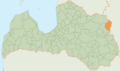
 Zilupes novada karte.png 592 × 350; 68 KB
-
 Ķeguma novada karte.png 592 × 350; 69 KB
-
 Ķekavas novada karte.png 592 × 350; 69 KB


.png)


.png)


.png)


