Category:Locator maps of municipalities of Evrytania prefecture
Jump to navigation
Jump to search
Media in category "Locator maps of municipalities of Evrytania prefecture"
The following 17 files are in this category, out of 17 total.
-
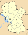
 2010 Dimi Evrytanias numbered.svg 737 × 935; 44 KB
-
 2010 Dimos Agrafon.svg 737 × 935; 41 KB
-
 2010 Dimos Karpenisiou.svg 737 × 935; 41 KB
-
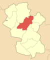
 Dimos Agrafon.png 400 × 479; 36 KB
-
 Dimos Aperantion.png 400 × 479; 36 KB
-
 Dimos Aspropotamou.png 400 × 479; 36 KB
-
 Dimos Domnistas.png 400 × 479; 36 KB
-
 Dimos Fourna.png 400 × 479; 36 KB
-
 Dimos Fragistas.png 400 × 479; 36 KB
-
 Dimos Karpenisiou.png 400 × 479; 35 KB
-
 Dimos Ktimenion.png 400 × 479; 36 KB
-
 Dimos Potamias Evrytanias.png 400 × 479; 36 KB
-
 Dimos Proussou.png 400 × 479; 36 KB
-
 Dimos Vinianis.png 400 × 479; 35 KB
-
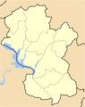
 Evrytania prefecture, Greece - political map - base.svg 744 × 943; 82 KB
-
-


