Category:Locator maps of municipalities of Drenthe
Jump to navigation
Jump to search
Provinces of the Netherlands: Drenthe · Flevoland · Friesland · Gelderland · Limburg · North Brabant · North Holland · Overijssel · South Holland · Zeeland
Media in category "Locator maps of municipalities of Drenthe"
The following 13 files are in this category, out of 13 total.
-
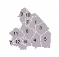 DrentheNumbered.png 176 × 170; 7 KB
-
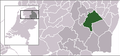 LocatieAaEnHunze.png 280 × 130; 8 KB
-
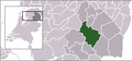
 LocatieAssen.png 280 × 130; 8 KB
-
 LocatieBorger-Odoorn.png 280 × 130; 8 KB
-
 LocatieCoevorden.png 280 × 130; 7 KB
-
 LocatieDeWolden.png 280 × 130; 7 KB
-
 LocatieEmmen.png 280 × 130; 8 KB
-
 LocatieHoogeveen.png 280 × 130; 7 KB
-
 LocatieMeppel.png 280 × 130; 7 KB
-
 LocatieMidden-Drenthe.png 280 × 130; 8 KB
-
 LocatieNoordenveld.png 280 × 130; 7 KB
-
 LocatieTynaarlo.png 280 × 130; 7 KB
-
 LocatieWesterveld.png 280 × 130; 8 KB


