Category:Locator maps of municipalities in the Landkreis Wunsiedel im Fichtelgebirge
Jump to navigation
Jump to search
Subcategories
This category has only the following subcategory.
Media in category "Locator maps of municipalities in the Landkreis Wunsiedel im Fichtelgebirge"
The following 48 files are in this category, out of 48 total.
-
 Arzberg im Landkreis Wunsiedel.png 470 × 392; 71 KB
-
 Arzberg in WUN.svg 520 × 390; 529 KB
-
 Bad Alexandersbad im Landkreis Wunsiedel.png 470 × 392; 71 KB
-
 Bad Alexandersbad in WUN.svg 520 × 390; 529 KB
-
 Hohenberg an der Eger im Landkreis Wunsiedel.png 470 × 392; 71 KB
-
 Hohenberg an der Eger in WUN.svg 520 × 390; 529 KB
-
 Höchstädt im Fichtelgebirge in WUN.svg 520 × 390; 529 KB
-
 Höchstädt im Landkreis Wunsiedel.png 470 × 392; 71 KB
-
 Kaiserhammer Forst-Ost in WUN.svg 520 × 390; 529 KB
-
 Kirchenlamitz im Landkreis Wunsiedel.png 470 × 392; 71 KB
-
 Kirchenlamitz in WUN.svg 520 × 390; 529 KB
-
 Map of Landkreis Wunsiedel im Fichtelgebirge.png 467 × 391; 64 KB
-
 Marktleuthen im Landkreis Wunsiedel.png 470 × 392; 71 KB
-
 Marktleuthen in WUN.svg 520 × 390; 529 KB
-
 Marktredwitz im Landkreis Wunsiedel.png 470 × 392; 71 KB
-
 Marktredwitz in WUN.svg 520 × 390; 529 KB
-
 Martinlamitzer Forst-Süd in WUN.svg 520 × 390; 529 KB
-
 Meierhöfer Seite in WUN.svg 520 × 390; 529 KB
-
 Municipalities in WUN.svg 520 × 390; 529 KB
-
 Nagel im Landkreis Wunsiedel.png 470 × 392; 71 KB
-
 Nagel in WUN.svg 520 × 390; 529 KB
-
 Neubauer Forst-Süd in WUN.svg 520 × 390; 533 KB
-
 Röslau im Landkreis Wunsiedel.png 470 × 392; 71 KB
-
 Röslau in WUN.svg 520 × 390; 529 KB
-
 Schirnding im Landkreis Wunsiedel.png 470 × 392; 71 KB
-
 Schirnding in WUN.svg 520 × 390; 529 KB
-
 Schönwald im Landkreis Wunsiedel.png 470 × 392; 71 KB
-
 Schönwald in WUN.svg 520 × 390; 529 KB
-
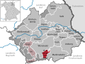
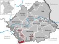
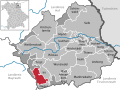
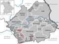
 Selb im Landkreis Wunsiedel.png 470 × 392; 72 KB
-
 Selb in WUN.svg 520 × 390; 529 KB
-
 Thiersheim im Landkreis Wunsiedel.png 470 × 392; 71 KB
-
 Thiersheim in WUN.svg 520 × 390; 529 KB
-
 Thierstein im Landkreis Wunsiedel.png 470 × 392; 71 KB
-
 Thierstein in WUN.svg 520 × 390; 529 KB
-
 Tröstau im Landkreis Wunsiedel.png 470 × 392; 71 KB
-
 Tröstau in WUN.svg 520 × 390; 529 KB
-
 Tröstauer Forst-Ost in WUN.svg 520 × 390; 529 KB
-
 Tröstauer Forst-West in WUN.svg 520 × 390; 529 KB
-
 Verwaltungsgemeinschaft Schirnding in WUN.svg 520 × 390; 529 KB
-
 Verwaltungsgemeinschaft Thiersheim in WUN.svg 520 × 390; 529 KB
-
 Verwaltungsgemeinschaft Tröstau in WUN.svg 520 × 390; 529 KB
-
 Vordorfer Forst in WUN.svg 520 × 390; 529 KB
-
 Weißenstadt im Landkreis Wunsiedel.png 470 × 392; 72 KB
-
 Weißenstadt in WUN.svg 520 × 390; 529 KB
-
 Weißenstadter Forst-Nord in WUN.svg 520 × 390; 529 KB
-
 Weißenstadter Forst-Süd in WUN.svg 520 × 390; 529 KB
-
 Wunsiedel im Landkreis Wunsiedel.png 470 × 392; 72 KB
-
 Wunsiedel in WUN.svg 520 × 390; 529 KB


