Category:Locator maps of municipalities in the Landkreis Sonneberg
Jump to navigation
Jump to search
Districts of Thuringia:
Altenburger Land · Eichsfeld · Gotha · Greiz · Ilm-Kreis · Kyffhäuserkreis · Landkreis Hildburghausen · Landkreis Saalfeld-Rudolstadt · Landkreis Sömmerda · Nordhausen district · Saale-Holzland-Kreis · Saale-Orla-Kreis · Schmalkalden-Meiningen · Sonneberg · Unstrut-Hainich-Kreis · Wartburgkreis · Weimarer Land
Urban districts (cities):
Deutsch: Für die Imagemap-Bearbeitung auf dewiki siehe Vorlage:Imagemap Landkreis Sonneberg
Subcategories
This category has the following 2 subcategories, out of 2 total.
Media in category "Locator maps of municipalities in the Landkreis Sonneberg"
The following 18 files are in this category, out of 18 total.
-
 Municipalities in SON.png 299 × 299; 6 KB
-
 Municipalities in SON.svg 1,063 × 1,063; 339 KB
-
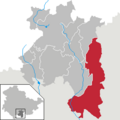 Föritztal in SON.png 299 × 299; 6 KB
-
 Föritztal in SON.svg 1,063 × 1,063; 254 KB
-
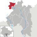
 Frankenblick in SON.png 299 × 299; 6 KB
-
 Frankenblick in SON.svg 1,063 × 1,063; 254 KB
-
 Goldisthal in SON.png 299 × 299; 6 KB
-
 Goldisthal in SON.svg 1,063 × 1,063; 254 KB
-
 Lauscha in SON.png 299 × 299; 6 KB
-
 Lauscha in SON.svg 1,063 × 1,063; 254 KB
-
 Neuhaus am Rennweg in SON.svg 1,063 × 1,063; 254 KB
-
 Neuhaus am Rennweg in SON.png 299 × 299; 6 KB
-
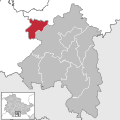
 Schalkau in SON.png 299 × 299; 6 KB
-
 Schalkau in SON.svg 1,063 × 1,063; 254 KB
-
 Sonneberg in SON.png 299 × 299; 6 KB
-
 Sonneberg in SON.svg 1,063 × 1,063; 254 KB
-
 Steinach in SON.png 299 × 299; 6 KB
-
 Steinach in SON.svg 1,063 × 1,063; 254 KB


