Category:Locator maps of municipalities in the Kreis Dithmarschen
Jump to navigation
Jump to search
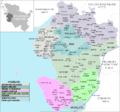
Districts of Schleswig-Holstein:
Urban districts (cities):
Media in category "Locator maps of municipalities in the Kreis Dithmarschen"
The following 137 files are in this category, out of 137 total.
-
 Albersdorf in HEI.PNG 446 × 418; 12 KB
-
 Amt Buesum-Wesselburen in HEI.png 446 × 418; 12 KB
-
 Amt Burg-Sankt Michaelisdonn in HEI.png 446 × 418; 12 KB
-
 Amt KLG Albersdorf.png 446 × 418; 12 KB
-
 Amt KLG Burg-Suederhastedt.png 446 × 418; 12 KB
-
 Amt KLG Büsum.PNG 446 × 418; 12 KB
-
 Amt KLG Eddelak-St. Michaelisdonn.png 446 × 418; 12 KB
-
 Amt KLG Eider.PNG 446 × 418; 12 KB
-
 Amt KLG Heide-Land.PNG 446 × 418; 12 KB
-
 Amt KLG Heider Umland in HEI.png 446 × 418; 12 KB
-
 Amt KLG Hennstedt.png 446 × 418; 12 KB
-
 Amt KLG Lunden.png 446 × 418; 12 KB
-
 Amt KLG Marne-Land.png 446 × 418; 12 KB
-
 Amt KLG Meldorf-Land.png 446 × 418; 12 KB
-
 Amt KLG Tellingstedt.png 446 × 418; 12 KB
-
 Amt KLG Weddingstedt.png 446 × 418; 12 KB
-
 Amt KLG Wesselburen.png 446 × 418; 12 KB
-
 Amt Marne-Nordsee in HEI.png 446 × 418; 12 KB
-
 Amt Mitteldithmarschen in HEI.png 446 × 418; 12 KB
-
 Arkebek in HEI.PNG 446 × 418; 12 KB
-
 Averlak in HEI.PNG 446 × 418; 12 KB
-
 Bargenstedt in HEI.PNG 446 × 418; 12 KB
-
 Barkenholm in HEI.PNG 446 × 418; 12 KB
-
 Barlt in HEI.PNG 446 × 418; 12 KB
-
 Bergewöhrden in HEI.PNG 446 × 418; 12 KB
-
 Brickeln in HEI.PNG 446 × 418; 12 KB
-
 Brunsbuettel in HEI.PNG 446 × 418; 11 KB
-
 Buchholz in HEI.PNG 446 × 418; 12 KB
-
 Buesum in HEI.png 446 × 418; 12 KB
-
 Buesumer Deichhausen in HEI.png 446 × 418; 12 KB
-
 Bunsoh in HEI.PNG 446 × 418; 12 KB
-
 Burg in HEI.PNG 446 × 418; 12 KB
-
 Busenwurth in HEI.PNG 446 × 418; 12 KB
-
 Dellstedt in HEI.PNG 446 × 418; 12 KB
-
 Delve in HEI.png 446 × 418; 12 KB
-
 Diekhusen-Fahrstedt in HEI.PNG 446 × 418; 12 KB
-
 Dingen in HEI.PNG 446 × 418; 12 KB
-
 Doerpling in HEI.png 446 × 418; 12 KB
-
 Eddelak in HEI.PNG 446 × 418; 12 KB
-
 Eggstedt in HEI.PNG 446 × 418; 12 KB
-
 Elpersbüttel in HEI.PNG 446 × 418; 12 KB
-
 Epenwoehrden in HEI.png 446 × 418; 12 KB
-
 Fedderingen in HEI.PNG 446 × 418; 12 KB
-
 Frestedt in HEI.PNG 446 × 418; 12 KB
-
 Friedrichsgabekoog in HEI.PNG 446 × 418; 12 KB
-
 Friedrichskoog in HEI.PNG 446 × 418; 12 KB
-
 Gaushorn in HEI.PNG 446 × 418; 12 KB
-
 Gluesing in HEI.png 446 × 418; 12 KB
-
 Grossenrade in HEI.png 446 × 418; 12 KB
-
 Groven in HEI.PNG 446 × 418; 12 KB
-
 Gudendorf in HEI.PNG 446 × 418; 12 KB
-
 Haegen in HEI.png 446 × 418; 12 KB
-
 Hedwigenkoog in HEI.PNG 446 × 418; 12 KB
-
 Heide in HEI.png 446 × 418; 11 KB
-
 Hellschen-Heringsand-Unterschaar in HEI.PNG 446 × 418; 12 KB
-
 Helse in HEI.png 446 × 418; 12 KB
-
 Hemingstedt in HEI.PNG 446 × 418; 12 KB
-
 Hemme in HEI.PNG 446 × 418; 12 KB
-
 Hennstedt in HEI.png 446 × 418; 12 KB
-
 Hillgroven in HEI.PNG 446 × 418; 12 KB
-
 Hochdonn in HEI.PNG 446 × 418; 12 KB
-
 Hoevede in HEI.png 446 × 418; 12 KB
-
 Hollingstedt in HEI.PNG 446 × 418; 12 KB
-
 Immenstedt in HEI.PNG 446 × 418; 12 KB
-
 Kaiser-Wilhelm-Koog in HEI.PNG 446 × 418; 12 KB
-
 Karolinenkoog in HEI.PNG 446 × 418; 12 KB
-
 Kleve in HEI.PNG 446 × 418; 12 KB
-
 Krempel in HEI.png 446 × 418; 12 KB
-
 Kronprinzenkoog in HEI.PNG 446 × 418; 12 KB
-
 Krumstedt in HEI.PNG 446 × 418; 12 KB
-
 Kuden in HEI.PNG 446 × 418; 12 KB
-
 Lehe in HEI.PNG 446 × 418; 12 KB
-
 Lieth in HEI.PNG 446 × 418; 12 KB
-
 Linden in HEI.PNG 446 × 418; 12 KB
-
 Lohe-Rickelshof in HEI.PNG 446 × 418; 12 KB
-
 Lunden in HEI.PNG 446 × 418; 12 KB
-
 Marne in HEI.PNG 446 × 418; 12 KB
-
 Marnerdeich in HEI.PNG 446 × 418; 12 KB
-
 Meldorf in HEI.png 446 × 418; 12 KB
-
 Neuenkirchen in HEI.PNG 446 × 418; 12 KB
-
 Neufeld in HEI.PNG 446 × 418; 12 KB
-
 Neufelderkoog in HEI.PNG 446 × 418; 12 KB
-
 Nindorf in HEI.PNG 446 × 418; 12 KB
-
 Norddeich in HEI.PNG 446 × 418; 12 KB
-
 Norderheistedt in HEI.PNG 446 × 418; 12 KB
-
 Nordermeldorf in HEI.PNG 446 × 418; 12 KB
-
 Norderwörden in HEI.PNG 446 × 418; 12 KB
-
 Nordhastedt in HEI.PNG 446 × 418; 12 KB
-
 Odderade in HEI.PNG 446 × 418; 12 KB
-
 Oesterdeichstrich in HEI.PNG 446 × 418; 12 KB
-
 Oesterwurth in HEI.PNG 446 × 418; 12 KB
-
 Offenbuettel in HEI.png 446 × 418; 12 KB
-
 Osterrade in HEI.PNG 446 × 418; 12 KB
-
 Ostrohe in HEI.PNG 446 × 418; 12 KB
-
 Overview2008-HEI-no.PNG 888 × 830; 51 KB
-
 Pahlen in HEI.png 446 × 418; 12 KB
-
 Quickborn in HEI.png 446 × 418; 12 KB
-
 Ramhusen in HEI.PNG 446 × 418; 12 KB
-
 Rehm-Flehde-Bargen in HEI.PNG 446 × 418; 12 KB
-
 Reinsbüttel in HEI.PNG 446 × 418; 12 KB
-
 Sankt Annen in HEI.PNG 446 × 418; 12 KB
-
 Sankt Michaelisdonn in HEI.PNG 446 × 418; 12 KB
-
 Sarzbuettel in HEI.png 446 × 418; 12 KB
-
 Schafstedt in HEI.PNG 446 × 418; 12 KB
-
 Schalkholz in HEI.PNG 446 × 418; 12 KB
-
 Schlichting in HEI.PNG 446 × 418; 12 KB
-
 Schmedeswurth in HEI.PNG 446 × 418; 12 KB
-
 Schrum in HEI.PNG 446 × 418; 12 KB
-
 Schuelp in HEI.png 446 × 418; 12 KB
-
 Stelle-Wittenwurth in HEI.PNG 446 × 418; 12 KB
-
 Struebbel in HEI.PNG 446 × 418; 12 KB
-
 Suederdorf in HEI.png 446 × 418; 12 KB
-
 Suederhastedt in HEI.png 446 × 418; 12 KB
-
 Suederheistedt in HEI.png 446 × 418; 12 KB
-
 Süderdeich in HEI.PNG 446 × 418; 12 KB
-
 Tellingstedt in HEI.png 446 × 418; 12 KB
-
 Tensbuettel-Roest in HEI.png 446 × 418; 12 KB
-
 Tielenhemme in HEI.png 446 × 418; 12 KB
-
 Trennewurth in HEI.png 446 × 418; 12 KB
-
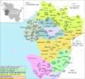 Uebersicht-HEI.png 888 × 830; 32 KB
-
 Volsemenhusen in HEI.PNG 446 × 418; 12 KB
-
 Wallen in HEI.png 446 × 418; 12 KB
-
 Warwerort in HEI.PNG 446 × 418; 12 KB
-
 Weddingstedt in HEI.PNG 446 × 418; 12 KB
-
 Welmbuettel in HEI.png 446 × 418; 12 KB
-
 Wennbuettel in HEI.png 446 × 418; 12 KB
-
 Wesselburen in HEI.PNG 446 × 418; 12 KB
-
 Wesselburener-Deichhausen in HEI.png 446 × 418; 12 KB
-
 Wesselburenerkoog in HEI.PNG 446 × 418; 12 KB
-
 Wesseln in HEI.PNG 446 × 418; 12 KB
-
 Westerborstel in HEI.PNG 446 × 418; 12 KB
-
 Westerdeichstrich in HEI.PNG 446 × 418; 12 KB
-
 Wiemerstedt in HEI.png 446 × 418; 12 KB
-
 Windbergen in HEI.PNG 446 × 418; 12 KB
-
 Woehrden in HEI.png 446 × 418; 12 KB
-
 Wolmersdorf in HEI.PNG 446 × 418; 12 KB
-
 Wrohm in HEI.PNG 446 × 418; 12 KB


