Category:Locator maps of municipalities in multiple German states
Jump to navigation
Jump to search
Media in category "Locator maps of municipalities in multiple German states"
The following 37 files are in this category, out of 37 total.
-
 De-map sv.svg 351 × 377; 34 KB
-
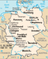
 Germany-CIA WFB Map.png 328 × 352; 16 KB
-
 Lage Bremen x 4.png 188 × 235; 5 KB
-
 Tyskland kart.png 328 × 352; 15 KB
-
 000 Gjermania harta.PNG 351 × 377; 24 KB
-
 Allemagne carte.png 328 × 352; 29 KB
-
 Ambulante Kinderhospizdienste in Deutschland.PNG 372 × 444; 44 KB
-
 Aurubis Standorte.png 612 × 720; 171 KB
-
 D-A-CH location map T(h)alheim Da(h)lheim.svg 1,257 × 1,514; 928 KB
-
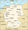
 De-map.png 351 × 377; 36 KB
-
 DE-mapa.png 327 × 351; 15 KB
-
 De-mapzhs.PNG 351 × 377; 22 KB
-
 Deutschland (Städte).png 603 × 806; 81 KB
-
 Deutschland Metropolregion-9.png 668 × 910; 52 KB
-
 Dfh-ufa network map.png 980 × 925; 139 KB
-
 Germany - Location Map (2013) - DEU - UNOCHA.svg 250 × 250; 1,015 KB
-
 Germany - Location Map (2019) - DEU - UNOCHA.svg 512 × 564; 920 KB
-
 Germany CIA map extended banner.gif 285 × 353; 17 KB
-
 Germany CIA map extended.gif 285 × 352; 18 KB
-
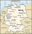
 Germany CIA map PL.png 351 × 377; 50 KB
-
 Germany DE1.PNG 1,616 × 2,171; 379 KB
-
 Germany sm01.jpg 351 × 377; 70 KB
-
 Gm-map-es.png 330 × 354; 30 KB
-
 Gm-map-ja.png 328 × 352; 19 KB
-
 Kaart duitsland.png 351 × 377; 72 KB
-
 Karta Njemacke.png 351 × 377; 51 KB
-

-
 Karte Deutschlandreise.png 184 × 246; 4 KB
-
 Karte mit Standorten.jpg 1,396 × 1,842; 408 KB
-
 Lage der Großstädte in Deutschland.png 188 × 235; 3 KB
-
 Overview Maps of Municipalities in Germany.svg 9,450 × 12,513; 878 KB
-
 Saksa-kartta.JPG 351 × 377; 72 KB
-
 Tyskland kart-sv.png 328 × 352; 46 KB
-
 Urbes in Germania.png 1,138 × 1,174; 141 KB
-
 Verteilung von Büttel-Orten in Deutschland.svg 423 × 563; 105 KB
-
 Vokietijos pasauslio cempionatu miestai.jpg 436 × 545; 28 KB
-
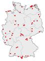
 Stammtische in Deutschland (meetups germany).png 188 × 235; 6 KB


alheim_Da(h)lheim.svg)


.png)


_-_DEU_-_UNOCHA.svg)
_-_DEU_-_UNOCHA.svg)


.png)