Category:Locator maps of geographical microregions of Hungary
Jump to navigation
Jump to search
Media in category "Locator maps of geographical microregions of Hungary"
The following 200 files are in this category, out of 210 total.
(previous page) (next page)-
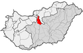
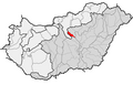
 HU microregion 1.1.11. Vác–Pesti-Duna-völgy.png 2,009 × 1,282; 69 KB
-
 HU microregion 1.1.12. Pesti-hordalékkúpsíkság.png 2,009 × 1,282; 70 KB
-
 HU microregion 1.1.21. Csepeli-sík.png 2,009 × 1,282; 70 KB
-
 HU microregion 1.1.22. Solti-sík.png 2,009 × 1,282; 70 KB
-
 HU microregion 1.1.23. Kalocsai-Sárköz.png 2,009 × 1,282; 70 KB
-
 HU microregion 1.1.24. Tolnai-Sárköz.png 2,009 × 1,282; 69 KB
-
 HU microregion 1.1.25. Mohácsi-sziget.png 2,009 × 1,282; 69 KB
-
 HU microregion 1.1.26. Mohácsi teraszos sík.png 2,009 × 1,282; 69 KB
-
 HU microregion 1.10.11. Közép-Nyírség.png 2,009 × 1,282; 70 KB
-
 HU microregion 1.10.12. Északkelet-Nyírség.png 2,009 × 1,282; 70 KB
-
 HU microregion 1.10.13. Délkelet-Nyírség.png 2,009 × 1,282; 70 KB
-
 HU microregion 1.10.14. Dél-Nyírség.png 2,009 × 1,282; 70 KB
-
 HU microregion 1.10.21. Nyugati-Nyírség.png 2,009 × 1,282; 70 KB
-
 HU microregion 1.11.11. Hajdúhát.png 2,009 × 1,282; 70 KB
-
 HU microregion 1.11.12. Dél-Hajdúság.png 2,009 × 1,282; 70 KB
-
 HU microregion 1.12.11. Dévaványai-sík.png 2,009 × 1,282; 70 KB
-
 HU microregion 1.12.12. Nagy-Sárrét.png 2,009 × 1,282; 70 KB
-
 HU microregion 1.12.13. Berettyó–Kálló köze.png 2,009 × 1,282; 70 KB
-
 HU microregion 1.12.14. Érmelléki löszös hát.png 2,009 × 1,282; 69 KB
-
 HU microregion 1.12.21. Bihari-sík.png 2,009 × 1,282; 70 KB
-
 HU microregion 1.12.22. Kis-Sárrét.png 2,009 × 1,282; 70 KB
-
 HU microregion 1.12.23. Körös menti sík.png 2,009 × 1,282; 70 KB
-
 HU microregion 1.13.11. Csanádi-hát.png 2,009 × 1,282; 69 KB
-
 HU microregion 1.13.12. Békési-hát.png 2,009 × 1,282; 70 KB
-
 HU microregion 1.13.21. Békési-sík.png 2,009 × 1,282; 70 KB
-
 HU microregion 1.13.22. Csongrádi-sík.png 2,009 × 1,282; 70 KB
-
 HU microregion 1.13.23. Körösszög.png 2,009 × 1,282; 70 KB
-
 HU microregion 1.2.11. Gerje–Perje-sík.png 2,009 × 1,282; 70 KB
-
 HU microregion 1.2.12. Pilis–Alpári-homokhát.png 2,009 × 1,282; 70 KB
-
 HU microregion 1.2.13. Kiskunsági-homokhát.png 2,009 × 1,282; 70 KB
-
 HU microregion 1.2.14. Bugaci-homokhát.png 2,009 × 1,282; 70 KB
-
 HU microregion 1.2.15. Dorozsma–Majsai-homokhát.png 2,009 × 1,282; 70 KB
-
 HU microregion 1.2.16. Kiskunsági löszös hát.png 2,009 × 1,282; 70 KB
-
 HU microregion 1.3.11. Illancs.png 2,009 × 1,282; 69 KB
-
 HU microregion 1.3.12. Bácskai löszös síkság.png 2,009 × 1,282; 69 KB
-
 HU microregion 1.4.11. Érd–Ercsi-hátság.png 2,009 × 1,282; 70 KB
-
 HU microregion 1.4.12. Váli-víz síkja.png 2,009 × 1,282; 70 KB
-
 HU microregion 1.4.21. Közép-Mezőföld.png 2,009 × 1,282; 70 KB
-
 HU microregion 1.4.22. Velencei-medence.png 2,009 × 1,282; 69 KB
-
 HU microregion 1.4.23. Sárrét.png 2,009 × 1,282; 69 KB
-
 HU microregion 1.4.24. Sárvíz-völgy.png 2,009 × 1,282; 70 KB
-
 HU microregion 1.4.25. Dél-Mezőföld.png 2,009 × 1,282; 70 KB
-
 HU microregion 1.4.31. Enyingi-hát.png 2,009 × 1,282; 69 KB
-
 HU microregion 1.4.32. Káloz–Igari-löszhátak.png 2,009 × 1,282; 70 KB
-
 HU microregion 1.4.33. Sió-völgy.png 2,009 × 1,282; 69 KB
-
 HU microregion 1.5.11. Dráva-sík.png 2,009 × 1,282; 69 KB
-
 HU microregion 1.5.12. Fekete-víz síkja.png 2,009 × 1,282; 69 KB
-
 HU microregion 1.5.13. Nyárád–Harkányi-sík.png 2,009 × 1,282; 69 KB
-
 HU microregion 1.6.11. Beregi-sík.png 2,009 × 1,282; 69 KB
-
 HU microregion 1.6.12. Szatmári-sík.png 2,009 × 1,282; 70 KB
-
 HU microregion 1.6.13. Bodrogköz.png 2,009 × 1,282; 69 KB
-
 HU microregion 1.6.14. Rétköz.png 2,009 × 1,282; 69 KB
-
 HU microregion 1.7.11. Taktaköz.png 2,009 × 1,282; 69 KB
-
 HU microregion 1.7.12. Borsodi-ártér.png 2,009 × 1,282; 70 KB
-
 HU microregion 1.7.13. Hevesi-ártér.png 2,009 × 1,282; 70 KB
-
 HU microregion 1.7.14. Szolnoki-ártér.png 2,009 × 1,282; 70 KB
-
 HU microregion 1.7.15. Jászság.png 2,009 × 1,282; 70 KB
-
 HU microregion 1.7.21. Tiszafüred–Kunhegyesi-sík.png 2,009 × 1,282; 70 KB
-
 HU microregion 1.7.22. Szolnok–Túri-sík.png 2,009 × 1,282; 70 KB
-
 HU microregion 1.7.23. Tiszazug.png 2,009 × 1,282; 69 KB
-
 HU microregion 1.7.31. Hortobágy.png 2,009 × 1,282; 70 KB
-
 HU microregion 1.8.11. Marosszög.png 2,009 × 1,282; 69 KB
-
 HU microregion 1.8.12. Dél-Tisza-völgy.png 2,009 × 1,282; 70 KB
-
 HU microregion 1.9.11. Hatvani-sík.png 2,009 × 1,282; 70 KB
-
 HU microregion 1.9.12. Tápió-vidék.png 2,009 × 1,282; 70 KB
-
 HU microregion 1.9.21. Gyöngyösi-sík.png 2,009 × 1,282; 69 KB
-
 HU microregion 1.9.22. Hevesi-sík.png 2,009 × 1,282; 70 KB
-
 HU microregion 1.9.31. Borsodi-Mezőség.png 2,009 × 1,282; 69 KB
-
 HU microregion 1.9.32. Sajó–Hernád-sík.png 2,009 × 1,282; 70 KB
-
 HU microregion 1.9.33. Harangod.png 2,009 × 1,282; 69 KB
-
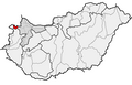
 HU microregion 2.1.11. Szigetköz.png 2,009 × 1,282; 58 KB
-
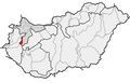
 HU microregion 2.1.12. Mosoni-sík.png 2,009 × 1,282; 58 KB
-
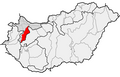
 HU microregion 2.1.21. Fertő-medence.png 2,009 × 1,282; 58 KB
-
 HU microregion 2.1.22. Hanság.png 2,009 × 1,282; 58 KB
-
 HU microregion 2.1.31. Kapuvári-sík.png 2,009 × 1,282; 58 KB
-
 HU microregion 2.1.32. Csornai-sík.png 2,009 × 1,282; 58 KB
-
 HU microregion 2.2.11. Marcal-völgy.png 2,009 × 1,282; 58 KB
-
 HU microregion 2.2.12. Kemenesalja.png 2,009 × 1,282; 58 KB
-
 HU microregion 2.2.13. Pápa–Devecseri-sík.png 2,009 × 1,282; 58 KB
-
 HU microregion 2.3.11. Győr–Tatai-teraszvidék.png 2,009 × 1,282; 58 KB
-
 HU microregion 2.3.12. Igmánd–Kisbéri-medence.png 2,009 × 1,282; 58 KB
-
 HU microregion 2.3.13. Almás–Táti-Duna-völgy.png 2,009 × 1,282; 58 KB
-
 HU microregion 3.1.11. Soproni-hegység.png 2,009 × 1,282; 58 KB
-
 HU microregion 3.1.12. Fertőmelléki-dombság.png 2,009 × 1,282; 58 KB
-
 HU microregion 3.1.13. Soproni-medence.png 2,009 × 1,282; 58 KB
-
 HU microregion 3.1.21. Kőszegi-hegység.png 2,009 × 1,282; 58 KB
-
 HU microregion 3.1.22. Vas-hegy és Kőszeghegyalja.png 2,009 × 1,282; 58 KB
-
 HU microregion 3.1.23. Pinka-sík.png 2,009 × 1,282; 59 KB
-
 HU microregion 3.1.31. Felső-Őrség.png 2,009 × 1,282; 58 KB
-
 HU microregion 3.1.32. Vasi-Hegyhát.png 2,009 × 1,282; 58 KB
-
 HU microregion 3.2.11. Ikva-sík.png 2,009 × 1,282; 58 KB
-
 HU microregion 3.2.12. Répce-sík.png 2,009 × 1,282; 59 KB
-
 HU microregion 3.2.13. Gyöngyös-sík.png 2,009 × 1,282; 59 KB
-
 HU microregion 3.2.14. Rábai teraszos sík.png 2,009 × 1,282; 59 KB
-
 HU microregion 3.2.15. Rába-völgy.png 2,009 × 1,282; 59 KB
-
 HU microregion 3.3.11. Alsó-Kemeneshát.png 2,009 × 1,282; 58 KB
-
 HU microregion 3.3.12. Felső-Kemeneshát.png 2,009 × 1,282; 59 KB
-
 HU microregion 3.4.11. Felső-Zala-völgy.png 2,009 × 1,282; 59 KB
-
 HU microregion 3.4.12. Kerka-vidék.png 2,009 × 1,282; 58 KB
-
 HU microregion 3.4.13. Közép-Zalai-dombság.png 2,009 × 1,282; 59 KB
-
 HU microregion 3.4.21. Egerszeg–Letenyei-dombság.png 2,009 × 1,282; 59 KB
-
 HU microregion 3.4.22. Principális-völgy.png 2,009 × 1,282; 59 KB
-
 HU microregion 3.4.23. Zalaapáti-hát.png 2,009 × 1,282; 59 KB
-
 HU microregion 3.4.24. Alsó-Zala-völgy.png 2,009 × 1,282; 58 KB
-
 HU microregion 3.4.25. Zalavári-hát.png 2,009 × 1,282; 58 KB
-
 HU microregion 3.4.31. Mura bal parti sík.png 2,009 × 1,282; 58 KB
-
 HU microregion 4.3.11. Marcali-hát.png 2,009 × 1,282; 56 KB
-
 HU microregion 4.3.12. Kelet-Belső-Somogy.png 2,009 × 1,282; 56 KB
-
 HU microregion 4.3.13. Nyugat-Belső-Somogy.png 2,009 × 1,282; 56 KB
-
 HU microregion 4.3.14. Közép-Dráva-völgy.png 2,009 × 1,282; 56 KB
-
 HU microregion 4.4.11. Mecsek-hegység.png 2,009 × 1,282; 58 KB
-
 HU microregion 4.4.12. Baranyai-Hegyhát.png 2,009 × 1,282; 58 KB
-
 HU microregion 4.4.21. Völgység.png 2,009 × 1,282; 58 KB
-
 HU microregion 4.4.22. Tolnai-Hegyhát.png 2,009 × 1,282; 58 KB
-
 HU microregion 4.4.23. Szekszárdi-dombság.png 2,009 × 1,282; 58 KB
-
 HU microregion 4.4.31. Pécsi-síkság.png 2,009 × 1,282; 58 KB
-
 HU microregion 4.4.32. Geresdi-dombság.png 2,009 × 1,282; 58 KB
-
 HU microregion 4.4.33. Villányi-hegység.png 2,009 × 1,282; 58 KB
-
 HU microregion 4.4.34. Dél-Baranyai-dombság.png 2,009 × 1,282; 58 KB
-
 HU microregion 4.4.41. Észak-Zselic.png 2,009 × 1,282; 58 KB
-
 HU microregion 4.4.42. Dél-Zselic.png 2,009 × 1,282; 58 KB
-
 HU microregion 5.1.11. Tátika-csoport.png 2,009 × 1,282; 58 KB
-
 HU microregion 5.1.12. Keszthelyi-fennsík.png 2,009 × 1,282; 58 KB
-
 HU microregion 5.1.21. Badacsony–Gulács-csoport.png 2,009 × 1,282; 58 KB
-
 HU microregion 5.1.22. Balaton-felvidék és kismedencéi.png 2,009 × 1,282; 58 KB
-
 HU microregion 5.1.23. Vilonyai-hegyek.png 2,009 × 1,282; 58 KB
-
 HU microregion 5.1.31. Veszprém–Nagyvázsonyi-medence.png 2,009 × 1,282; 58 KB
-
 HU microregion 5.1.32. Kab-hegy–Agártető-csoport.png 2,009 × 1,282; 59 KB
-
 HU microregion 5.1.33. Sümeg–Tapolcai-hát.png 2,009 × 1,282; 58 KB
-
 HU microregion 5.1.34. Devecseri-Bakonyalja.png 2,009 × 1,282; 58 KB
-
 HU microregion 5.1.41. Öreg-Bakony.png 2,009 × 1,282; 59 KB
-
 HU microregion 5.1.42. Bakonyi-kismedencék.png 2,009 × 1,282; 59 KB
-
 HU microregion 5.1.43. Keleti-Bakony.png 2,009 × 1,282; 59 KB
-
 HU microregion 5.1.44. Veszprém–Devecseri-árok.png 2,009 × 1,282; 59 KB
-
 HU microregion 5.1.51. Pápai-Bakonyalja.png 2,009 × 1,282; 59 KB
-
 HU microregion 5.1.52. Pannonhalmi-dombság.png 2,009 × 1,282; 58 KB
-
 HU microregion 5.1.53. Súri-Bakonyalja.png 2,009 × 1,282; 59 KB
-
 HU microregion 5.2.11. Bársonyos.png 2,009 × 1,282; 57 KB
-
 HU microregion 5.2.12. Által-ér-völgy.png 2,009 × 1,282; 57 KB
-
 HU microregion 5.2.13. Móri-árok.png 2,009 × 1,282; 57 KB
-
 HU microregion 5.2.21. Vértes-fennsík.png 2,009 × 1,282; 57 KB
-
 HU microregion 5.2.22. Vértes peremvidéke.png 2,009 × 1,282; 57 KB
-
 HU microregion 5.2.23. Gánti-medence.png 2,009 × 1,282; 57 KB
-
 HU microregion 5.2.31. Zámolyi-medence.png 2,009 × 1,282; 57 KB
-
 HU microregion 5.2.32. Sörédi-hát.png 2,009 × 1,282; 57 KB
-
 HU microregion 5.2.33. Lovasberényi-hát.png 2,009 × 1,282; 57 KB
-
 HU microregion 5.2.34. Velencei-hegység.png 2,009 × 1,282; 57 KB
-
 HU microregion 5.3.21. Etyeki-dombság.png 2,009 × 1,282; 56 KB
-
 HU microregion 5.3.22. Zsámbéki-medence.png 2,009 × 1,282; 56 KB
-
 HU microregion 5.3.31. Budai-hegyek.png 2,009 × 1,282; 56 KB
-
 HU microregion 5.3.32. Tétényi-fennsík.png 2,009 × 1,282; 56 KB
-
 HU microregion 5.3.33. Budaörsi- és Budakeszi-medence.png 2,009 × 1,282; 56 KB
-
 HU microregion 6.1.11. Visegrádi-Dunakanyar.png 2,009 × 1,282; 56 KB
-
 HU microregion 6.1.12. Visegrádi-hegység.png 2,009 × 1,282; 56 KB
-
 HU microregion 6.2.11. Központi-Börzsöny.png 2,009 × 1,282; 56 KB
-
 HU microregion 6.2.12. Börzsönyi-kismedencék.png 2,009 × 1,282; 56 KB
-
 HU microregion 6.2.13. Börzsönyi-peremhegység.png 2,009 × 1,282; 56 KB
-
 HU microregion 6.3.11. Kosdi-dombság.png 2,009 × 1,282; 57 KB
-
 HU microregion 6.3.12. Nézsa–Csővári-dombság.png 2,009 × 1,282; 57 KB
-
 HU microregion 6.3.21. Központi-Cserhát.png 2,009 × 1,282; 57 KB
-
 HU microregion 6.3.22. Galga-völgy.png 2,009 × 1,282; 57 KB
-
 HU microregion 6.3.23. Ecskendi-dombság.png 2,009 × 1,282; 57 KB
-
 HU microregion 6.3.24. Cserhátalja.png 2,009 × 1,282; 57 KB
-
 HU microregion 6.3.31. Terényi-dombság.png 2,009 × 1,282; 57 KB
-
 HU microregion 6.3.32. Szécsényi-dombság.png 2,009 × 1,282; 57 KB
-
 HU microregion 6.3.41. Karancs.png 2,009 × 1,282; 57 KB
-
 HU microregion 6.3.42. Litke–Etesi-dombság.png 2,009 × 1,282; 57 KB
-
 HU microregion 6.3.51. Gödöllői-dombság.png 2,009 × 1,282; 57 KB
-
 HU microregion 6.3.52. Monor–Irsai-dombság.png 2,009 × 1,282; 57 KB
-
 HU microregion 6.4.11. Magas-Mátra.png 2,009 × 1,282; 57 KB
-
 HU microregion 6.4.12. Nyugati-Mátra.png 2,009 × 1,282; 57 KB
-
 HU microregion 6.4.13. Déli-Mátra.png 2,009 × 1,282; 57 KB
-
 HU microregion 6.4.21. Keleti-Mátraalja.png 2,009 × 1,282; 57 KB
-
 HU microregion 6.4.22. Nyugati-Mátraalja.png 2,009 × 1,282; 57 KB
-
 HU microregion 6.4.23. Mátralába.png 2,009 × 1,282; 57 KB
-
 HU microregion 6.4.24. Parád–Recski-medence.png 2,009 × 1,282; 57 KB
-
 HU microregion 6.5.11. Bükk-fennsík.png 2,009 × 1,282; 57 KB
-
 HU microregion 6.5.12. Északi-Bükk.png 2,009 × 1,282; 57 KB
-
 HU microregion 6.5.13. Déli-Bükk.png 2,009 × 1,282; 57 KB
-
 HU microregion 6.5.21. Tárkányi-medence.png 2,009 × 1,282; 57 KB
-
 HU microregion 6.5.22. Egri-Bükkalja.png 2,009 × 1,282; 57 KB
-
 HU microregion 6.5.23. Miskolci-Bükkalja.png 2,009 × 1,282; 57 KB
-
 HU microregion 6.5.31. Tardonai-dombság.png 2,009 × 1,282; 57 KB
-
 HU microregion 6.5.32. Upponyi-hegység.png 2,009 × 1,282; 57 KB
-
 HU microregion 6.6.11. Aggteleki-hegység.png 2,009 × 1,282; 56 KB
-
 HU microregion 6.6.12. Alsó-hegy.png 2,009 × 1,282; 56 KB
-
 HU microregion 6.7.11. Központi-Zemplén.png 2,009 × 1,282; 57 KB
-
 HU microregion 6.7.12. Abaúji-hegyalja.png 2,009 × 1,282; 57 KB
-
 HU microregion 6.7.21. Tokaji-hegy.png 2,009 × 1,282; 57 KB
-
 HU microregion 6.7.22. Szerencsi-dombság.png 2,009 × 1,282; 57 KB
-
 HU microregion 6.7.23. Hegyalja.png 2,009 × 1,282; 57 KB
-
 HU microregion 6.7.31. Hegyközi-dombság.png 2,009 × 1,282; 57 KB
-
 HU microregion 6.7.32. Vitányi-rögök.png 2,009 × 1,282; 57 KB
-
 HU microregion 6.8.11. Alsó-Ipoly-völgy.png 2,009 × 1,282; 58 KB
-
 HU microregion 6.8.12. Középső-Ipoly-völgy.png 2,009 × 1,282; 58 KB
-
 HU microregion 6.8.13. Nógrádi-medence.png 2,009 × 1,282; 58 KB
-
 HU microregion 6.8.21. Zagyva-völgy.png 2,009 × 1,282; 58 KB
-
 HU microregion 6.8.22. Medves-vidék.png 2,009 × 1,282; 58 KB
-
 HU microregion 6.8.23. Felső-Tarnai-dombság.png 2,009 × 1,282; 58 KB
-
 HU microregion 6.8.24. Tarna-völgy.png 2,009 × 1,282; 58 KB


