Category:Locator maps of former municipalities in Vogtlandkreis
Jump to navigation
Jump to search
Districts of Saxony:
Urban districts (cities):
Media in category "Locator maps of former municipalities in Vogtlandkreis"
The following 59 files are in this category, out of 59 total.
-
 Burgstein in V.svg 1,305 × 1,305; 1.41 MB
-
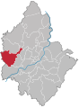
 Plauen - Chrieschwitz.svg 855 × 1,139; 84 KB
-
 Erlbach in V.svg 1,178 × 1,254; 340 KB
-
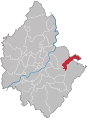
 Plauen - Großfriesen.svg 855 × 1,139; 84 KB
-
 Hammerbrücke in V.svg 1,305 × 1,305; 1.35 MB
-
 Plauen - Haselbrunn.svg 855 × 1,139; 84 KB
-
 Plauen - Jößnitz.svg 855 × 1,139; 84 KB
-
 Plauen - Kauschwitz.svg 855 × 1,139; 84 KB
-
 Plauen - Kleinfriesen.svg 855 × 1,139; 84 KB
-
 Leubnitz in V.svg 1,305 × 1,305; 1.41 MB
-
 Mehltheuer in V.svg 1,305 × 1,305; 1.41 MB
-
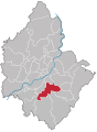
 Plauen - Meßbach.svg 855 × 1,139; 84 KB
-
 Morgenröthe-Rautenkranz in V.svg 1,305 × 1,305; 1.35 MB
-
 Mylau in V.svg 1,178 × 1,254; 340 KB
-
 Mühltroff in V.svg 1,178 × 1,254; 342 KB
-
 Plauen - Neundorf.svg 855 × 1,139; 84 KB
-
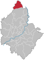
 Plauen - Oberlosa.svg 855 × 1,139; 84 KB
-
 Pausa-Vogtl. in V.svg 1,178 × 1,254; 342 KB
-
 Plauen - Innenstadt+Haselbrunn.svg 855 × 1,139; 67 KB
-
 Plauen - Reißig+Reißigwald.svg 855 × 1,139; 68 KB
-
 Plauen Stadtteil Chrieschwitz (302).svg 850 × 1,151; 83 KB
-
 Plauen Stadtteil Großfriesen (303).svg 850 × 1,151; 83 KB
-
 Plauen Stadtteil Haselbrunn (202).svg 850 × 1,151; 83 KB
-
 Plauen Stadtteil Jößnitz (207).svg 850 × 1,151; 83 KB
-
 Plauen Stadtteil Kauschwitz (209).svg 850 × 1,151; 83 KB
-
 Plauen Stadtteil Kleinfriesen (304).svg 850 × 1,151; 83 KB
-
 Plauen Stadtteil Meßbach (402).svg 850 × 1,151; 83 KB
-
 Plauen Stadtteil Neundorf (505).svg 850 × 1,151; 83 KB
-
 Plauen Stadtteil Oberlosa (403).svg 850 × 1,151; 83 KB
-
 Plauen Stadtteil Reinsdorf (405).svg 850 × 1,151; 83 KB
-
 Plauen Stadtteil Reusa mit Sorga (305).svg 850 × 1,151; 83 KB
-
 Plauen Stadtteil Röttis (211).svg 850 × 1,151; 83 KB
-
 Plauen Stadtteil Steinsdorf (208).svg 850 × 1,151; 83 KB
-
 Plauen Stadtteil Straßberg (506).svg 850 × 1,151; 83 KB
-
 Plauen Stadtteil Stöckigt (406).svg 850 × 1,151; 83 KB
-
 Plauen Stadtteil Tauschwitz (307).svg 850 × 1,151; 83 KB
-
 Plauen Stadtteil Thiergarten (408).svg 850 × 1,151; 83 KB
-
 Plauen Stadtteil Unterlosa (409).svg 850 × 1,151; 83 KB
-
 Plauen Stadtteil Zwoschwitz (210).svg 850 × 1,151; 83 KB
-
 Plauen - Reinsdorf.svg 855 × 1,139; 84 KB
-
 Plauen - Reusa mit Sorga.svg 855 × 1,139; 84 KB
-
 Reuth in V.svg 1,178 × 1,254; 340 KB
-
 Plauen - Röttis.svg 855 × 1,139; 84 KB
-
 Plauen - Steinsdorf.svg 855 × 1,139; 84 KB
-
 Plauen - Straßberg.svg 855 × 1,139; 84 KB
-
 Plauen - Stöckigt.svg 855 × 1,139; 84 KB
-
 Syrau in V.svg 1,305 × 1,305; 1.41 MB
-
 Tannenbergsthal in V.svg 1,305 × 1,305; 1.35 MB
-
 Plauen - Tauschwitz.svg 855 × 1,139; 84 KB
-
 Plauen - Thiergarten.svg 855 × 1,139; 84 KB
-
 Plauen - Unterlosa.svg 855 × 1,139; 84 KB
-
 Verwaltungsgemeinschaft Klingenthal in V.svg 1,178 × 1,254; 342 KB
-
 Verwaltungsgemeinschaft Markneukirchen in V.svg 1,178 × 1,254; 340 KB
-
 Verwaltungsgemeinschaft Pausa in V.svg 1,178 × 1,254; 342 KB
-
 Verwaltungsgemeinschaft Weischlitz in V.svg 1,178 × 1,254; 340 KB
-
 Verwaltungsverband Rosenbach in V.svg 1,305 × 1,305; 1.41 MB
-
 Verwaltungsverband Waldgebiet Vogtland in V.svg 1,305 × 1,305; 1.35 MB
-
 Plauen - Zwoschwitz.svg 855 × 1,139; 84 KB
-
 Zwota in V.svg 1,178 × 1,254; 342 KB


.svg)
.svg)
.svg)
.svg)
.svg)
.svg)
.svg)
.svg)
.svg)
.svg)
.svg)
.svg)
.svg)
.svg)
.svg)
.svg)
.svg)
.svg)
.svg)


