Category:Locator maps of former cantons of Ain
Jump to navigation
Jump to search
Media in category "Locator maps of former cantons of Ain"
The following 86 files are in this category, out of 86 total.
-
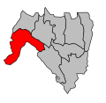
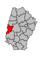
 Canton de Pont-de-Veyle.svg 984 × 902; 204 KB
-
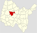
 Map canton code 01 01.svg 474 × 459; 6 KB
-
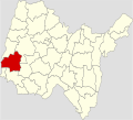
 Map canton code 01 02.svg 340 × 459; 12 KB
-
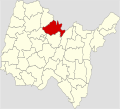
 Map canton code 01 03.svg 478 × 459; 5 KB
-
 Map canton code 01 04.svg 482 × 467; 6 KB
-
 Map canton code 01 06.svg 486 × 467; 5 KB
-
 Map canton code 01 07.svg 348 × 467; 12 KB
-
 Map canton code 01 08.svg 356 × 475; 12 KB
-
 Map canton code 01 09.svg 490 × 475; 6 KB
-
 Map canton code 01 10.svg 364 × 483; 12 KB
-
 Map canton code 01 11.svg 372 × 491; 12 KB
-
 Map canton code 01 12.svg 330 × 459; 3 KB
-
 Map canton code 01 13.svg 338 × 467; 3 KB
-
 Map canton code 01 14.svg 346 × 475; 3 KB
-
 Map canton code 01 15.svg 498 × 483; 6 KB
-
 Map canton code 01 16.svg 494 × 475; 5 KB
-
 Map canton code 01 17.svg 506 × 491; 6 KB
-
 Map canton code 01 18.svg 514 × 499; 6 KB
-
 Map canton code 01 19.svg 380 × 499; 12 KB
-
 Map canton code 01 20.svg 388 × 507; 12 KB
-
 Map canton code 01 21.svg 396 × 511; 12 KB
-
 Map canton code 01 22.svg 502 × 483; 5 KB
-
 Map canton code 01 23.svg 510 × 491; 5 KB
-
 Map canton code 01 24.svg 518 × 499; 5 KB
-
 Map canton code 01 25.svg 404 × 515; 12 KB
-
 Map canton code 01 26.svg 412 × 519; 12 KB
-
 Map canton code 01 27.svg 420 × 523; 12 KB
-
 Map canton code 01 28.svg 522 × 507; 6 KB
-
 Map canton code 01 29.svg 428 × 527; 12 KB
-
 Map canton code 01 30.svg 436 × 531; 12 KB
-
 Map canton code 01 31.svg 530 × 511; 6 KB
-
 Map canton code 01 32.svg 444 × 535; 12 KB
-
 Map canton code 01 33.svg 452 × 539; 12 KB
-
 Map canton code 01 34.svg 460 × 543; 12 KB
-
 Map canton code 01 35.svg 468 × 547; 12 KB
-
 Map canton code 01 36.svg 538 × 515; 6 KB
-
 Map canton code 01 39.svg 476 × 551; 12 KB
-
 Map canton code 01 40.svg 484 × 555; 12 KB
-
 Map canton code 01 41.svg 526 × 507; 5 KB
-
 Map canton code 01 42.svg 492 × 559; 12 KB
-
 Map canton code 01 43.svg 500 × 563; 12 KB
-
 Map canton code 01 98.svg 534 × 511; 5 KB
-
 Map canton code 01 99.svg 508 × 567; 12 KB
-
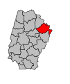
 Map of Ain Department, France, Cantons Ambérieu-en-Bugey.svg 1,000 × 908; 44 KB
-
 Map of Ain Department, France, Cantons Bellegarde-sur-Valserine.svg 1,000 × 908; 44 KB
-
 Map of Ain Department, France, Cantons Belley.svg 1,000 × 908; 44 KB
-
 Map of Ain Department, France, Cantons Bourg-en-Bresse-Est.svg 1,000 × 908; 44 KB
-
 Map of Ain Department, France, Cantons Bourg-en-Bresse-Nord-Centre.svg 1,000 × 908; 44 KB
-
 Map of Ain Department, France, Cantons Bourg-en-Bresse-Sud.svg 1,000 × 908; 44 KB
-
 Map of Ain Department, France, Cantons Brénod.svg 1,000 × 908; 44 KB
-
 Map of Ain Department, France, Cantons Bâgé-le-Châtel.svg 1,000 × 908; 44 KB
-
 Map of Ain Department, France, Cantons Ceyzériat.svg 1,000 × 908; 44 KB
-
 Map of Ain Department, France, Cantons Chalamont.svg 1,000 × 908; 44 KB
-
 Map of Ain Department, France, Cantons Champagne-en-Valromey.svg 1,000 × 908; 44 KB
-
 Map of Ain Department, France, Cantons Châtillon-sur-Chalaronne.svg 1,000 × 908; 44 KB
-
 Map of Ain Department, France, Cantons Coligny.svg 1,000 × 908; 44 KB
-
 Map of Ain Department, France, Cantons Collonges.svg 1,000 × 908; 44 KB
-
 Map of Ain Department, France, Cantons Ferney-Voltaire.svg 1,000 × 908; 44 KB
-
 Map of Ain Department, France, Cantons Gex.svg 1,000 × 908; 44 KB
-
 Map of Ain Department, France, Cantons Hauteville-Lompnes.svg 1,000 × 908; 44 KB
-
 Map of Ain Department, France, Cantons Izernore.svg 1,000 × 908; 44 KB
-
 Map of Ain Department, France, Cantons Lagnieu.svg 1,000 × 908; 44 KB
-
 Map of Ain Department, France, Cantons Lhuis.svg 1,000 × 908; 44 KB
-
 Map of Ain Department, France, Cantons Meximieux.svg 1,000 × 908; 44 KB
-
 Map of Ain Department, France, Cantons Miribel.svg 1,000 × 908; 44 KB
-
 Map of Ain Department, France, Cantons Montluel.svg 1,000 × 908; 44 KB
-
 Map of Ain Department, France, Cantons Montrevel-en-Bresse.svg 1,000 × 908; 44 KB
-
 Map of Ain Department, France, Cantons Nantua.svg 1,000 × 908; 44 KB
-
 Map of Ain Department, France, Cantons Oyonnax-Nord.svg 1,000 × 908; 44 KB
-
 Map of Ain Department, France, Cantons Oyonnax-Sud.svg 1,000 × 908; 44 KB
-
 Map of Ain Department, France, Cantons Poncin.svg 1,000 × 908; 44 KB
-
 Map of Ain Department, France, Cantons Pont-d'Ain.svg 1,000 × 908; 44 KB
-
 Map of Ain Department, France, Cantons Pont-de-Vaux.svg 1,000 × 908; 44 KB
-
 Map of Ain Department, France, Cantons Pont-de-Veyle.svg 1,000 × 908; 44 KB
-
 Map of Ain Department, France, Cantons Péronnas.svg 1,000 × 908; 44 KB
-
 Map of Ain Department, France, Cantons Reyrieux.svg 1,000 × 908; 44 KB
-
 Map of Ain Department, France, Cantons Saint-Rambert-en-Bugey.svg 1,000 × 908; 44 KB
-
 Map of Ain Department, France, Cantons Saint-Trivier-de-Courtes.svg 1,000 × 908; 44 KB
-
 Map of Ain Department, France, Cantons Saint-Trivier-sur-Moignans.svg 1,000 × 908; 44 KB
-
 Map of Ain Department, France, Cantons Seyssel.svg 1,000 × 908; 44 KB
-
 Map of Ain Department, France, Cantons Thoissey.svg 1,000 × 908; 44 KB
-
 Map of Ain Department, France, Cantons Treffort-Cuisiat.svg 1,000 × 908; 44 KB
-
 Map of Ain Department, France, Cantons Trévoux.svg 1,000 × 908; 44 KB
-
 Map of Ain Department, France, Cantons Villars-les-Dombes.svg 1,000 × 908; 44 KB
-
 Map of Ain Department, France, Cantons Viriat.svg 1,000 × 908; 44 KB
-
 Map of Ain Department, France, Cantons Virieu-le-Grand.svg 1,000 × 908; 44 KB


