Category:Locator maps of districts of Thuringia in Germany (gray scheme)
Jump to navigation
Jump to search
Federal states of Germany:
Media in category "Locator maps of districts of Thuringia in Germany (gray scheme)"
The following 21 files are in this category, out of 21 total.
-
 Lage des Landkreises Altenburger Land in Deutschland.PNG 197 × 235; 2 KB
-
 Lage des Landkreises Eichsfeld in Deutschland.png 197 × 235; 2 KB
-
 Erfurt-Position.png 176 × 234; 6 KB
-
 Lage des Landkreises Gotha in Deutschland.png 197 × 235; 3 KB
-
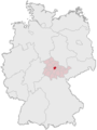
 Lage des Landkreises Greiz in Deutschland.png 197 × 235; 3 KB
-
 Lage des Landkreises Hildburghausen in Deutschland.png 197 × 235; 2 KB
-
 Lage des Ilm-Kreises in Deutschland.png 197 × 235; 3 KB
-
 Lage des Kyffhäuserkreises in Deutschland.png 197 × 235; 2 KB
-
 Lage der kreisfreien Stadt Eisenach in Deutschland.png 176 × 234; 4 KB
-
 Lage der kreisfreien Stadt Suhl in Deutschland.png 176 × 234; 4 KB
-
 Lage der kreisfreien Stadt Weimar in Deutschland.png 176 × 234; 4 KB
-
 Lage des Landkreises Nordhausen in Deutschland.png 197 × 235; 2 KB
-
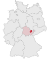 Lage des Saale-Holzland-Kreises in Deutschland.png 197 × 235; 2 KB
-
 Lage des Saale-Orla-Kreises in Deutschland.png 197 × 235; 2 KB
-
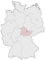
 Lage des Landkreises Saalfeld-Rudolstadt in Deutschland.png 197 × 235; 3 KB
-
 Lage des Landkreises Schmalkalden-Meiningen in Deutschland.png 197 × 235; 3 KB
-
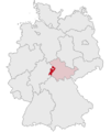
 Lage des Landkreises Sömmerda in Deutschland.png 197 × 235; 3 KB
-
 Lage des Landkreises Sonneberg in Deutschland.png 197 × 235; 2 KB
-
 Lage des Unstrut-Hainich-Kreises in Deutschland.png 197 × 235; 2 KB
-
 Lage des Wartburgkreises in Deutschland.png 197 × 235; 3 KB
-
 Lage des Landkreises Weimarer Land in Deutschland.png 197 × 235; 3 KB


