Category:Locator maps of districts of Albania
Jump to navigation
Jump to search
Subcategories
This category has the following 2 subcategories, out of 2 total.
Media in category "Locator maps of districts of Albania"
The following 147 files are in this category, out of 147 total.
-
 Albania District.svg 508 × 1,002; 276 KB
-
 AlbaniaBerat.png 117 × 225; 20 KB
-
 AlbaniaBulqize.png 119 × 225; 20 KB
-
 AlbaniaDelvine.png 110 × 225; 17 KB
-
 AlbaniaDevoll.png 118 × 225; 17 KB
-
 AlbaniaDibre.png 113 × 225; 19 KB
-
 AlbaniaDurres.png 126 × 225; 17 KB
-
 AlbaniaElbasan.png 110 × 225; 17 KB
-
 AlbaniaFier.png 119 × 225; 24 KB
-
 AlbaniaGjirokaster.png 100 × 225; 18 KB
-
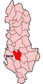
 AlbaniaGramsh.png 106 × 225; 17 KB
-
 AlbaniaHas.png 106 × 225; 17 KB
-
 AlbaniaKavaje.png 122 × 225; 12 KB
-
 AlbaniaKolonje.png 119 × 225; 17 KB
-
 AlbaniaKorce.png 118 × 225; 17 KB
-
 AlbaniaKruje.png 115 × 225; 17 KB
-
 AlbaniaKucove.png 107 × 225; 17 KB
-
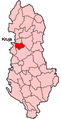
 AlbaniaKukes.png 107 × 225; 17 KB
-
 AlbaniaKurbin.png 122 × 225; 17 KB
-
 AlbaniaLezhe.png 113 × 225; 19 KB
-
 AlbaniaLibrazhd.png 114 × 225; 16 KB
-
 AlbaniaMalesiEMadhe.png 123 × 225; 21 KB
-
 AlbaniaMallakaster.png 110 × 225; 13 KB
-
 AlbaniaMat.png 100 × 225; 12 KB
-
 AlbaniaMirdite.png 104 × 225; 17 KB
-
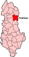
 AlbaniaPeqin.png 105 × 225; 15 KB
-
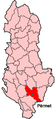 AlbaniaPermet.png 106 × 225; 17 KB
-
 AlbaniaPogradec.png 121 × 225; 15 KB
-
 AlbaniaPuke.png 104 × 225; 17 KB
-
 AlbaniaSarande.png 110 × 225; 14 KB
-
 AlbaniaShkoder.png 127 × 225; 12 KB
-
 AlbaniaSkrapar.png 105 × 225; 17 KB
-
 AlbaniaTepelene.png 105 × 225; 17 KB
-
 AlbaniaTirane.png 107 × 225; 17 KB
-
 AlbaniaTropoje.png 107 × 225; 17 KB
-
 AlbaniaVlore.png 104 × 225; 17 KB
-
 Berat District.svg 508 × 1,002; 276 KB
-
 Berat megye.png 100 × 225; 12 KB
-
 Locator Map Bulqize-Albania.png 100 × 225; 16 KB
-
 Bulqizë District.svg 508 × 1,002; 276 KB
-
 Delvinë District.svg 508 × 1,002; 276 KB
-
 Devoll District.svg 508 × 1,002; 276 KB
-
 Dibër District.svg 508 × 1,002; 276 KB
-
 Durrës district.svg 508 × 1,002; 276 KB
-
 Elbasan District.svg 508 × 1,002; 276 KB
-
 Fier District.svg 508 × 1,002; 276 KB
-
 Gjirokaster megye.png 100 × 225; 12 KB
-
 Gjirokastër District.svg 508 × 1,002; 276 KB
-
 Gramsh District.svg 508 × 1,002; 276 KB
-
 Has District.svg 508 × 1,002; 276 KB
-
 Kavajë District.svg 508 × 1,002; 276 KB
-
 Kolonjë District.svg 508 × 1,002; 276 KB
-
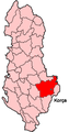
 Korce megye.png 100 × 225; 12 KB
-
 Korçë District.svg 508 × 1,002; 276 KB
-
 Kreis-Berat.png 284 × 600; 53 KB
-
 Kreis-Bulqize.png 284 × 600; 53 KB
-
 Kreis-Delvine.png 284 × 600; 53 KB
-
 Kreis-Devoll.png 284 × 600; 53 KB
-
 Kreis-Diber.png 284 × 600; 53 KB
-
 Kreis-Durres.png 284 × 600; 53 KB
-
 Kreis-Elbasan.png 284 × 600; 53 KB
-
 Kreis-Fier.png 284 × 600; 53 KB
-
 Kreis-Gjirokaster.png 284 × 600; 53 KB
-
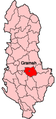
 Kreis-Gramsh.png 284 × 600; 53 KB
-
 Kreis-Has.png 284 × 600; 52 KB
-
 Kreis-Kavaje.png 284 × 600; 53 KB
-
 Kreis-Kolonje.png 284 × 600; 53 KB
-
 Kreis-Korca.png 284 × 600; 53 KB
-
 Kreis-Kruje.png 284 × 600; 53 KB
-
 Kreis-Kucove.png 284 × 600; 53 KB
-
 Kreis-Kukes.png 284 × 600; 53 KB
-
 Kreis-Kurbin.png 284 × 600; 53 KB
-
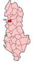
 Kreis-Lezhe.png 284 × 600; 53 KB
-
 Kreis-Librazhd.png 284 × 600; 53 KB
-
 Kreis-Lushnje.png 284 × 600; 53 KB
-
 Kreis-Malesi e Madhe.png 284 × 600; 53 KB
-
 Kreis-Mallakaster.png 284 × 600; 53 KB
-
 Kreis-Mat.png 284 × 600; 53 KB
-
 Kreis-Mirdite.png 284 × 600; 53 KB
-
 Kreis-Peqin.png 284 × 600; 53 KB
-
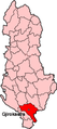
 Kreis-Podgradec.png 284 × 600; 53 KB
-
 Kreis-Puke.png 284 × 600; 53 KB
-
 Kreis-Saranda.png 284 × 600; 53 KB
-
 Kreis-Shkoder.png 284 × 600; 53 KB
-
 Kreis-skrapar.png 284 × 600; 53 KB
-
 Kreis-Tepelene.png 284 × 600; 54 KB
-
 Kreis-Tirana.png 284 × 600; 53 KB
-
 Kreis-Tropoje.png 284 × 600; 53 KB
-
 Kreis-Vlore.png 284 × 600; 53 KB
-
 Krujë District.svg 508 × 1,002; 276 KB
-
 Kukës District.svg 508 × 1,002; 276 KB
-
 Kurbin District.svg 508 × 1,002; 276 KB
-
 Kuçovë District.svg 508 × 1,002; 276 KB
-
 Lezhë District.svg 508 × 1,002; 276 KB
-
 Librazhd District.svg 508 × 1,002; 276 KB
-
 Lushnjë District.svg 508 × 1,002; 276 KB
-
 Mallakastër District.svg 508 × 1,002; 276 KB
-
 Malësi e Madhe District.svg 508 × 1,002; 276 KB
-
 Mat District.svg 508 × 1,002; 276 KB
-
 Mirditë District.svg 508 × 1,002; 276 KB
-
 Peqin District.svg 508 × 1,002; 276 KB
-
 Pogradec District.svg 508 × 1,002; 276 KB
-
 Pukë District.svg 508 × 1,002; 276 KB
-
 Përmet District.svg 508 × 1,002; 276 KB
-
 Rrethi i Beratit në Hartën e Shqipërisë.svg 274 × 611; 160 KB
-
 Rrethi i Bulqizës në Hartën e Shqipërisë.svg 274 × 611; 159 KB
-
 Rrethi i Delvinës në Hartën e Shqipërisë.svg 274 × 611; 157 KB
-
 Rrethi i Devollit në Hartën e Shqipërisë.svg 274 × 611; 156 KB
-
 Rrethi i Dibrës në Hartën e Shqipërisë.svg 274 × 611; 158 KB
-
 Rrethi i Durrësit në Hartën e Shqipërisë.svg 274 × 611; 158 KB
-
 Rrethi i Elbasanit në Hartën e Shqipërisë.svg 274 × 611; 160 KB
-
 Rrethi i Fierit në Hartën e Shqipërisë.svg 274 × 611; 159 KB
-
 Rrethi i Gjirokastrës në Hartën e Shqipërisë.svg 274 × 611; 158 KB
-
 Rrethi i Gramshit në Hartën e Shqipërisë.svg 274 × 611; 158 KB
-
 Rrethi i Hasit në Hartën e Shqipërisë.svg 274 × 611; 157 KB
-
 Rrethi i Kavajës në Hartën e Shqipërisë.svg 274 × 611; 159 KB
-
 Rrethi i Kolonjës në Hartën e Shqipërisë.svg 274 × 611; 157 KB
-
 Rrethi i Korçës në Hartën e Shqipërisë.svg 274 × 611; 159 KB
-
 Rrethi i Krujës në Hartën e Shqipërisë.svg 274 × 611; 158 KB
-
 Rrethi i Kukësit në Hartën e Shqipërisë.svg 274 × 611; 158 KB
-
 Rrethi i Kurbinit në Hartën e Shqipërisë.svg 274 × 611; 158 KB
-
 Rrethi i Kuçovës në Hartën e Shqipërisë.svg 274 × 611; 156 KB
-
 Rrethi i Lezhës në Hartën e Shqipërisë.svg 274 × 611; 159 KB
-
 Rrethi i Librazhdit në Hartën e Shqipërisë.svg 274 × 611; 159 KB
-
 Rrethi i Lushnjes në Hartën e Shqipërisë.svg 274 × 611; 161 KB
-
 Rrethi i Mallakastrës në Hartën e Shqipërisë.svg 274 × 611; 157 KB
-
 Rrethi i Malësisë së Madhe në Hartën e Shqipërisë.svg 274 × 611; 156 KB
-
 Rrethi i Matit në Hartën e Shqipërisë.svg 274 × 611; 159 KB
-
 Rrethi i Mirditës në Hartën e Shqipërisë.svg 274 × 611; 161 KB
-
 Rrethi i Peqinit në Hartën e Shqipërisë.svg 274 × 611; 157 KB
-
 Rrethi i Pogradecit në Hartën e Shqipërisë.svg 274 × 611; 158 KB
-
 Rrethi i Pukës në Hartën e Shqipërisë.svg 274 × 611; 160 KB
-
 Rrethi i Përmetit në Hartën e Shqipërisë.svg 274 × 611; 158 KB
-
 Rrethi i Sarandës në Hartën e Shqipërisë.svg 274 × 611; 157 KB
-
 Rrethi i Shkodrës në Hartën e Shqipërisë.svg 274 × 611; 159 KB
-
 Rrethi i Skraparit në Hartën e Shqipërisë.svg 274 × 611; 158 KB
-
 Rrethi i Tepelenës në Hartën e Shqipërisë.svg 274 × 611; 159 KB
-
 Rrethi i Tiranës në Hartën e Shqipërisë.svg 274 × 611; 161 KB
-
 Rrethi i Tropojës në Hartën e Shqipërisë.svg 274 × 611; 157 KB
-
 Rrethi i Vlorës në Hartën e Shqipërisë.svg 274 × 611; 157 KB
-
 Sarandë District.svg 508 × 1,002; 276 KB
-
 Shkodër District.svg 508 × 1,002; 276 KB
-
 Skrapar District.svg 508 × 1,002; 276 KB
-
 Tepelenë District.svg 508 × 1,002; 276 KB
-
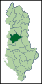 Tirana district green.svg 508 × 1,002; 238 KB
-
 Tropojë District.svg 508 × 1,002; 276 KB
-
 Vlorë District.svg 508 × 1,002; 276 KB


