Category:Locator maps of districts in Nazi Germany
Jump to navigation
Jump to search
Media in category "Locator maps of districts in Nazi Germany"
The following 10 files are in this category, out of 10 total.
-
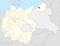
 Locator map Angerburg in Germany.PNG 3,966 × 3,000; 1.65 MB
-
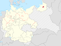
 Locator map Bartenstein in Germany.PNG 3,966 × 3,000; 1.65 MB
-
 Locator map Braunsberg in Germany.PNG 3,966 × 3,000; 1.65 MB
-
 Locator map Angerapp in Germany.PNG 3,966 × 3,000; 1.65 MB
-
 Locator map Elbing in Germany.PNG 3,966 × 3,000; 34.1 MB
-
 Locator map Allenstein LK in Germany.PNG 3,966 × 3,000; 1.66 MB
-
 Locator map Elchniederung in Germany.png 3,966 × 3,000; 34.1 MB
-
 Locator map Gerdauen in Germany.png 3,966 × 3,000; 34.1 MB
-
 Locator map Ebenrode in Germany.PNG 3,966 × 3,000; 1.65 MB
-
 Locator map RB Westpreussen in Germany wiki.PNG 3,966 × 3,000; 1.66 MB


