Category:Locator maps of cycling routes in Brandenburg
Jump to navigation
Jump to search
Federal states of Germany:
Media in category "Locator maps of cycling routes in Brandenburg"
The following 14 files are in this category, out of 14 total.
-
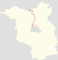
Positionskarte der Radroute Berlin–Kopenhagen in Brandenburg.svg 2,905 × 3,000; 663 KB
-
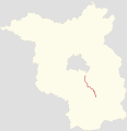
Positionskarte der Radroute Berlin–Leipzig in Brandenburg.svg 2,905 × 3,000; 187 KB
-
Positionskarte der Radroute Elberadroute D10 in Brandenburg.svg 2,905 × 3,000; 1.02 MB
-
Positionskarte der Radroute Euroroute R1 in Brandenburg.svg 2,905 × 3,000; 681 KB
-
Positionskarte der Radrouten des Flaeming-Skate in Brandenburg.svg 2,905 × 3,000; 856 KB
-
Positionskarte der Radroute Gänsetour in Brandenburg.svg 2,905 × 3,000; 612 KB
-
Positionskarte der Radroute Gurkenradweg in Brandenburg.svg 2,905 × 3,000; 775 KB
-
Positionskarte der Radroute Hofjagdweg in Brandenburg.svg 2,905 × 3,000; 638 KB
-
Positionskarte der Radroute Oder-Havel-Radweg in Brandenburg.svg 2,905 × 3,000; 624 KB
-
Positionskarte der Radroute Oder-Neiße-Radweg D12 in Brandenburg.svg 2,905 × 3,000; 195 KB
-
Positionskarte der Radroute Oder-Spree-Tour in Brandenburg.svg 2,905 × 3,000; 748 KB
-
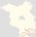
Positionskarte der Radroute Fürst-Pückler-Weg in Brandenburg.svg 2,905 × 3,000; 216 KB
-
Positionskarte der Radroute Spreeradweg in Brandenburg.svg 2,905 × 3,000; 765 KB
-
Positionskarte der Radroute Tour Brandenburg in Brandenburg.svg 2,905 × 3,000; 1.18 MB


