Category:Locator maps of counties of Tarnopol Voivodeship
Jump to navigation
Jump to search
Media in category "Locator maps of counties of Tarnopol Voivodeship"
The following 17 files are in this category, out of 17 total.
-
 POL powiat borszczowski map.svg 750 × 912; 22 KB
-
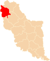
 POL powiat brodzki map.svg 750 × 912; 22 KB
-
 POL powiat brzeżański map.svg 750 × 912; 22 KB
-
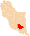
 POL powiat buczacki map.svg 750 × 912; 22 KB
-
 POL powiat czortkowski map.svg 750 × 912; 22 KB
-
 POL powiat kamionecki map.svg 750 × 912; 22 KB
-
 POL powiat kopyczyniecki map.svg 750 × 912; 22 KB
-
 POL powiat podhajecki map.svg 750 × 912; 22 KB
-
 POL powiat przemyślański map.svg 750 × 912; 22 KB
-
 POL powiat radziechowski map.svg 750 × 912; 22 KB
-
 POL powiat skałacki map.svg 750 × 912; 22 KB
-
 POL powiat tarnopolski map.svg 750 × 912; 22 KB
-
 POL powiat trembowelski map.svg 750 × 912; 22 KB
-
 POL powiat zaleszczycki map.svg 750 × 912; 22 KB
-
 POL powiat zbaraski map.svg 750 × 912; 22 KB
-
 POL powiat zborowski map.svg 750 × 912; 22 KB
-
 POL powiat złoczowski map.svg 750 × 912; 22 KB


