Category:Locator maps of counties in Lithuania
Jump to navigation
Jump to search
Subcategories
This category has the following 2 subcategories, out of 2 total.
Media in category "Locator maps of counties in Lithuania"
The following 21 files are in this category, out of 21 total.
-
 Alytaus apskritis.png 712 × 542; 29 KB
-
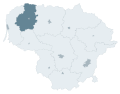
 Alytaus-apskritis.png 1,424 × 1,083; 127 KB
-
 Kauno apskritis.png 712 × 542; 29 KB
-
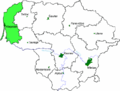 Klaipedos apskritis.png 712 × 542; 29 KB
-
 Lithuanian-Counties-Alytus.svg 765 × 595; 480 KB
-
 Lithuanian-Counties-Kaunas.svg 765 × 595; 480 KB
-
 Lithuanian-Counties-Klaipeda.svg 765 × 595; 480 KB
-
 Lithuanian-Counties-Marijampole.svg 765 × 595; 480 KB
-
 Lithuanian-Counties-Panevezys.svg 765 × 595; 480 KB
-
 Lithuanian-Counties-Siauliai.svg 765 × 595; 480 KB
-
 Lithuanian-Counties-Taurage.svg 765 × 595; 480 KB
-
 Lithuanian-Counties-Telsiai.svg 765 × 595; 480 KB
-
 Lithuanian-Counties-Utena.svg 765 × 595; 480 KB
-
 Lithuanian-Counties-Vilnius.svg 765 × 595; 480 KB
-
 Marijampoles apskritis.png 712 × 542; 29 KB
-
 Panevezio apskritis.png 712 × 542; 31 KB
-
 Siauliu apskritis.png 712 × 542; 31 KB
-
 Taurages apskritis.png 712 × 542; 29 KB
-
 Telsiu apskritis.png 712 × 542; 31 KB
-
 Utenos apskritis.png 712 × 542; 32 KB
-
 Vilniaus apskritis.png 712 × 542; 29 KB


